The trip to the top of McDonald Peak (10,089 ft.) in the Sawtooth Range is a 3,200 vertical foot ascent all in snow. McDonald sits between Alturas and Pettit Lakes and look directly across the valley at Horton Peak of the White Cloud Mountain Range. The round-trip effort of 24+ hours includes a dawn photo-shoot followed with a sunrise ski off the summit back down to the valley floor. The trip involves an overnight just below the summit and then an ascent to the peak starting about 90 minutes before daylight. Chris Lundy and I make the effort without our normal third partner Sara Lundy. Sara is unavailable to make the trip. The initial implication of being sans Sara is two-people carry the weight normally distributed between three. Our packs weigh 50+ pounds each. Luckily, one of Sara’s big skills – route finding – is not as necessary as the route to the top follows a straight line up the spine of the mountain.
Many times we find our plans being conservative in terms of time estimates. This will not be one of those trips as the above average snowfall and heavy pack eliminate any chance for a quick trip to the top. Our plan has us spending the night in small protected area about 700 feet below the summit. The location Chris suggests is superb. As is the norm we build a spot for our sleeping tent as well as a Mid. The Mid acts as a cover over a living area that is separate for the sleeping area. Separating sleeping and living areas improves the quality of winter camping 3,456% or some similar percentage. The technique of creating a winter camping living area is to dig out spots for seating (a bench) and cooking (top) and eating (top) followed by the Mid being placed as a cover for protection. The result? Think of a sunken living room with high ceilings in a home.
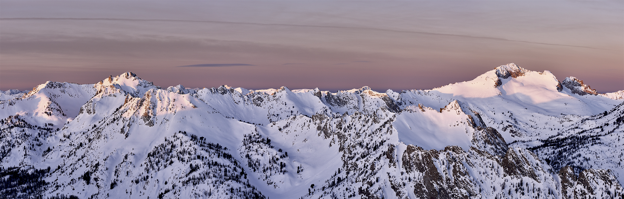
The morning ascent involves using skins on our skis for the first 300 vertical feet. The remaining 400 vertical feet up to the ridge and summit involves a boot pack – in effect skis placed your back and climbing in your ski boots. The route to the top is highly variable. It involves post-holing in deep snow on all fours, rock scrambling, walking uphill on a windblown cornice and recovering from sinking into snow that is waist deep. Arriving 15 minutes ahead of schedule our effort is rewarded with a fascinating small stream of dark clouds, reds, oranges. and pinks.
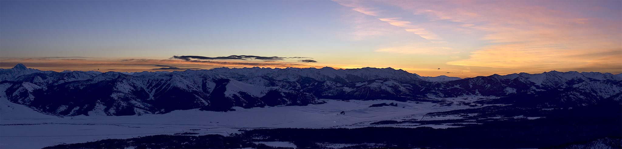
As dawn begins I look east and south and can make out four mountain ranges and their highest peaks. My son Kyle and I summited each of them in 2012. Castle Peak (11,815 ft.) the highest in the White Cloud Mountain Range is a big black blob as dawn light starts more to the south. As the light increases, I can make out the route Kyle and I took to its summit. Hyndman Peak (12,009 ft.) and the Pioneer Mountain Range make themselves most apparent first. They are located farther east and south, sitting – in this view – between the White Cloud Mountain Range and the Boulder Mountain Range. Next up I can identify Ryan Peak (11,714 ft.) the tallest in the Boulder Mountain Range. However the most prominent piece of rock is Galena Peak (11,115 ft). Chris and I plan on summiting and skiing down Galena Peak later this month. To the south is the Smoky Mountain Range and its tallest peak Saviers (10,440 ft). All of the rock is bathed in a pinkish orange. Saviers evokes fond memories for me as Kyle and I climbed four named peaks in one day (Lower Titus, Titus, Bromaghin and Saviers) in the month of October in the best fall weather possible just a few days before a heavy snowfall. Behind me are the Sawtooths (the fifth range) and in full view is Snowyside Peak. The mountains are bathed in pink. I can see all the way to the Rakers. I am certain the Rakers are waving hello to me, saying thanks for the visit last August.
The wind at the summit of McDonald is strong and constant. The temperature feels much colder than the projections from the weather service. With shots in-hand Chris and I descend from the summit. The top portions of the ski are wind encrusted snow. Luckily the lower half of the bowl provides wonderful soft snow down to the campground. After breakfast and a short nap we break camp. Except for about 200 vertical feet of heavy crud, the 2,400 vertical foot trip down is almost all a smooth powdery ski in trees or side traverse to the valley floor.