Glassford Peak is on my mind. The mountain has been on my mind for the past 40 years. I have yet to climb it. Glassford (11,602 ft.) is buried in the middle of the Boulder Hemmingway Wilderness. It is the third highest peak in the Boulder Mountain Range.
Glassford is the most prominent peak heading into (from the south) and out of (to the north) Ketchum, Idaho.
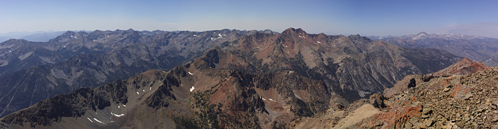
Looking west at Glassford Peak from the Top of Ryan Peak.
I have summitted the tallest (Ryan at 11,714ft.) and most of the high peaks in the Boulder Mountain Range. Last year, my son Kyle and I, summited Galena Peak (11,153 ft.) on my birthday.
The Post for Galena Peak is [here].
The Post for Ryan Peak is [here].
Glassford intrigues me, in that I see it most every day while at home in Ketchum or on my way to the cabin in Stanley. Summitting Glassford is a difficult proposition because both the ascent routes involve six plus miles of climbing\scrambling in the back-country and at least 5,000+ vertical feet of gain.
I have a good idea what it will take to summit via the south route (Wood River). I have travelled material portions of the route. I know little about attempting to summit form the north. Notes about the ascent from the north indicate it is more straight forward, but includes more gain in elevation. The ascent from the north is materially more isolated and requires extensive travel by vehicle in the back-country.
I decide it is time for a little reconnaissance. I decide to go to the starting point of the northern ascent of Glassford. This effort entails 73.07 miles and 2 hours and 13 minutes of travel (one way) from the cabin in Stanley. This means, traveling out of the Sawtooth Mountains, down the magnificent and rugged Salmon River Canyon, down the magnificent and isolated East Fork Salmon River Canyon, through the White Cloud Mountain Range and Cecil Andrus – White Cloud Wilderness, deep into the heart of the northern Boulder Mountain Range and, deep into the West Pass Creek canyon and Hemingway-Boulder Wilderness.
The trip from Stanley losses almost a 1,000 vertical on the Salmon to East Fork and then gains 2,000 vertical to West Pass.
The Border Collies (Sage and Willow) suggest they join me for support and encouragement
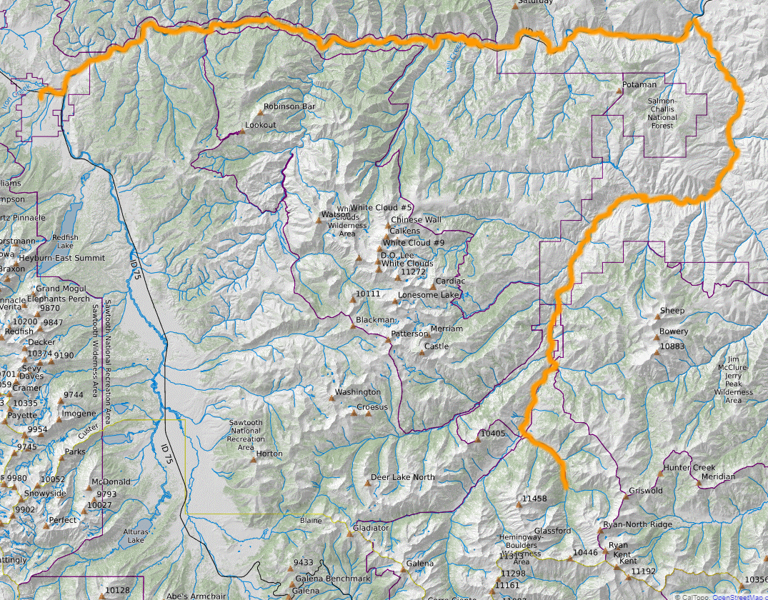
The Recon Route.
For climbers starting in Ketchum, the North Route means 134+ miles of travel before starting the ascent. The irony is that the trailhead starting points for the South and North routes is less than ten miles apart. Most of the notations from climbers suggest the north route is worth the travel distance if an overnighter of camping can be made.
I have spent a great deal of time on the East Fork of the Salmon River. I have conducted and completed a variety of efforts in the region. However, I have never travelled to the end of the road.
The East Fork of the Salmon River Road is other worldly – in terms of terrain and human-kind. Much of the first miles of the river floor is held in private hands. However, these lands are immediately and entirely surrounded by government land. The owners (ranches, homes, retreats, buildings and structures of all types) are best described as independent. The owners come from just about every socio-economic background imaginable. Most of the owners I have met are polite and courteous. However, most are somewhat skeptical of outsiders.
East Fork Salmon River Road is paved (kind of) to the turn out for Big Boulder Basin. Taken at 30-35 mph the route is rather enjoyable. The subsequent dirt Forest Service Road (#120) is well maintained and straight-forward. I have travelled #120 as far as Little Bolder Creek Campground and Trailhead.
At about five miles from the end of USFS Development Road #120, private property is encountered. The property (and therefore the road) is gated. Signs inform travelers they are leaving Forest Service Lands and about to enter private property. The landowner grants all travelers free access past the gate as long as they stay on the road. Travelers are warned (explicitly) that leaving the road will be considered trespassing and dealt with accordingly. After one mile, the private property ends and another gate (with signs indicating the opposite) appear. Opening and closing the gate is straight-forward. The road-bed on the private property is poorly maintained and rough for travel.
In another mile Forest Service #120 is met on the left by West Pass Creek Road (USFS Development Road #063). The 3.2 miles of travel up West Pass Creek Road to the West Pass Trailhead is much more forest service back-country-ish in nature. However, it is straightforward to navigate if you take your time. Forest Service #120 continues for another mile to its end-point – The Bowery Guard Station.
I took the time to travel to the end of both roads and hike in the area (on and off trail).
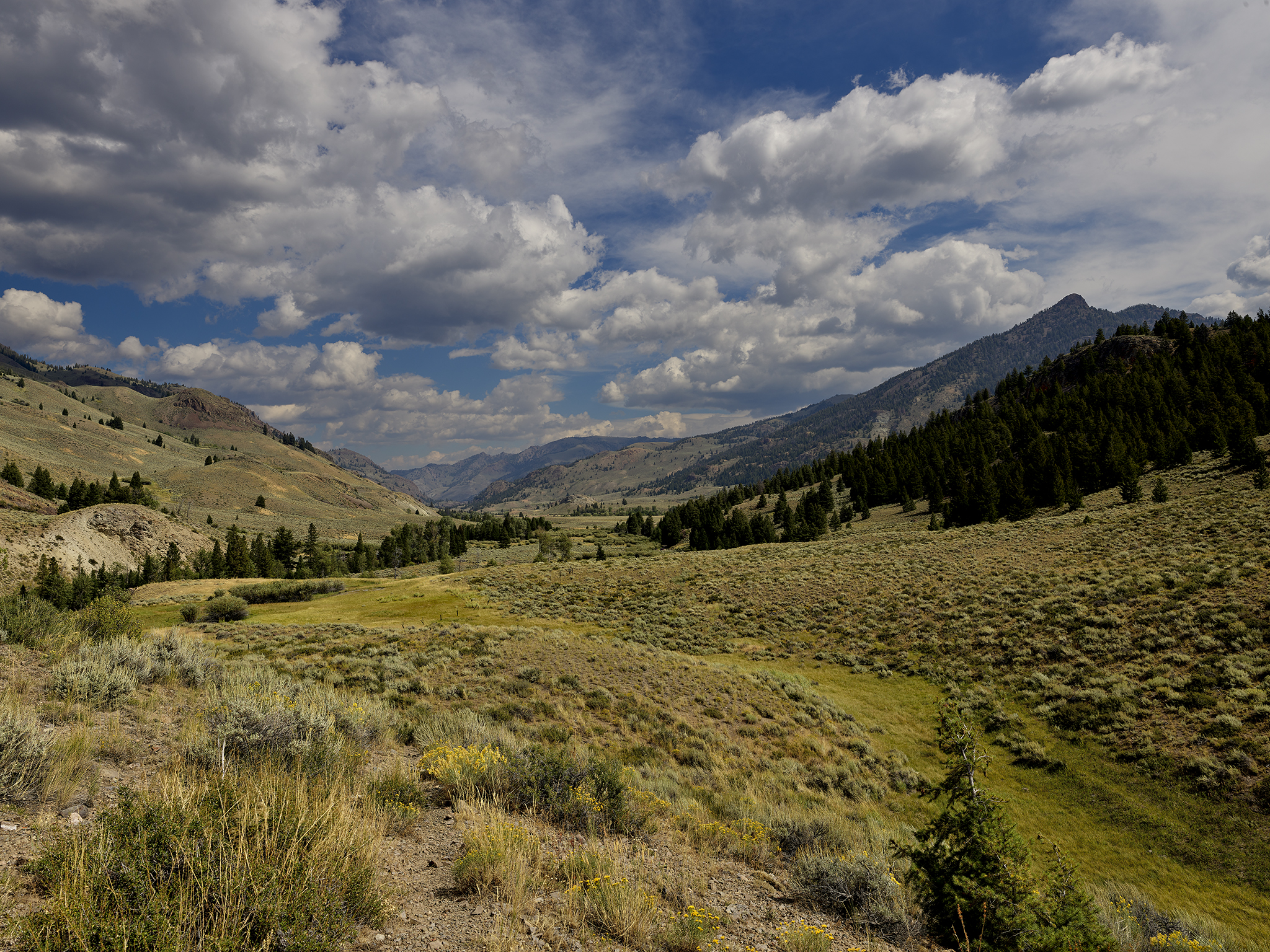
The scenery and beauty of the area is remarkable.
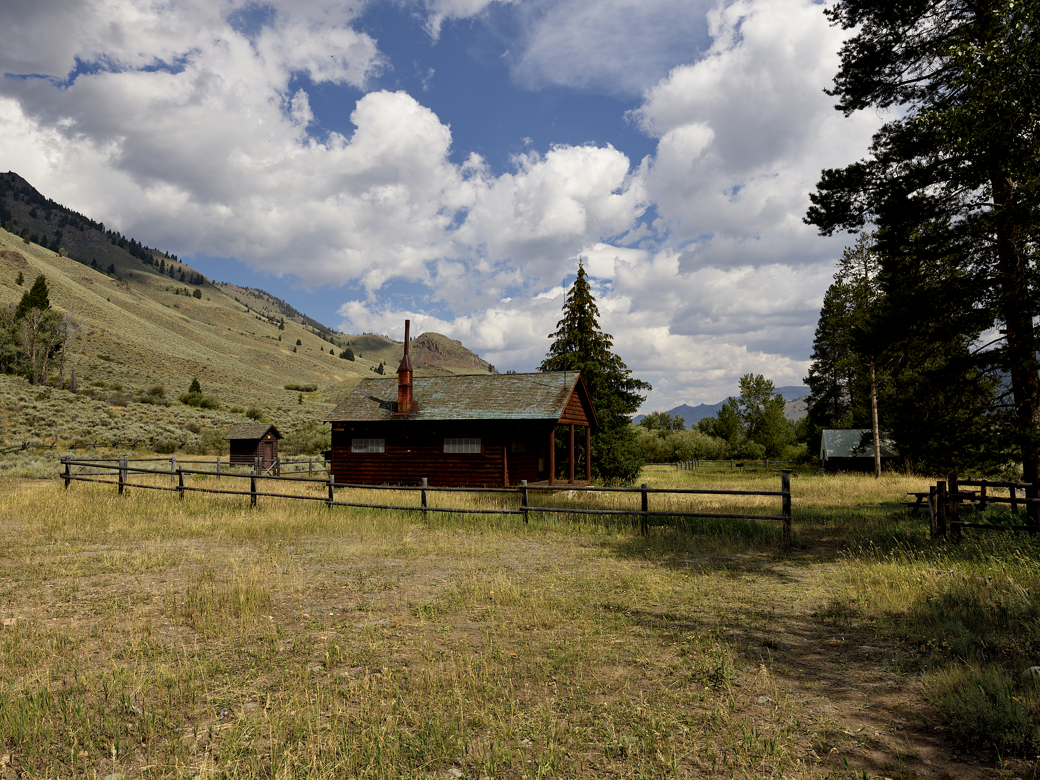
The U.S.F.S. Bowery Guard Station.

View of the East Fork of the Salmon River looking south from a ridgeline above the Bowery Guard Station. The peaks in the distance in the center: (left to right) Easley (11,108 ft.), Cerro Ciento (11,154 ft.), and Galena (11,153 ft.).
View of the East Fork of the Salmon River looking north from a ridgeline above the Bowery Guard Station. The peak on the right (9,420 ft.) is unnamed.
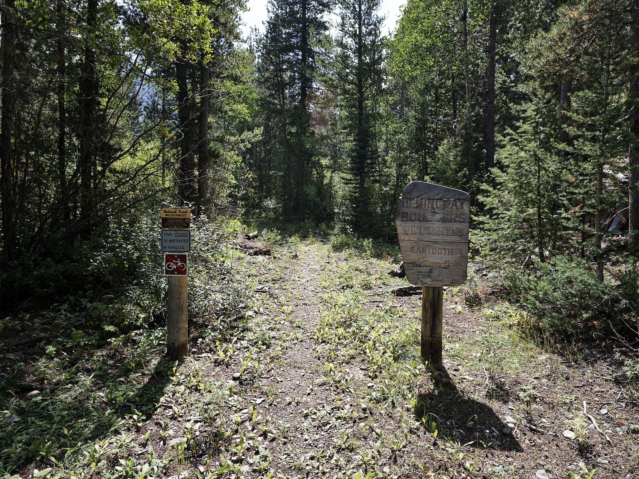
The West Pass Trail at the entry into the Hemingway – Boulder Wilderness.
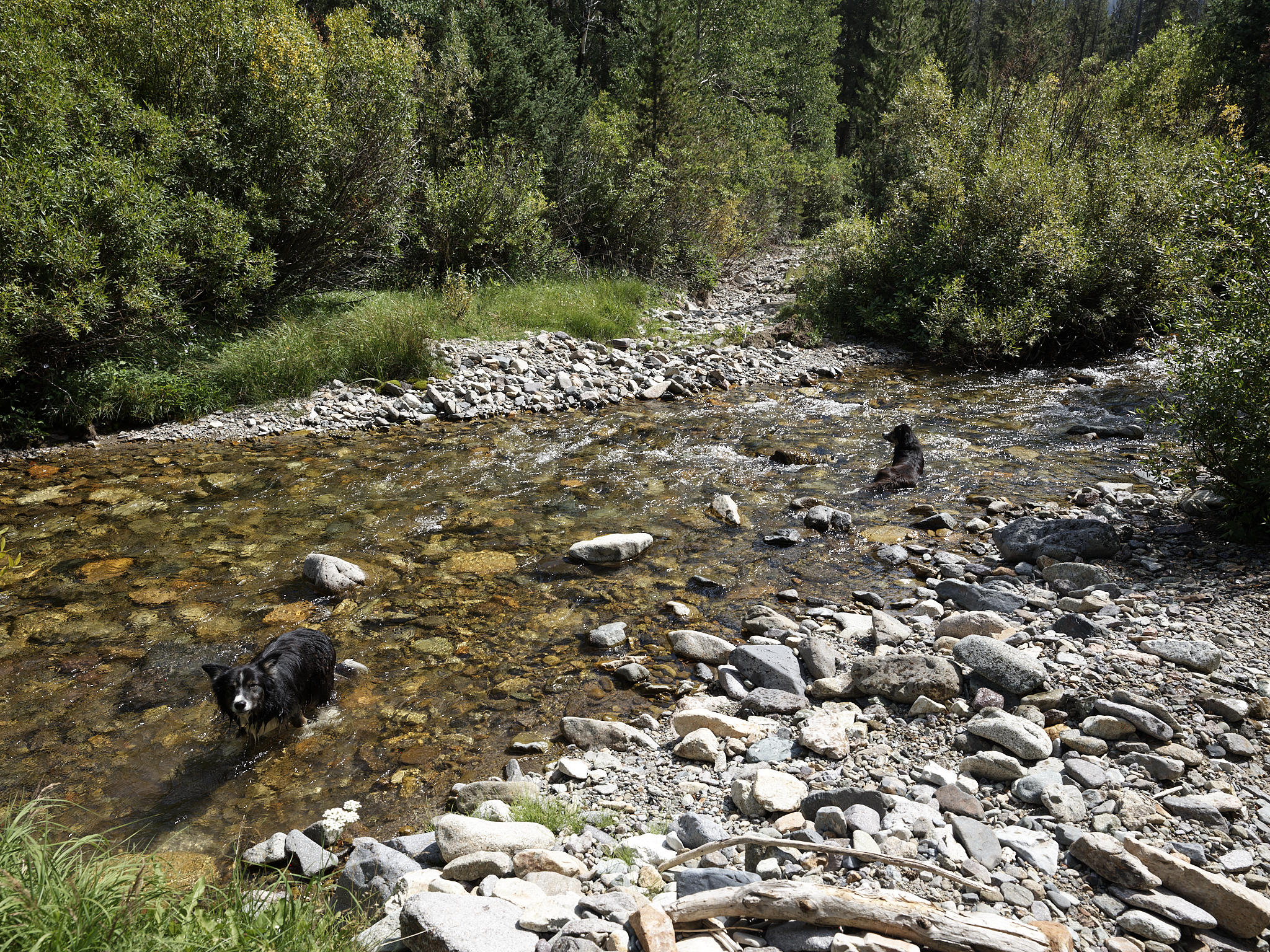
Willow (left) and Sage grab a quick bath and drink of water in West Pass Creek where the trail crosses the creek.
**** Jeff’s Thoughts and Other Worthless Trivia ****
This is not the first or nor will it be the last spot in the region where I have to open\close gates into and out of private property on a Forest Service Road.