Fantastical is the best word I can think of to describe the Bay of Fundy. It is a world of natural extremes and exceptions.
The ocean tides can vary up to 53.6 feet every 6.135 hours in this place. The water flow every 6.135 hours in the bay during this period of time possesses more volume than all the rivers of all the world combined.
The southern part of the bay is where the border of Canada and the United States exists. The ocean, bay, tides, and wildlife do not seem to have passports. Nor do they appear to check in with Customs for the United States or Canada.
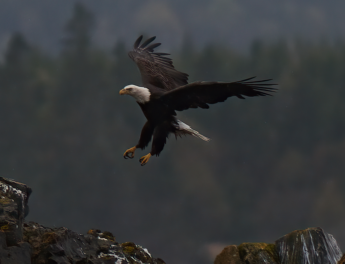
Eagle Landing on International Border in the rain
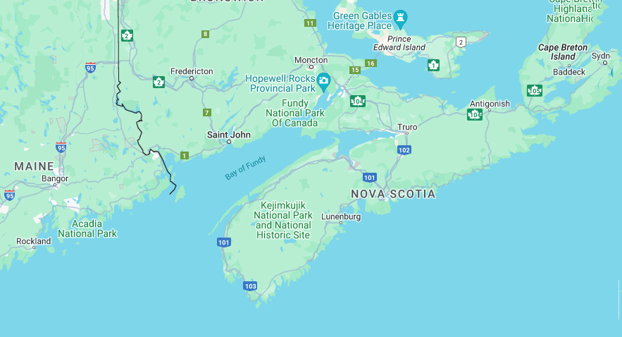
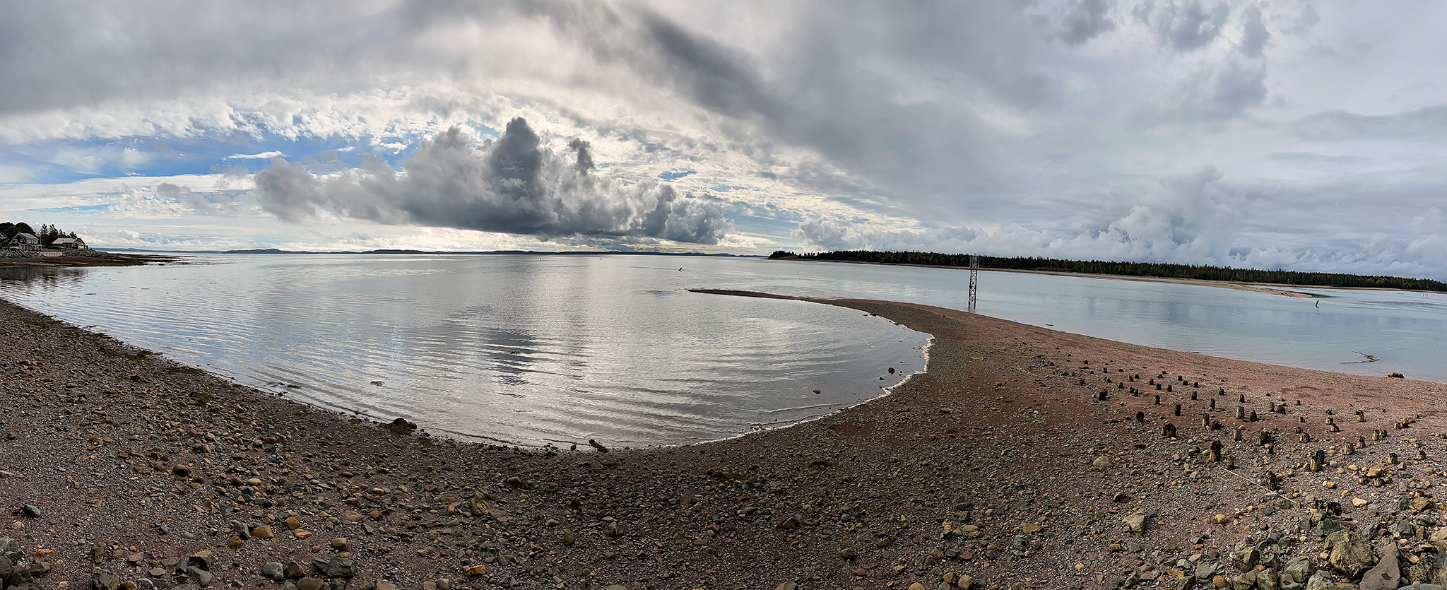
The Bay of Fundy
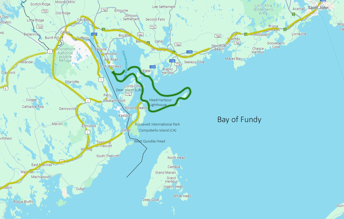
South Bay of Fundy
The City on Fundy that is Almost Your Name
Lubec Maine is pronounced like my last name, except that it is missing a K. I am not completely sure as to why, because official records (Act of Incorporation in 1811) have it as Lubeck, then part of Massachusetts. It was named for Lübeck, Germany at the suggestion of Jonathan Weston. I have yet to find any documentation as to why the k was dropped in 1818. Maine became as State in 1820.
Lubec is the easternmost city in the contiguous United States. It is the closest point (West Quoddy Head) in the contiguous United States to the continent of Africa.
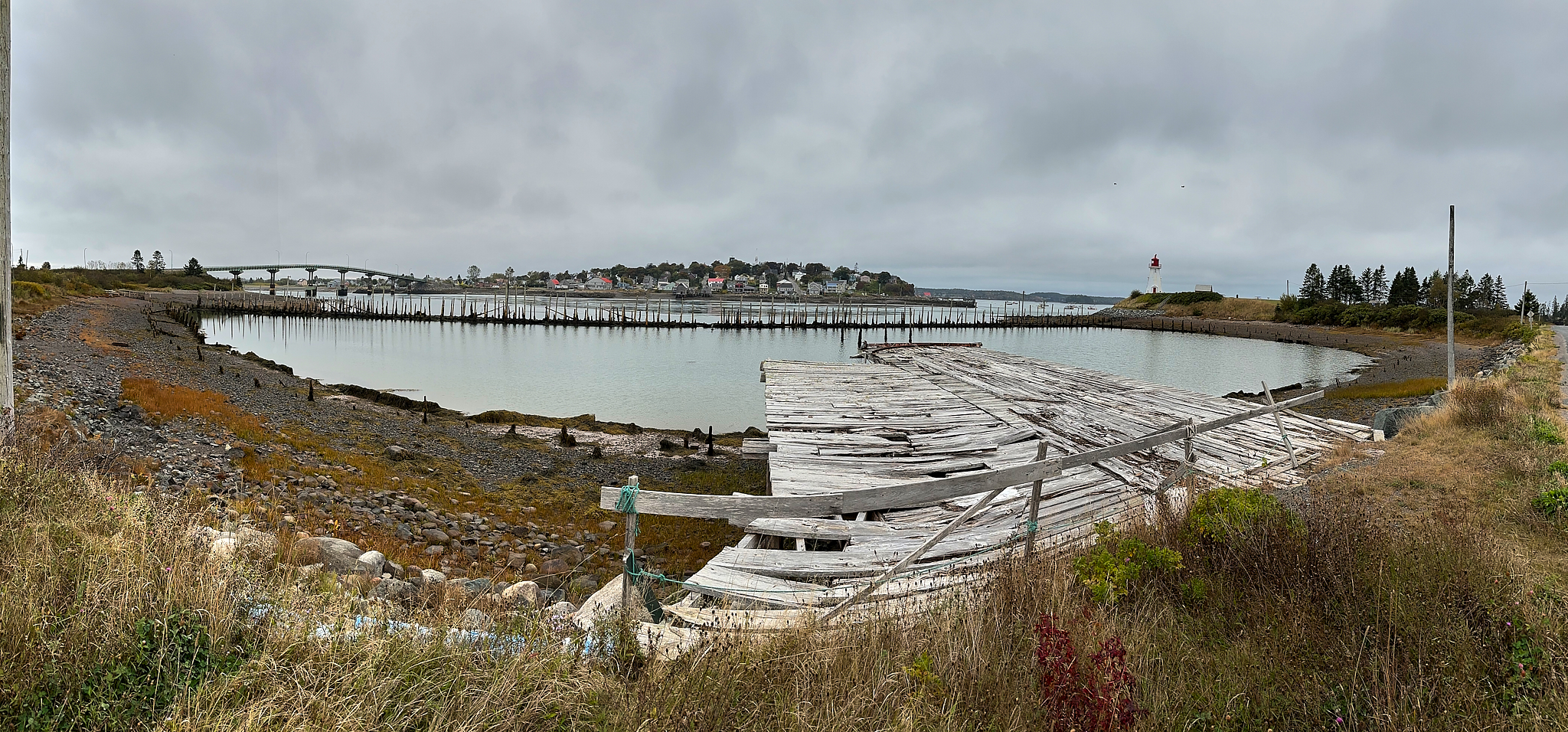
Lubec Maine from Compobello Island CA
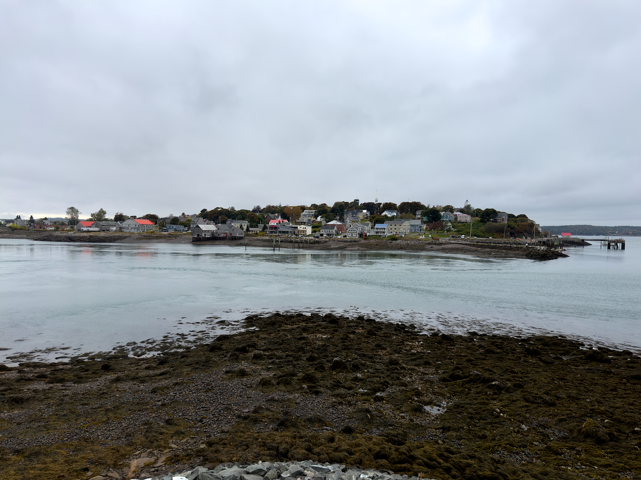
Flagg’s Pointe, Lubec Maine from Compobello Island CA
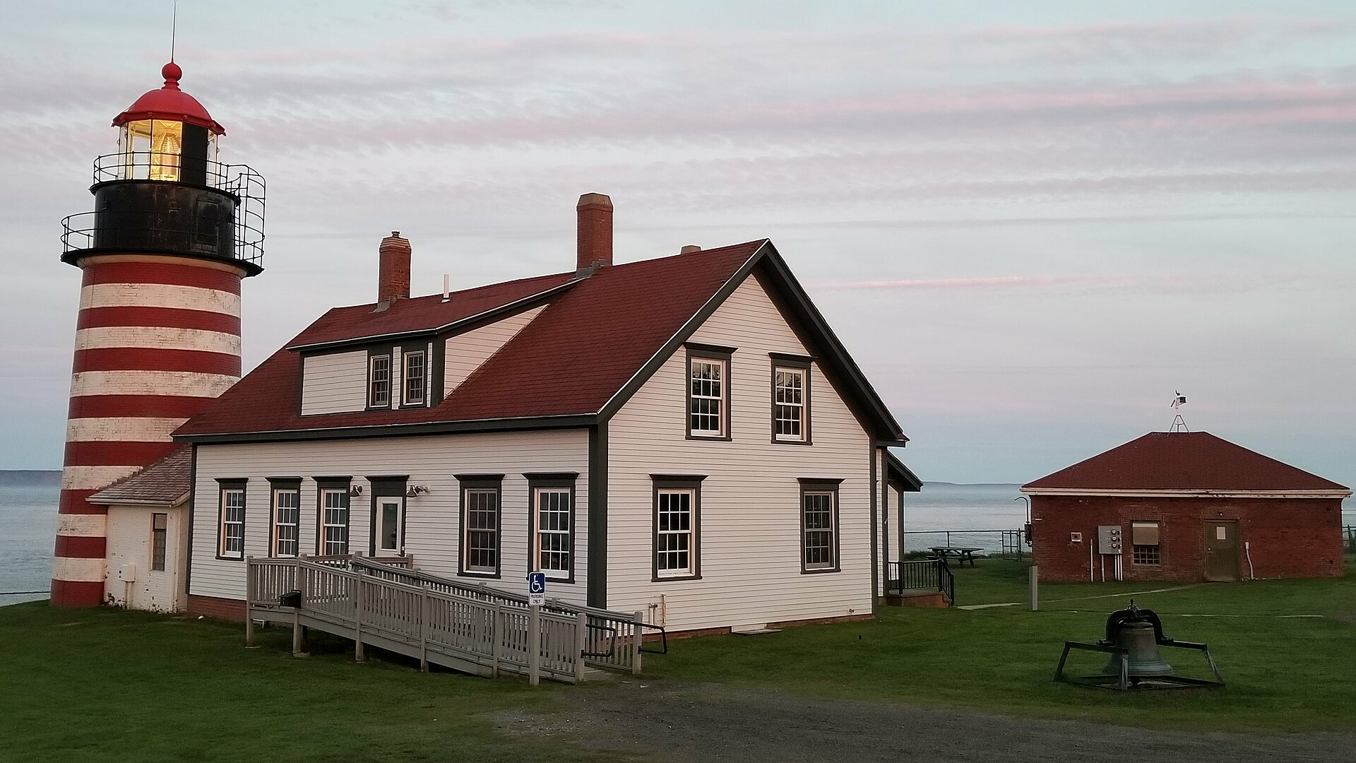
The West Quoddy Head Lighthouse of Lubec Maine
For more on Lubec Maine, look [here].
As with most of the region, the First Nations Tribe Passamaquoddy or Peskotomuhkat, aka “Pollock Spearer” lived off the land and seas prior the arrival of Europeans. More about them is [here].
Compobello Island: International Park and Summer Home of FDR
Compobello Island New Brunswick CA sits across the water (and international border) from Lubec Maine. The island is a wonderful place to visit. The island has no direct road connection to anywhere else in Canada. Travel to Canada without going by bridge through Lubec Maine requires two ferry crossings.
The Roosevelt Compobello International Park presents a fascinating story. It is the only park in the world maintained by two countries (US and Canada). The park, for the most part, looks such as it did starting in the Guilded Age (late 1800’s) up to the 1940’s. It is the era of the Elite (and all their children and support staff) spending the summer at their large estate or in grand hotels. The island experiences outsized land speculation and resort building during the 1880’s. Four large hotels are built within a few years of each other. FDR’s parents buy land after visiting and build a summer cottage (see below).
FDR courted his cousin (and future wife) Eleanor on the island. They honeymooned on the island. In early years the FDR family spent summer’s on the island. At 39 years-old the historically fit and energetic FDR almost died while on the island from Polio after strenuous day of activity. FDR would learn that he had contracted Polio prior to his island visit. Some solid background on FDR’s illness is located [here].
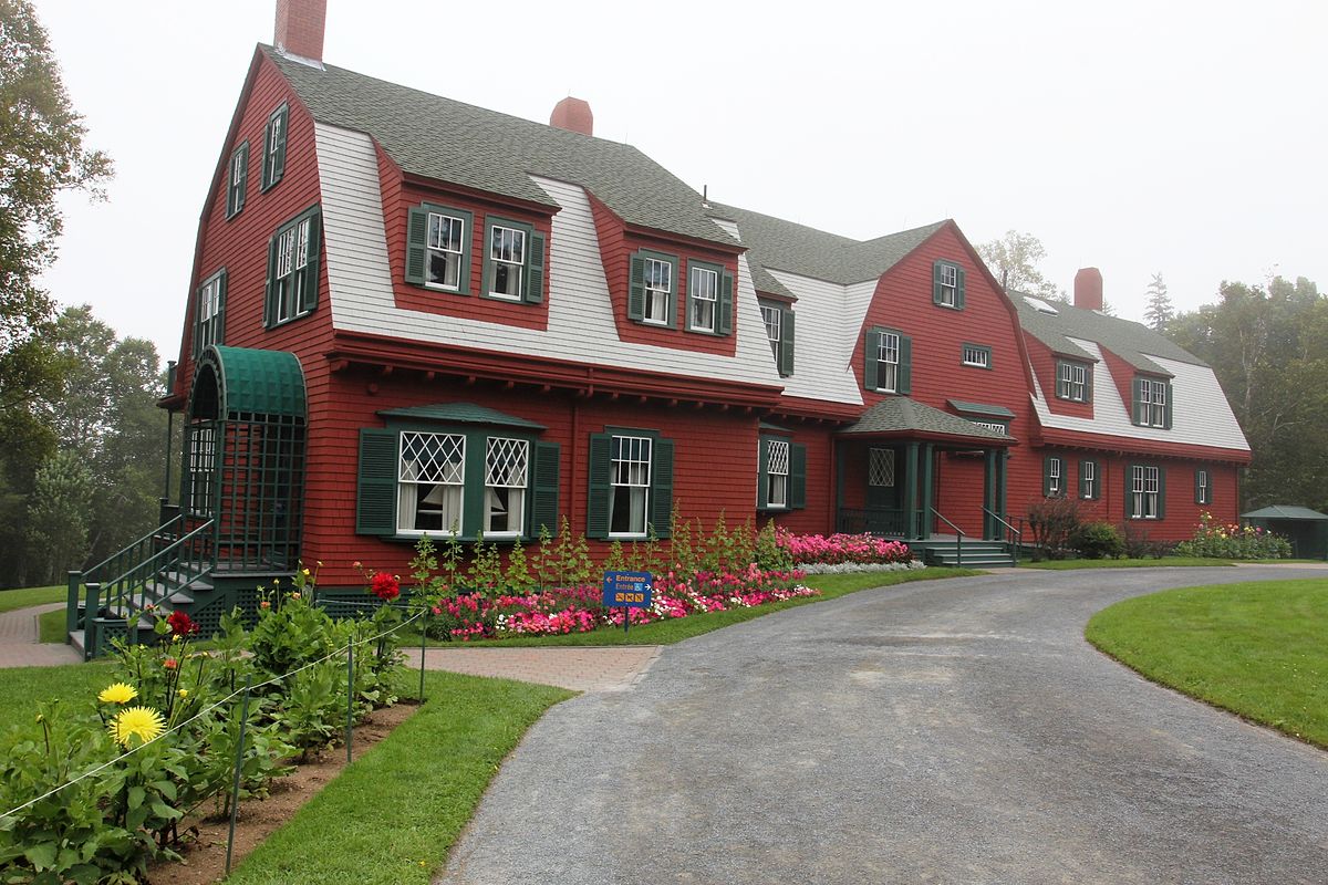
The Roosevelt Cottage.
Their are many interesting stories – with subplots about this period of time on Compobello. The National Park Service tells the story well [here].
St. Andrews and a Return to British Colonialism
The town of St. Andrews New Brunswick is located a few miles up into the Bay of Fundy from Compobello Island. By land it is about 90 minutes travel time and two visits to US-Canadian Customs away. We will do the route twice on this trip.
The storyline of French-British-Native American linage filled with religious overtone remains pervasive.
St. Andrews seems to reflect British Colonialism as its foundation.
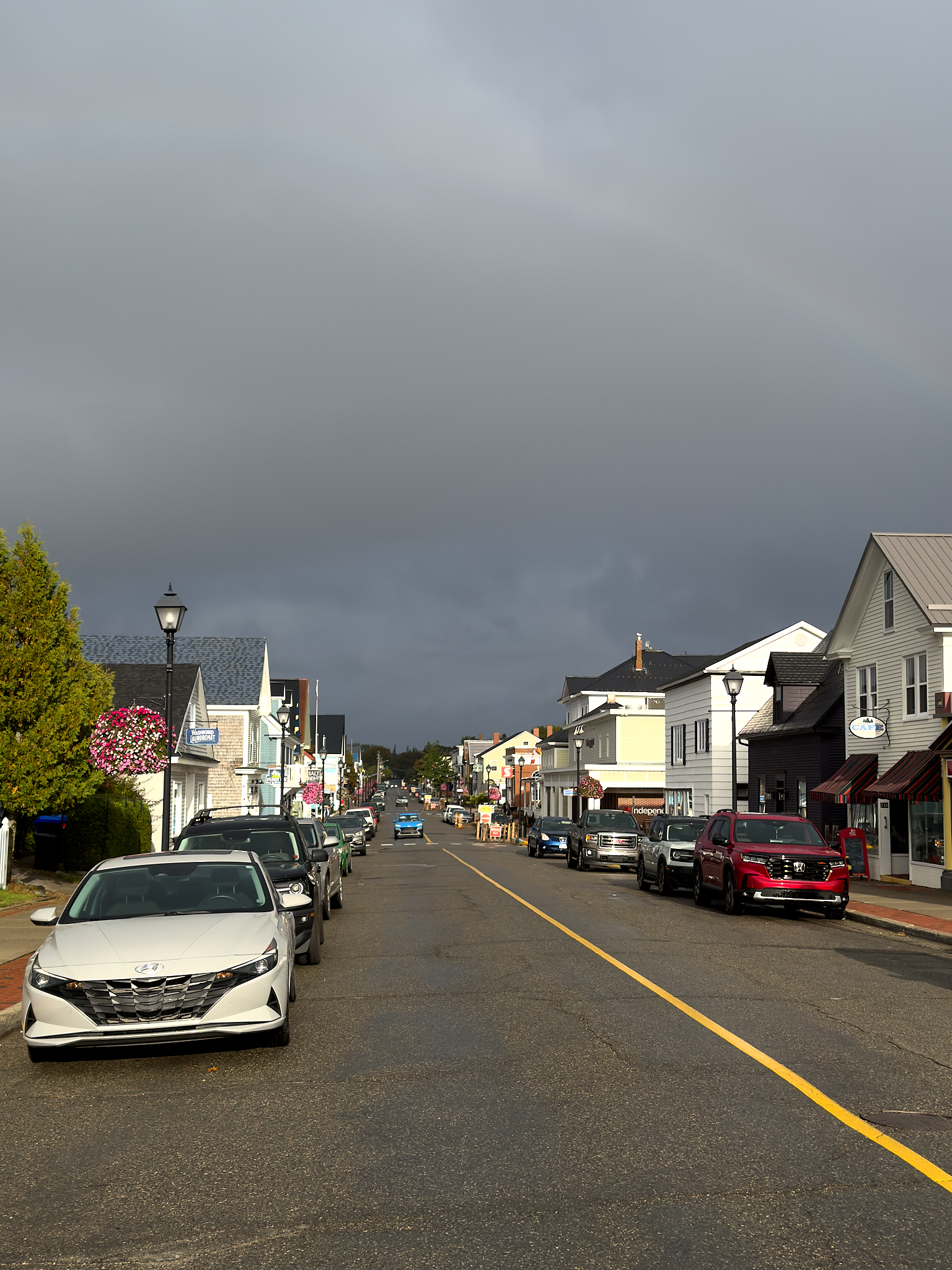
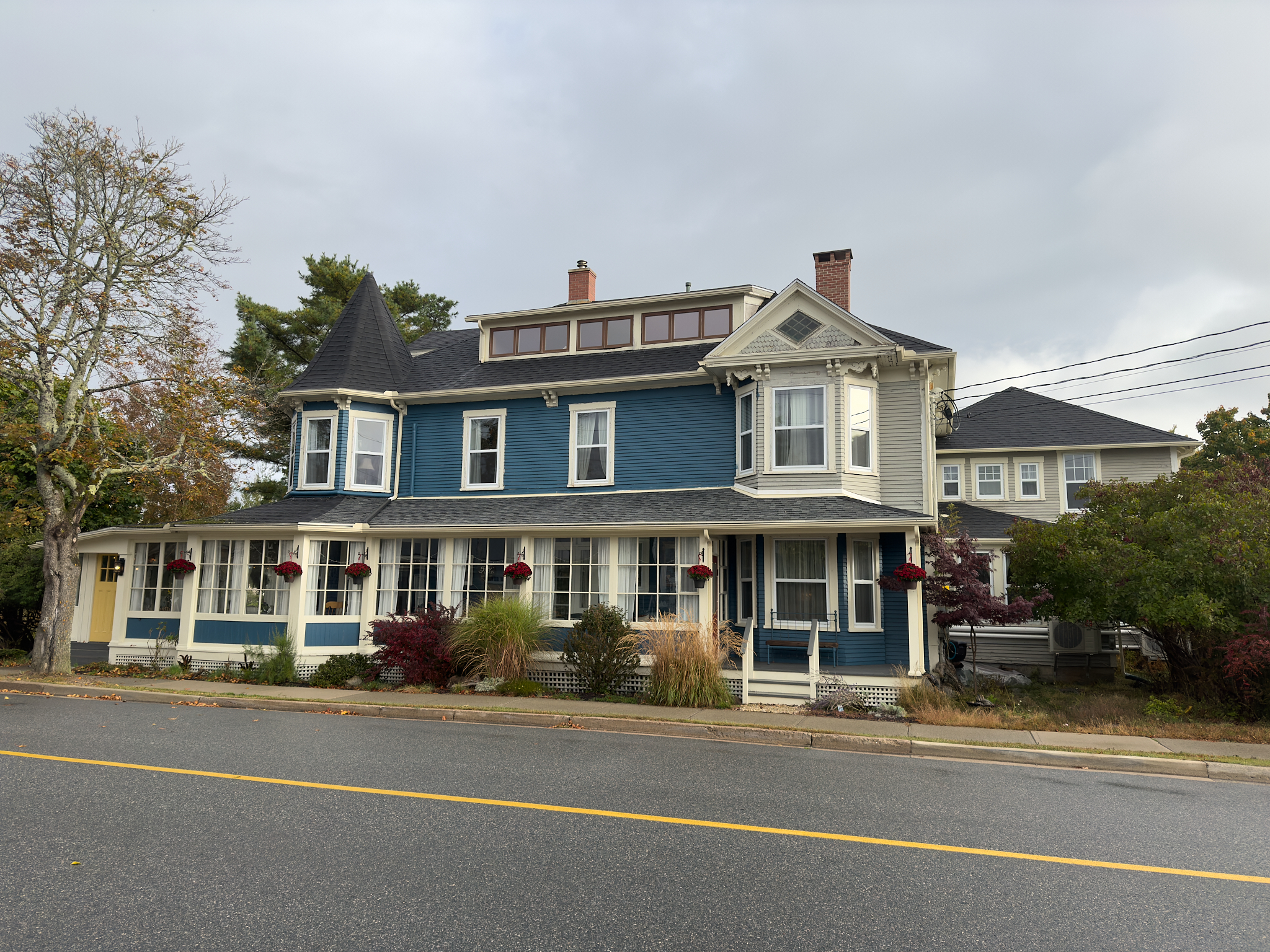
St. Andrews New Brunswick
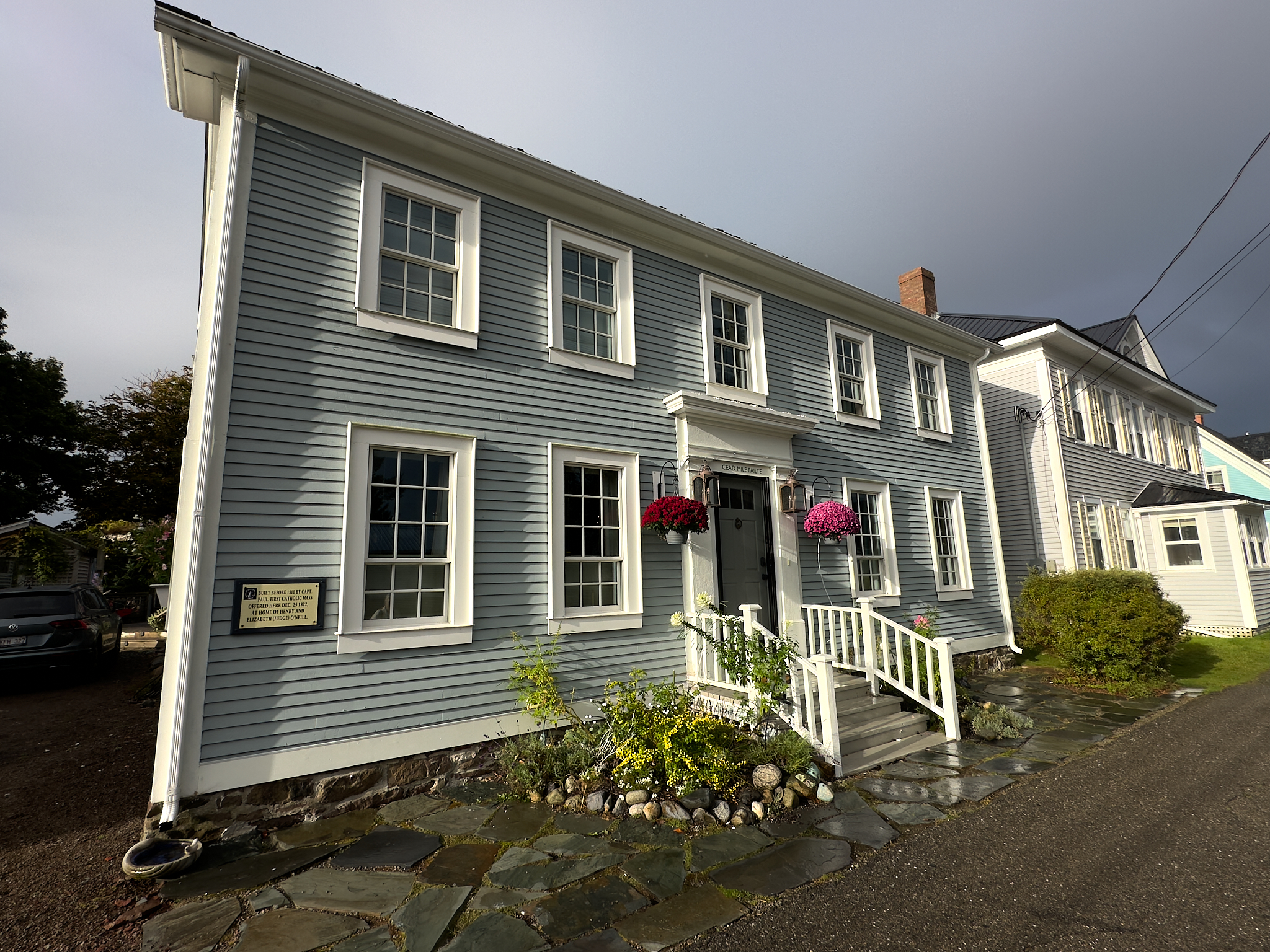
Home built in 1810 by Captain Paul. First Catholic Mass offered here in 1822.
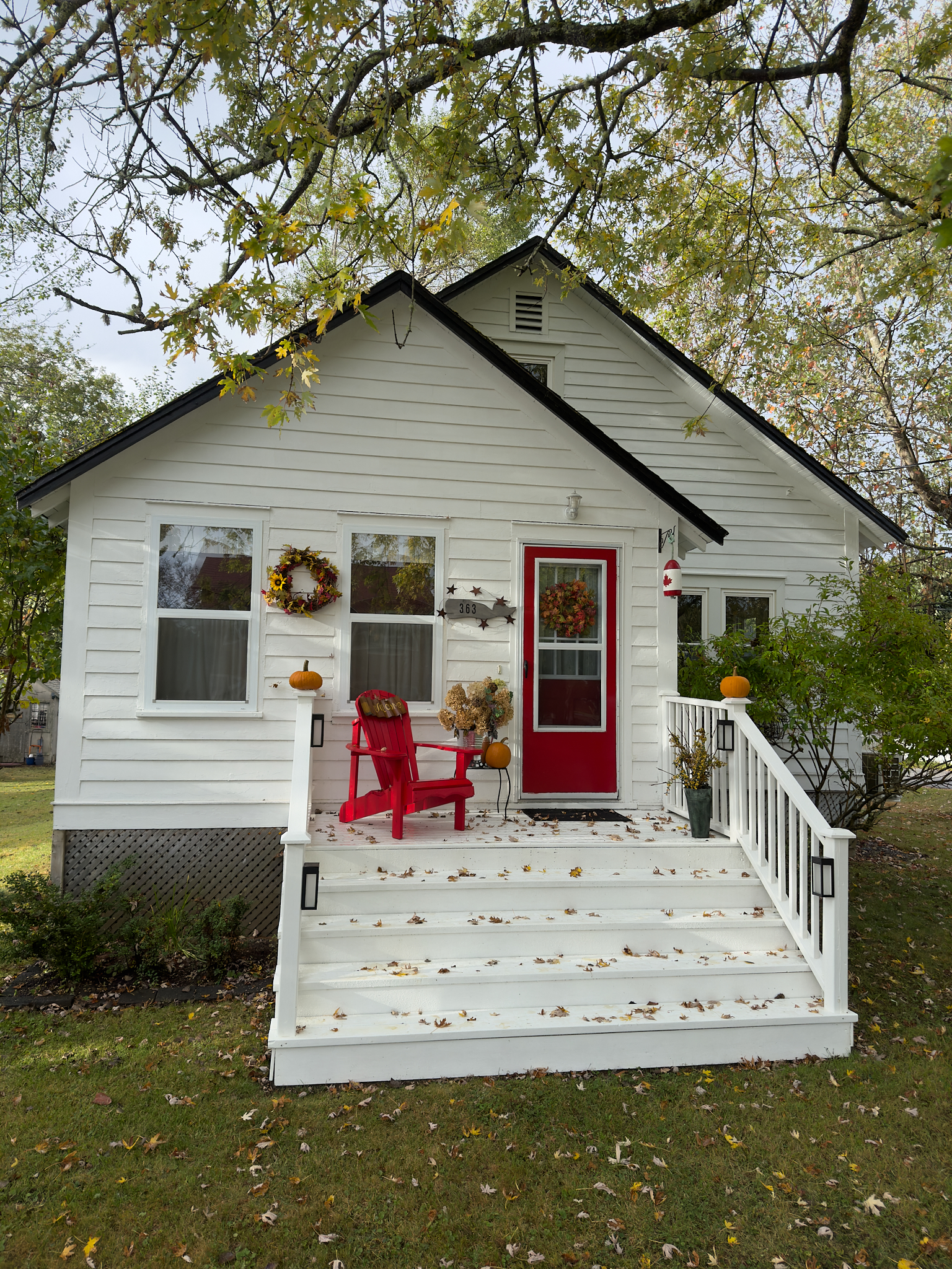
A cottage near the Lighthouse.
Built in 1808, one of the oldest waterfront homes in St. Andrews
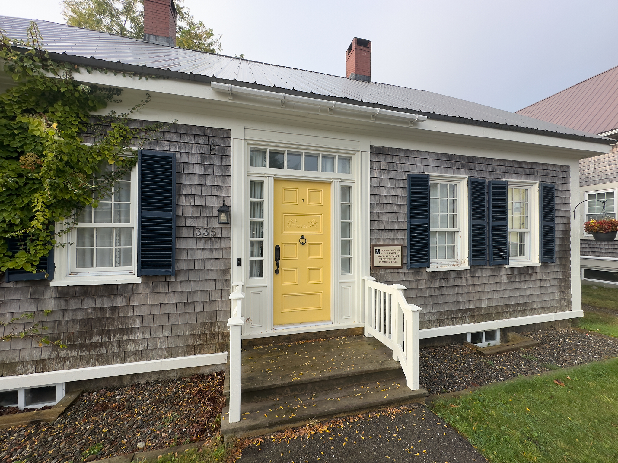
A Bed & Breakfast in St. Andrews.
The Bay of Fundy as seen from St. Andrews Lighthouse.
The St. Andrews Blockhouse
A remnant of war and privateering sits starkly where the Bay of Fundy meets the St. Croix River in St. Andrews. At this location, a British Blockhouse with canon’s pointed at the US stands ready.
A Blockhouse is a military fort (usually isolated) that defends a position. It has long slits in its walls (called loopholes) allowing defenders to fire at opposition. While Blockhouses date back to ancient Greece the British utilized Blockhouses extensively.
Three Blockhouses were built in St. Andrews in the early 1800’s to protect British Interests. When the War of 1812 became a thing, the residents of St. Andrews had little fear of the people on the other side, as the northern US traded extensively with Atlantic Canada. A local truce was immediately established. The Blockhouse’s main purpose was to protect St. Andrews from Privateer’s who raided and ransacked towns and villages in the region.
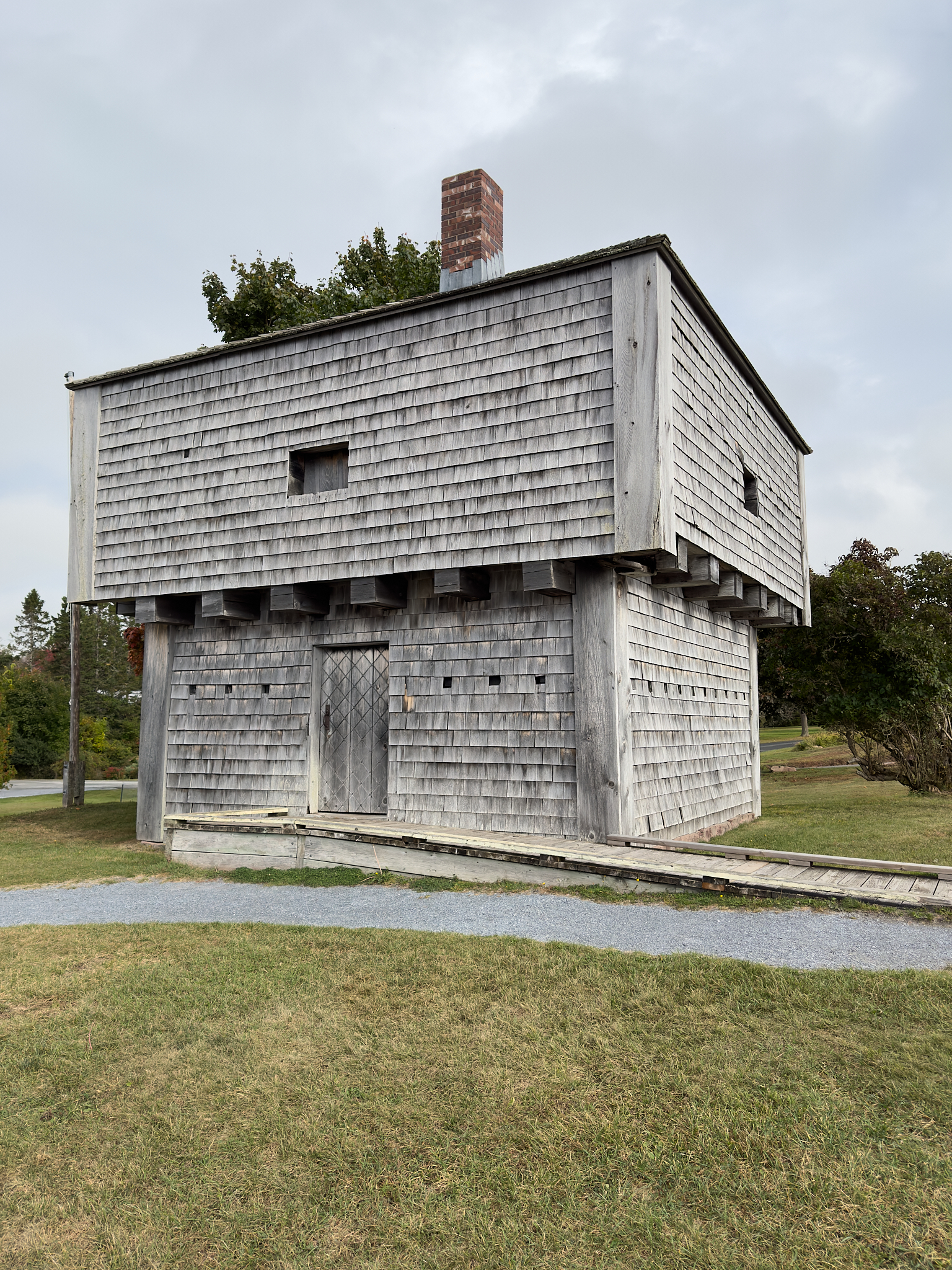
The last of the three Blockhouses in St. Andrews built in the 1800’s. The only one older still standing in Canada was built in 1750.
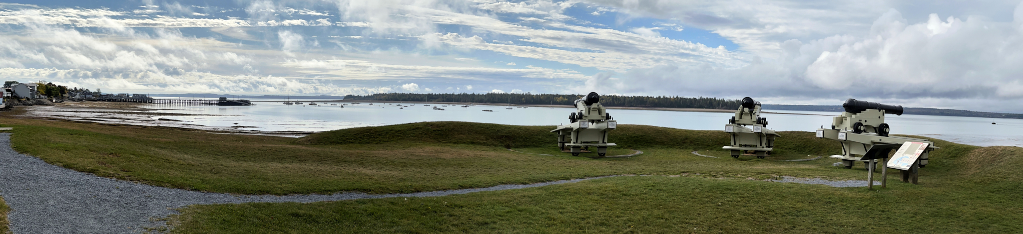
View of the Bay of Fundy and St. Croix River from the grounds of the Blockhouse in St. Andrews
Bay of Fundy National Park
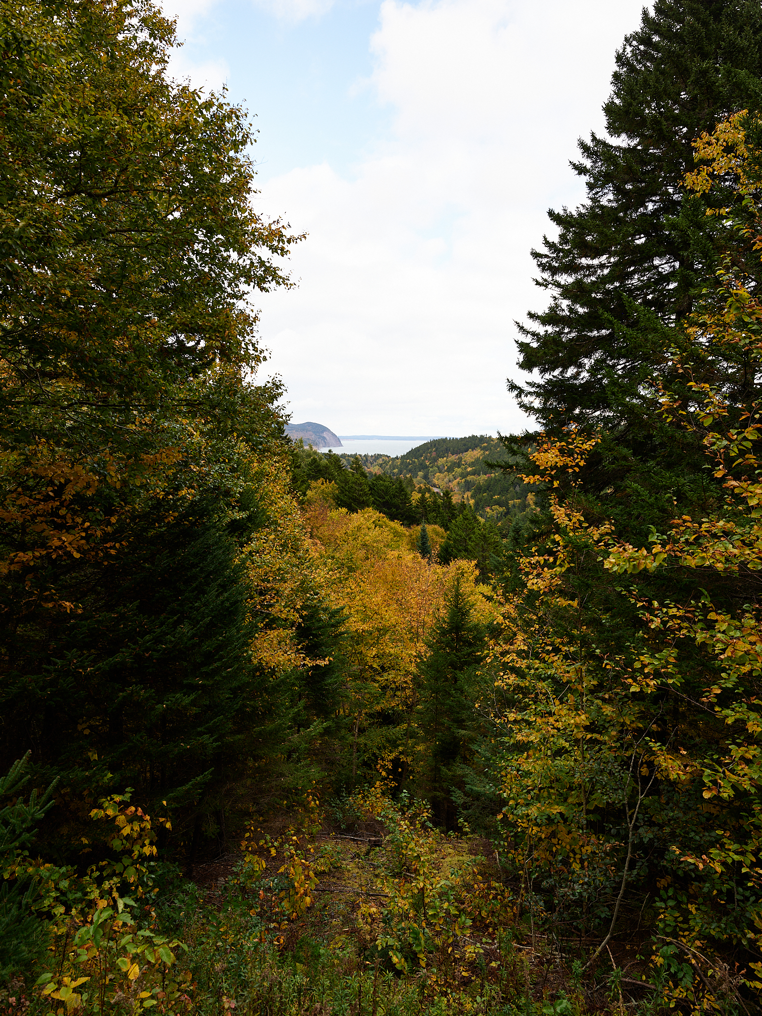
The Maritimes during the last week of September and first weeks of October are a great time to visit. The leaves on the trees are at their peak of changing color and visitors to the area are materially less than in the summer.
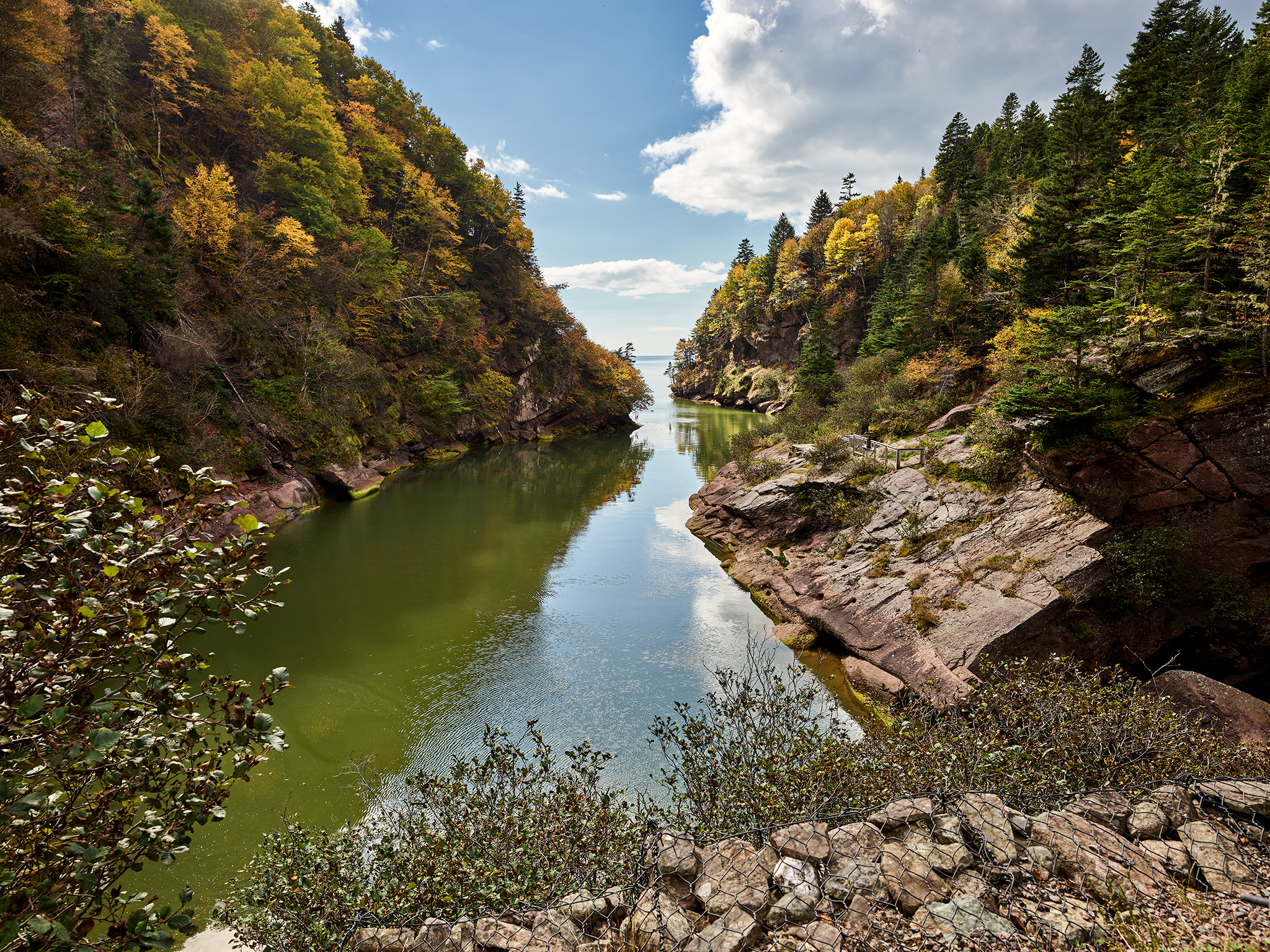
At 80 square miles in size, Bay of Fundy National Park is Canada’s smallest National Park. However, the scenery of the interior and coastline pack a wallop. The tide at Goose Bay can change as much as 49 feet in 6.135 hours. Fundy National Park provides 8 miles of coastline and stretches deep into the forests of the Acadian Highlands. The village of Alma (population 262) sits at the border of the park.
The highways and infrastructure of the park are well built and configured. They meld nicely into the natural beauty of the surroundings. Fundy National Park has 62 miles of hiking and biking (on 25 trails) and it possess 25 viewable water falls.
Two of our favorite spots from our visit were Point Wolfe and Dickson Falls. Both areas are located on the southeastern part of Bay of Fundy National Park.
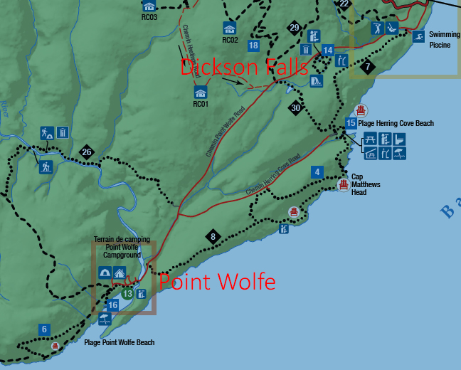
For a complete map of Bay of Fundy National Park go [here].
Point Wolfe
Point Wolfe was a village in New Brunswick. A river (14.9 miles long) of the same name flows from the Caledonian Hills to Chignectou Bay on the Bay of Fundy. The village once had 75 homes, about 150 residents, a sawmill, a church, and a Post Office. Wolfe River was dammed to assist the sawmill in operating profitably. The village was expropriated as part of development of Fundy National Park in the late 1940’s. The center of what was the village is now a campsite. The river is no longer dammed.
Point Wolfe River Bay of Fundy National Park.
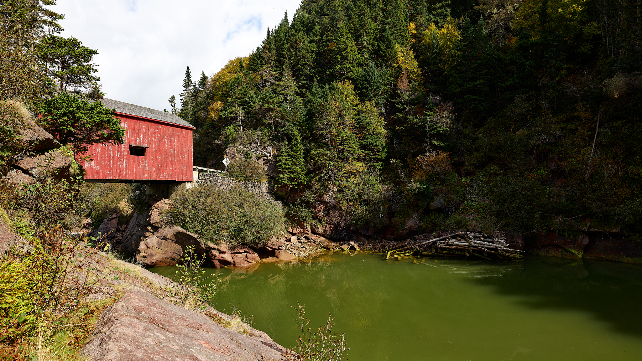
Point Wolfe Bridge, Pointe Wolfe River, Bay of Fundy National Park.
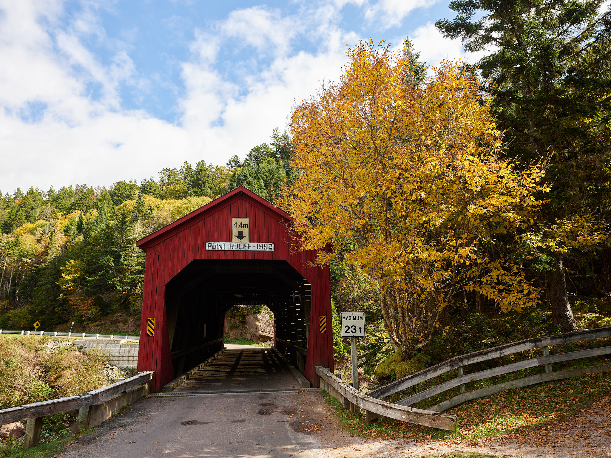
The Point Wolfe Bridge
The Point Wolfe bridge was first built at this location in 1853. It was rebuilt in 1909 after the collapse of the original. The 1909 bridge cost $1,456 ($50,400 in 2024). In 1990 the federal government of Canada determined that rock near to bridge could dislodge, fall, and destroy it. A project to remove the rock ensued. Explosives used to remove the rock caused the rock to travel further than estimated. Chunks of rock hit the bridge, causing it to collapse. In 1992 a replacement for the 1909 bridge was completed at a cost of $545,000.
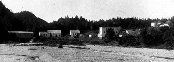
The village of Point Wolfe as seen from the Wolfe River in 1910. The 1909 version of the bridge is pictured on the far left.
Dickson Falls
Dickson Falls is the most visited (and photographed) site in Bay of Fundy National Park The Loop trail drops 140 feet down down to Dickson Brook. The trail is more of a stairs and boardwalk event for about one mile in length.
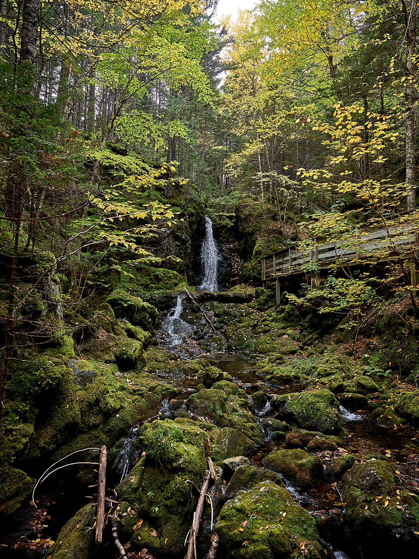
Dickson Falls
Dickson Brook heading to the Bay of Fundy in Bay of Fundy National Park.
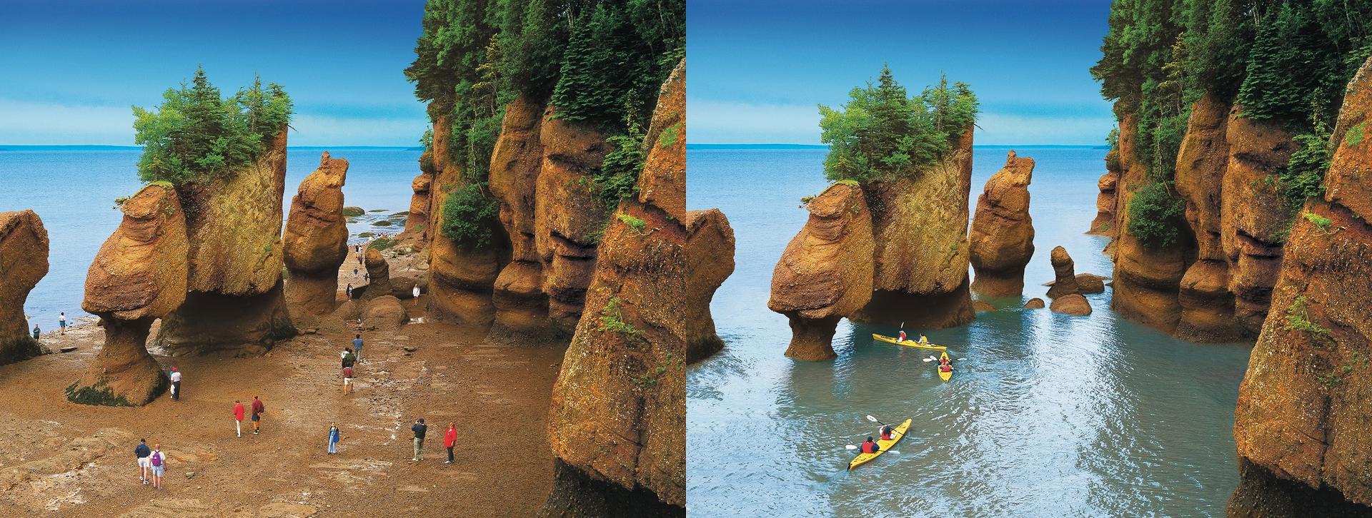
Hopewell Rocks Provincial Park
Hopewell Rocks Provincial Park is located about 25 miles north of Bay of Fundy National Park. The setting is truly one of the wonders of the world.
With over 20 sea-stacks on 1.2 miles of coastline the term “nature at work” has never had more meaning to me. A great aspect of the park is it can be experienced guided or self guided. Interpretive Specialists appear casually (as if they are another visitor) and can add remarkable insight and context to what is before your eyes.
Hopewell Rocks
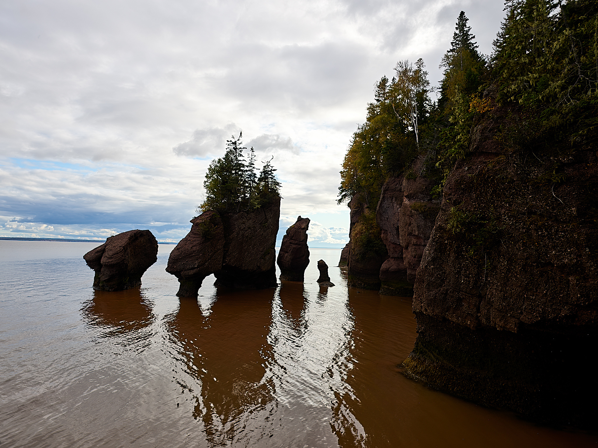
Hopewell Rocks Jeff & Linda’s view near HIGH TIDE near sunset.
On this trip I am purely a tourist travelling the Maritimes. There is no grand plan for capturing images. The nice thing is we get this viewing practically alone within 30 minutes of high tide. We also have a Interpretive Specialist on-hand – who has lived her whole life in the Hopewell area – providing back story. The tide will vary 35 feet on this day.
It is my understanding that Hopewell Rocks is also one of the finest places in the world to capture images of wildlife. About 132 different species of birds have been captured in image at Hopewell. The Sharpe Shinned Hawk would be The Prize of prizes for me. While the light is poor and I do not have my big prime lenses with me, Linda suggests I take a few minutes to look at the trees nearby for possibilities.
We spot a bird that looks like a hawk way off in the distance. The bird is surveying its territory and on occasion looks at me. The bird is a Sharpe Shinned Hawk. Perhaps we will meet again in better conditions.
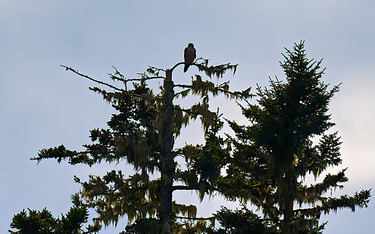
The Sharp Shinned Hawk looks me in the eyes. It seems to be saying… “call me and we can talk about best times and dates for a photo-shoot.”
*** Jeff’s Thoughts and Other Worthless Trivia ***
I am fond of Canada – the country and its people. A visit to the Maritimes solidified the feeling.
Great post
Thanks
Mikey,
You are welcome.
Terrific pics, a lot like the UP.
Tom,
I agree!
Great to hear from you.
Jeff
Still functional, handicap is 13.9. Begin play with the Men’s Club in St Augustine on Tuesday.