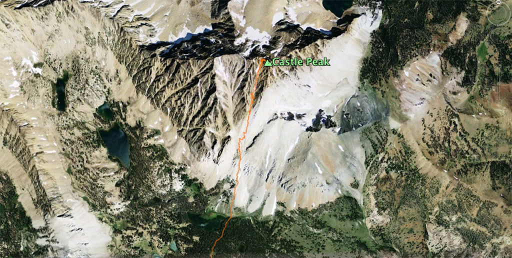
Reading about or listening to people discribing their attempt to summit Castle Peak reveals some common themes; “difficult”, “demanding”, “confusing”, “frustrating”, “painful”, “never ending” and “silly of me to attempt.” I, along with my son Kyle, decided to establish if any or all of these statements about the 15.5 mile (6,628 of vertical) trip to the 11,815 foot summit of the highest peak in the White Cloud Mountains of Idaho were true.
The first thing I found out is that round trip is 1.5 miles longer than any writeup suggests. The second is that everyone’s description of the last 400 feet of vertical being a confusing mix of narrow class 3+ corridors and gulley’s is true. The third is that no one bothers to mention is that in addition to the 5,600+ vertical to the top of Castle Peak, you will have to be ready for another 1,000 of vertical gain on the return trip back to the trail-head (300 of which is in the last mile).
I also learned (painfully) something about myself. Despite hiking to a goal similar to that of Castle Peak about every other week this season, I handicap myself significantly (to the point of almost breaking) if I have not slept more than four hours on any of the three nights leading up to the ascent and have worked five straight 12 hour+ days. As Kyle said to me about 600 feet from the summit, “kind of hard to operate when the batteries have been run down to nothing.” Simply put I had no reserves available to me on this day. Luckily Kyle had a fully charged battery and helped guide me to the summit.
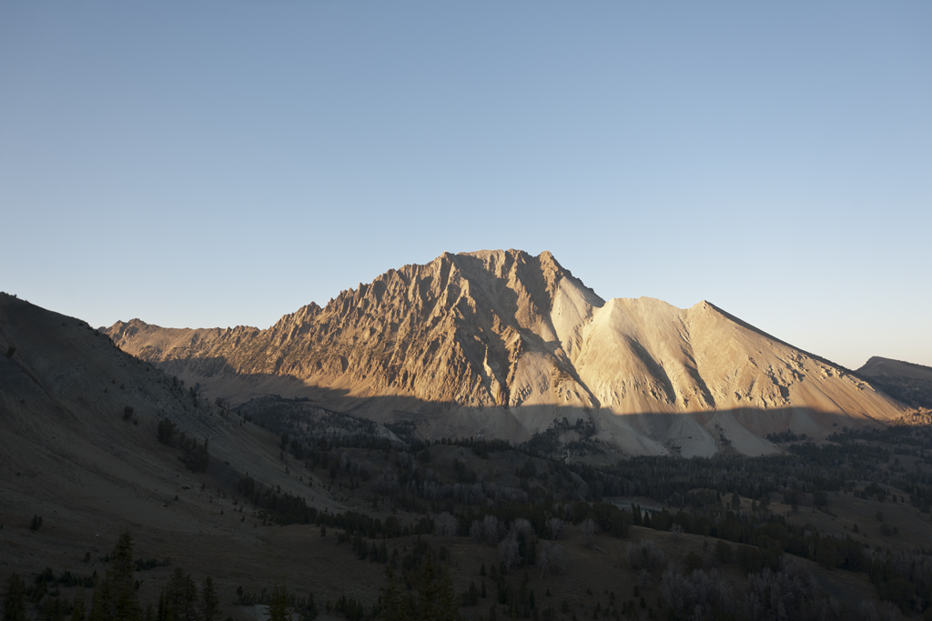
![Castle Peak in the Morning [CF007192]](http://jefflubeck.net/wp-content/uploads/2012/10/Castle-Peak-in-the-Morning-CF007192.jpg)
Castle Peak just after sunrise from the saddle overlooking Chamberlain Basin (9,852 feet elevation).
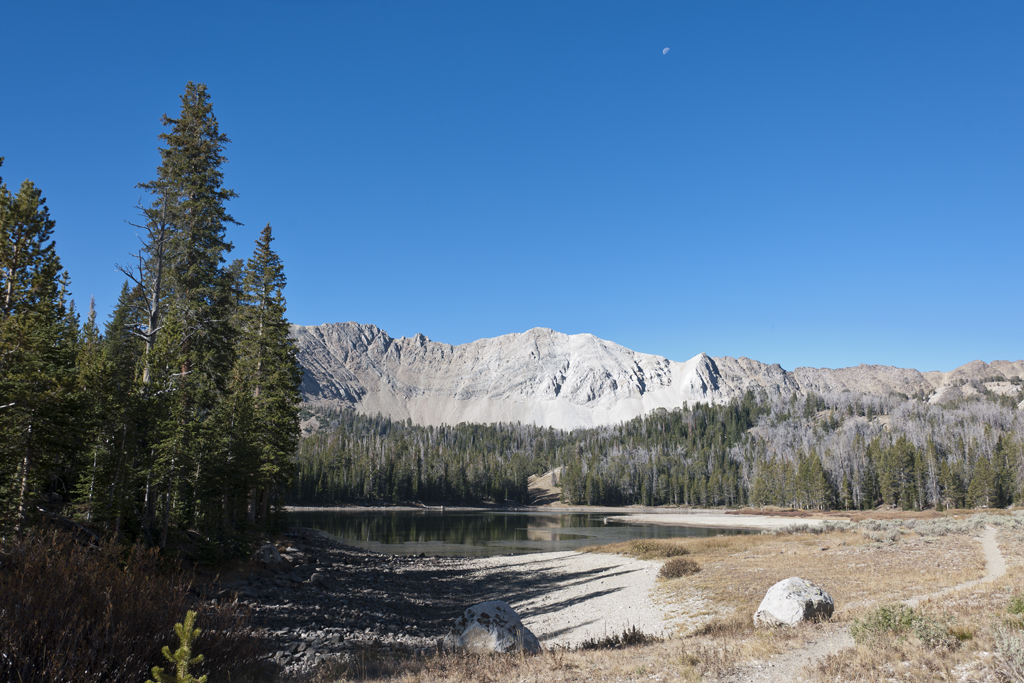
I was told by a few people that attempting Castle Peak from the south and the Chamberlain lakes basin might involve up to 15 hours of effort start-to-finish. Given this situation, the majority attempt Castle as part of a multi-day camp out with most using the lake at 9,197 as a base. Kyle desired to try Castle in one day using the house as the starting point. Seeing we had taken this approach all season – I agreed. However, given it was now October we would need options (i.e., headlamps, different types of clothing) as backup and start out from the house well before sunrise. I have been part of many hikes and competed in many ultra-marathon back-country mountain endurance races, so I knew what we needed to do and have at our disposal.
The first cold front of the fall entered the region on Wednesday. Therefore I knew that although the weather was going to be sunny and free of precipitation the temperatures were going to be lower than normal. Both Kyle and I prepared for the possibility. Driving to the trail-head the temperatures hovered between 12-15 degrees Fahrenheit. The trail-head is 11 miles in from Highway 75 (Valley Road just south of Smiley Creek) and becomes a lightly traveled forest service road/jeep trail (Pole Creek) that gains, drops, gains and drops about 2,000+ vertical feet and involves three water fording. The Jeep Grand Cherokee has been up to these kinds of conditions this year and handles the challenge with plenty of room to spare. The trail-head is on Washington Creek and at 8400+ plus elevation. The trip takes us 1:40 start to finish.
With the sun less than 15 minutes from rising Kyle and I head out in 15 degree temperature (7:55 AM). We set a fast pace to get warm. The trail-bed is in very good to excellent condition. However, I just do not feel like myself – but the going is smooth, the pace seems appropriate and the terrain and views are awesome. Along the way Kyle and I follow all the ground rules of staying hydrated and taking in small amounts of fuel.
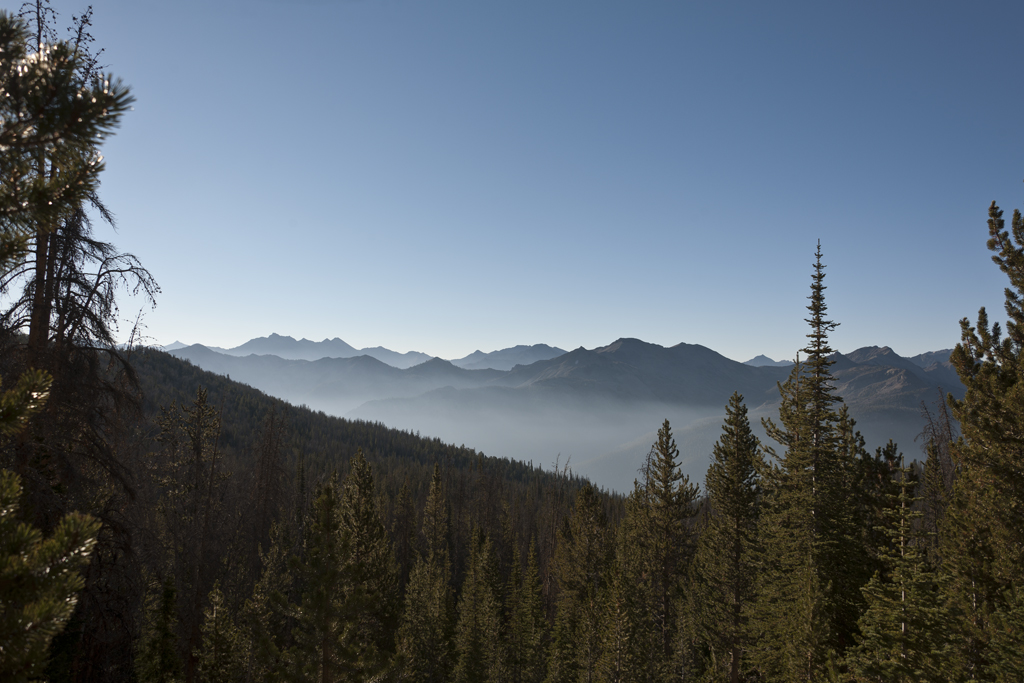
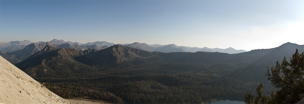
On the way to Castle Peak about 1/2 mile on the south side to the saddle (9,852 feet elevation) overlooking Chamberlain Basin and onto Castle Peak.
We arrive at a saddle that allows us to look at both the Boulder Mountains to the south and east and upon turning the other way – down into the Chamberlain Basin and Castle Peak to the north and west. The views are breath-taking. From the saddle we drop down into a set of lakes with the unnamed lake (at 9197 feet) sitting at the base of the ascent.
At the lake 9,197 the trail T’s into a another trail that heads west and east. There is no real trail from this point to the summit which is 2,618 feet above all of which is to be gained in a little over a mile. Kyle and I water up, split an energy bar and carefully go over maps and descriptions by others who have attempted to summit via this route. It should be noted these descriptions are at times vague and conflicting.
I will now use some words and phrases to describe the next 2,000 vertical feet of the ascent. Cross-country, loose scree, kinda looks like a trail, couloir, huge waterfall at some time during the year, bolder hopping. really fun bolder hopping, class 2+ section, gully, really nice low class three section with really good holds, nasty ancient rock that produces small slides, and 2 steps up and 3 steps back.
With about 600 vertical feet left, Kyle can clearly see I am not keeping our normal pace – not even close to the one on the Class 3 section of Thompson Peak last week. My legs feel strong and I feel no more winded than that on Hyndman Peak. However I have no energy or reserve to draw upon. We asses the situation and both agree I can make it to the summit but not at our normal pace. Kyle makes a nice adjustment and keeps his eye on me. We also agree that we need to stop and re-access the final route as we close in on the summit.
At about 75 – 100 feet from the summit there are a number of gully’s and gaps before us. The reason for the name Castle Peak becomes very obvious to me as there appears to be about 15 turrets representing what could be the summit. We read the notes from each of the narratives and all it does is add confusion. Kyle and I agree it is time to take off the packs and scout the area and talk about which way makes sense. Kyle climbs to a couple of spots that seem like the logical summit and visually sights what he thinks is the highest. Some of the descriptions from the narratives are not what we (or the most detailed map) indicates is the top. What Kyle thinks (and the most detailed map indicates) is the top is our choice. The good news is that this break for sighting has allowed my energy to return and the last piece of gain and solid class 3+ climb is actually enjoyable.
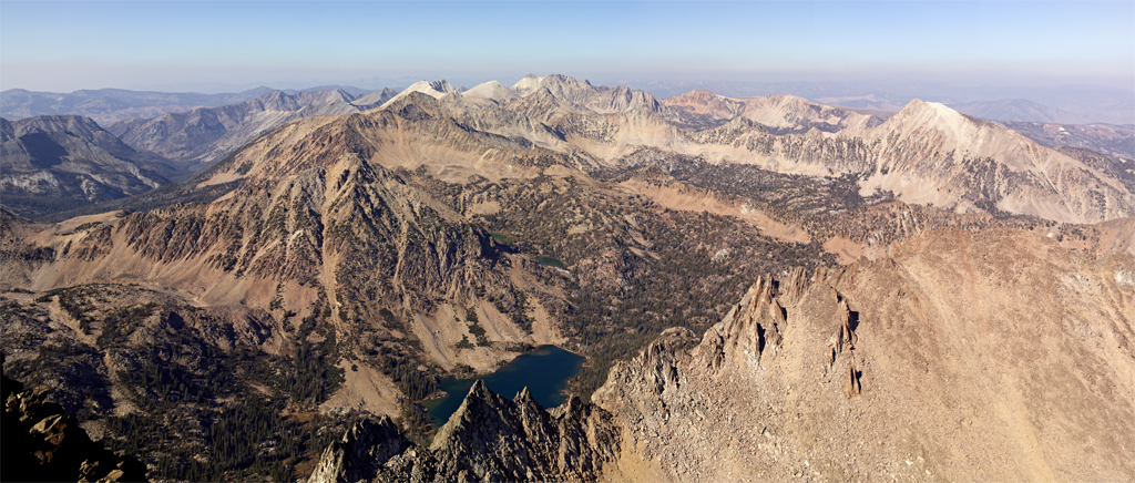
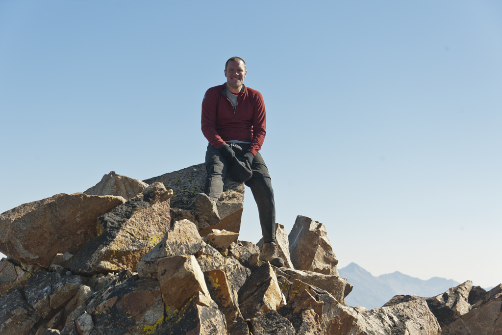
We eat lunch and take pictures using the camera gear I have lugged to the summit (of which I have seriously questioned its value on this day). It should be noted that the picture below is almost three feet high by five feet wide at 100% resolution (i.e., no enlargement). This image printed on satin-canvas is nice looking to some. The image has been reduced by over 90% to fit on the screen.
Kyle and I head down the route we came. The first 1,500 vertical are less fun than the ascent. However, it is not about stamina – its is about falling debris. Kyle and I agree that we need to navigate more closely as a group one section at a time in order to avoid being hurt/seriously injured/killed by falling debris.
Once down to lake 9,197 we power up to its sister lake and then to the saddle at 9,852. For some reason my energy has returned. Creek beds with little frozen waterfalls form this morning remain frozen. At the saddle, I take a shot of Castle Peak at sunset.
Years ago my friend Mark Curtis taught me some techniques using varying strides on downhill returns. Sometimes downhill routes at the end of a hike can be tiring and injury riddled. Seeing my energy level is surprisingly good, Kyle and I agree I will lead and set a very brisk pace, in the hopes we we get back to the Jeep before headlamps are required. Both of us carry a really strong pace – even over the last mile and last 300 vertical feet of gain at the finish. We arrive at the Jeep at little after 7:30PM (7:38). We made it. So in about 11:45 we summit-ed Castle Peak, took photos for 1.5 hours along the way, had a nice lunch and returned to our vehicle without needing to use our headlamps. After a full change of clothes and footwear we are on our way home. We get back to the house a little before 9:30. Linda has the Tiger’s playoff game and Spartan’s football game recorded and ready for viewing, while downing some Pizza and garlic bread.
Oh and what about all those words and phrases I was attempting to uncover if they were true or not? How about true! (but also add the word awesome).
![Castle Peak Route Cropped [CF007192]](http://jefflubeck.net/wp-content/uploads/2012/10/Castle-Peak-Route-Cropped-CF007192.jpg)
