March 2026
M T W T F S S
 1
2345678
9101112131415
16171819202122
23242526272829
3031  

Capturing Kauai – On Knife’s Edge at Nu’alolo

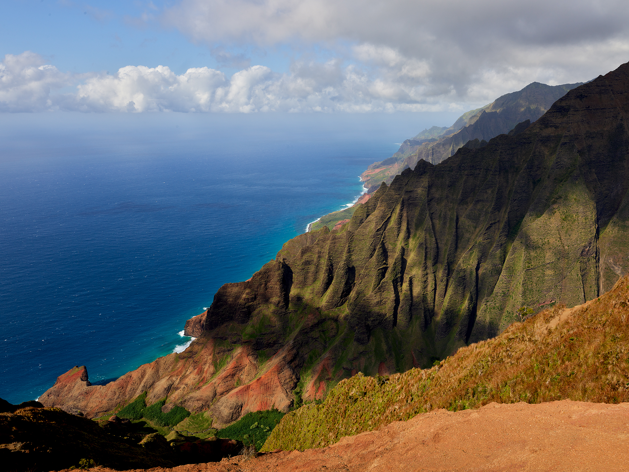
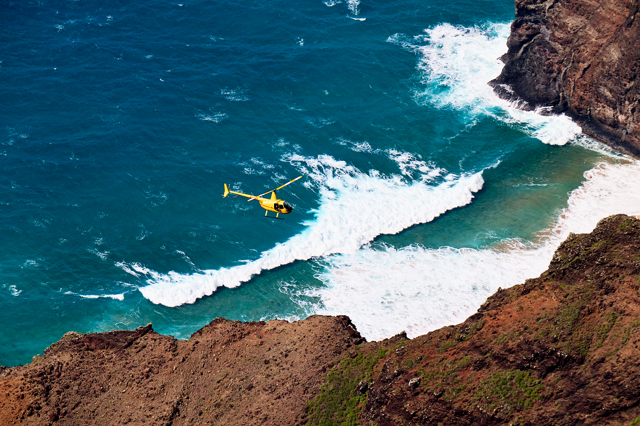
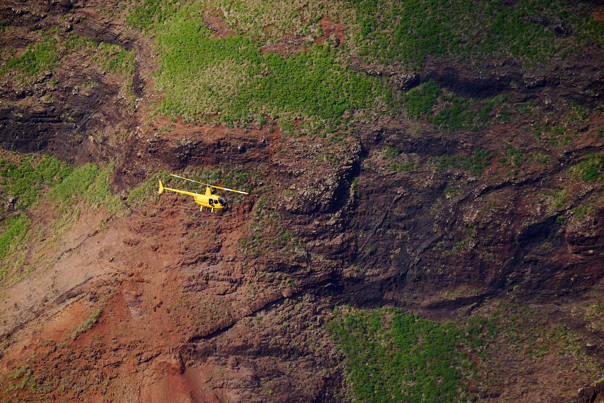
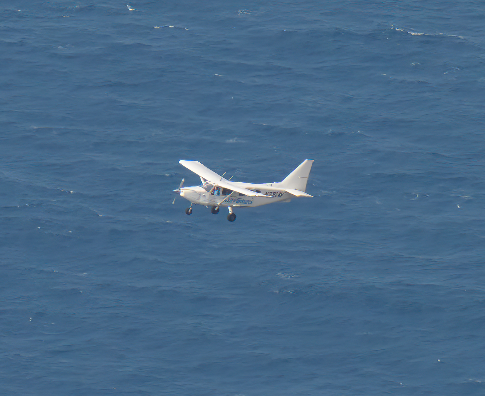
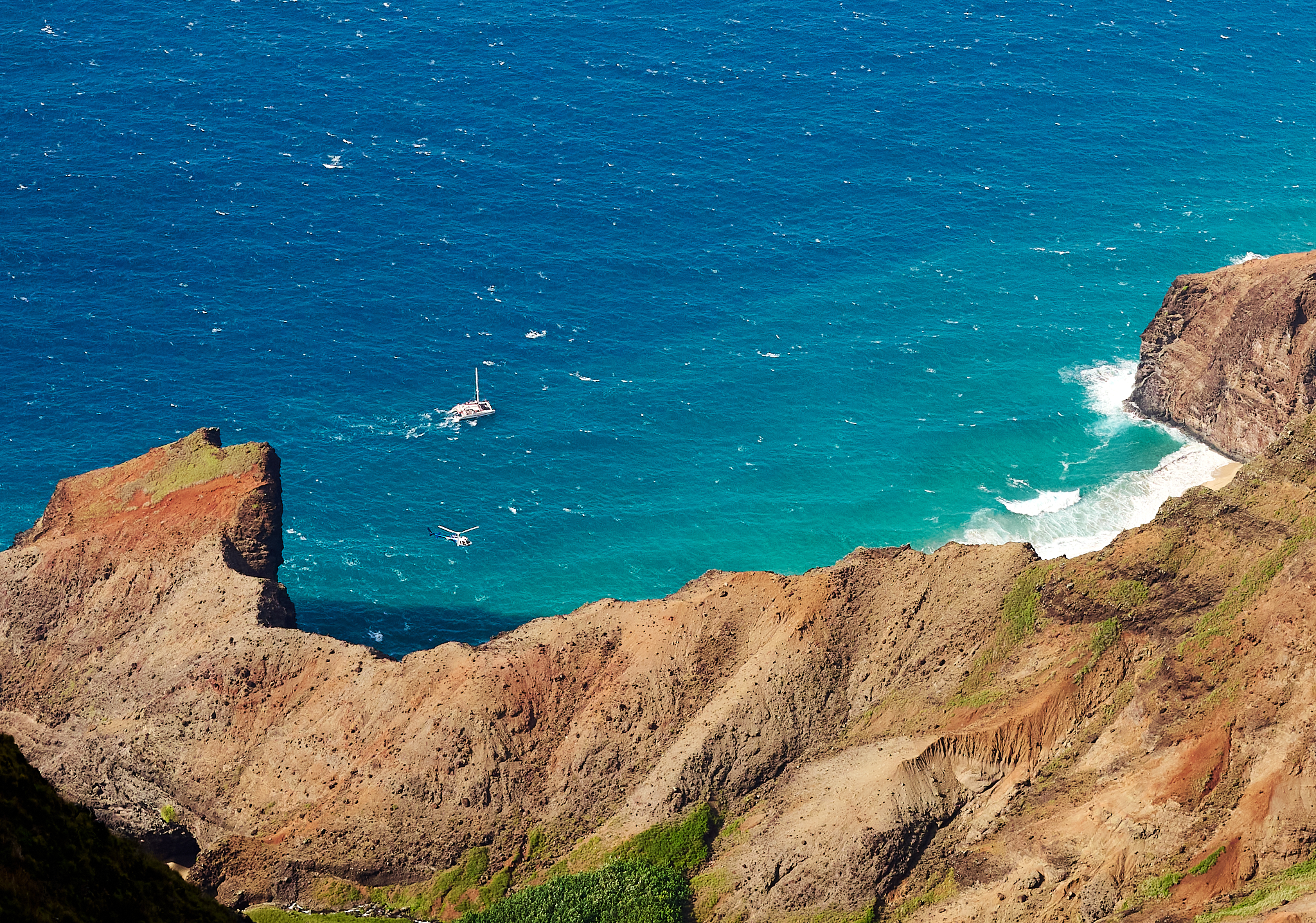
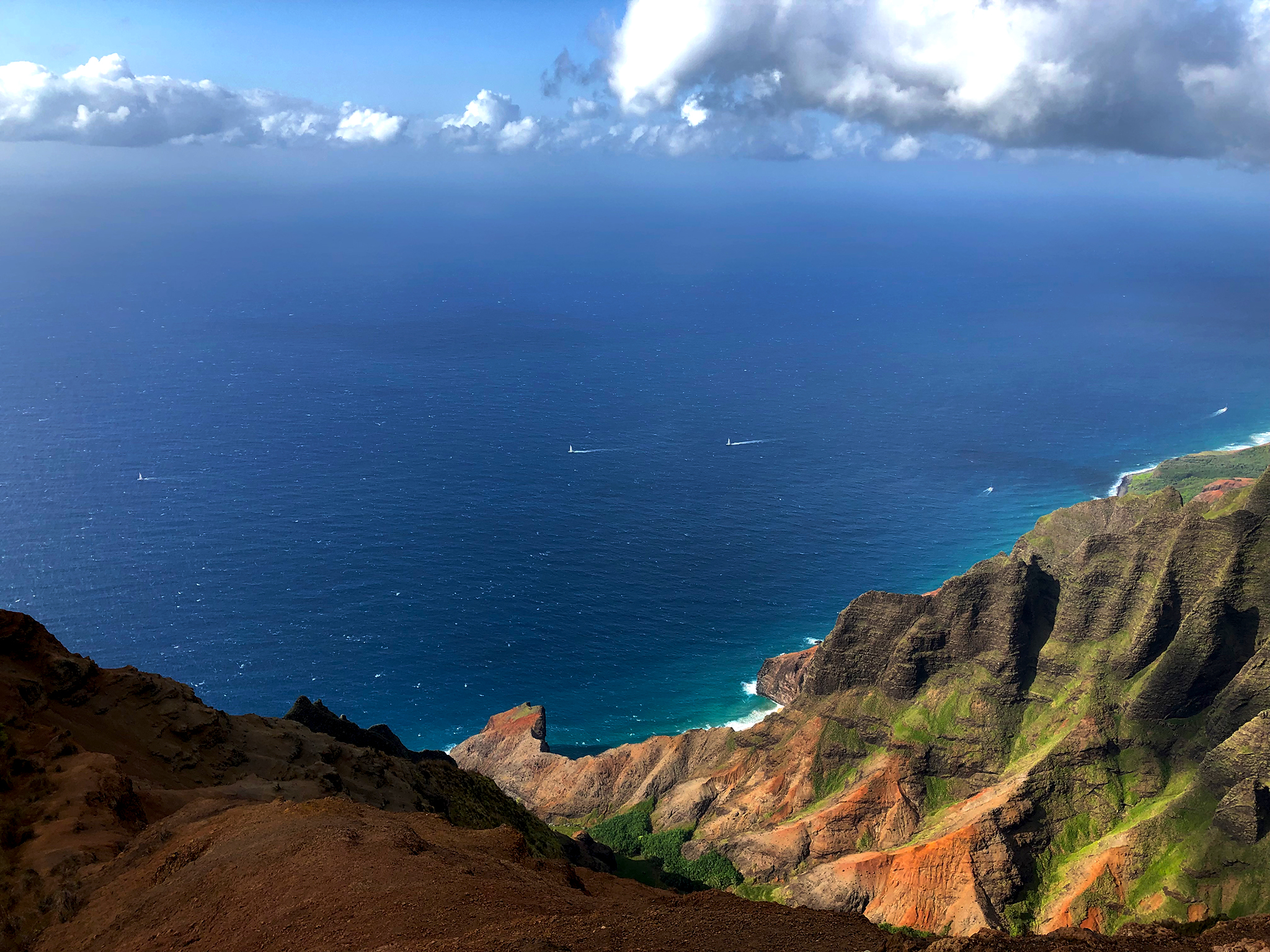
Nu’alolo on the island of Kauai is a great example for what makes Kauai magical. This canyon and shoreline on the Na Pali coast should not be missed.  Experiencing Nu’alolo and what it offers is reason enough to take a hike, and a helicopter/plane ride, and a boat tour while visiting the island.

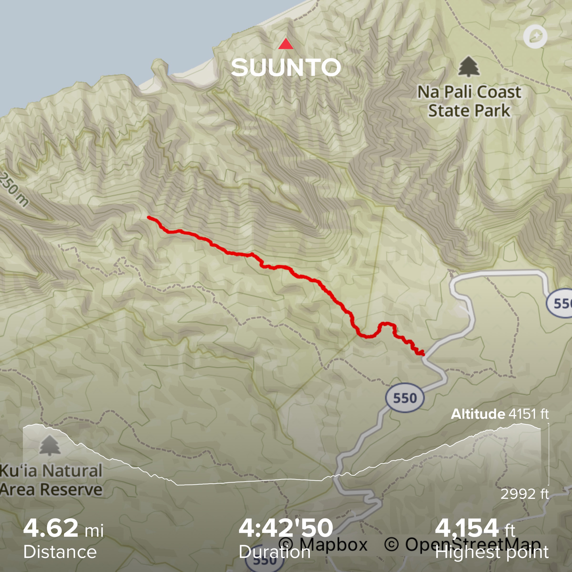
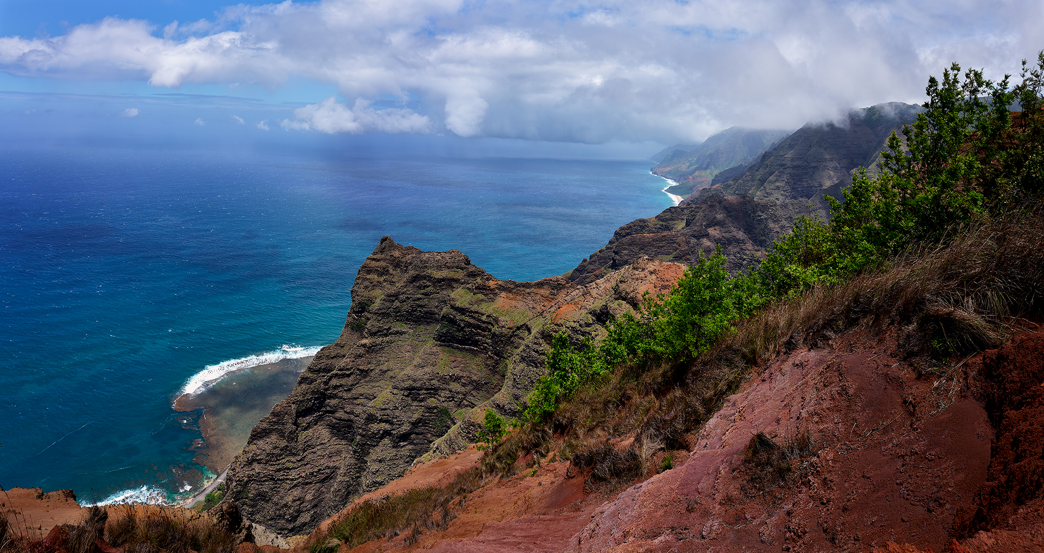
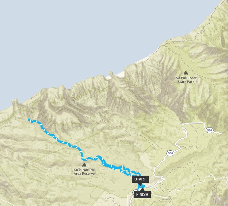
On this day, the land route is my choice.  The Nu’alolo Trail is officially 7.6 miles in length (round-trip) and 2,686 vertical feet lost and re-gained. I however, add another one-mile of length to the trip, such that I can photograph the Na Pali Coast at its finest, and Nu’alolo Kai Beach 2,089 feet above it shores.

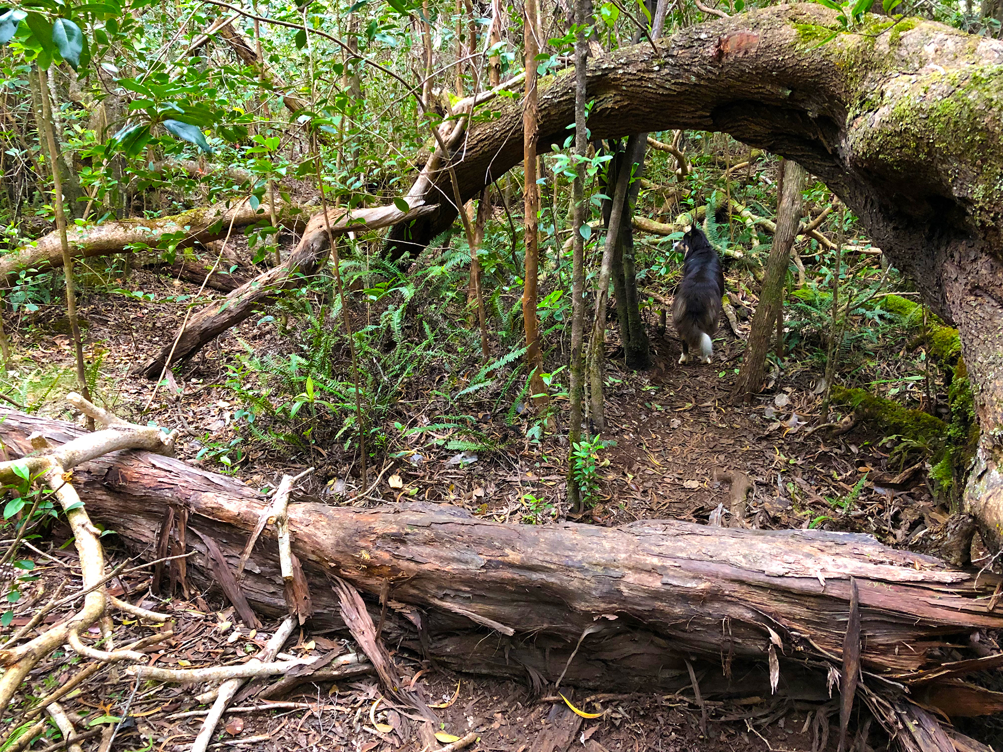
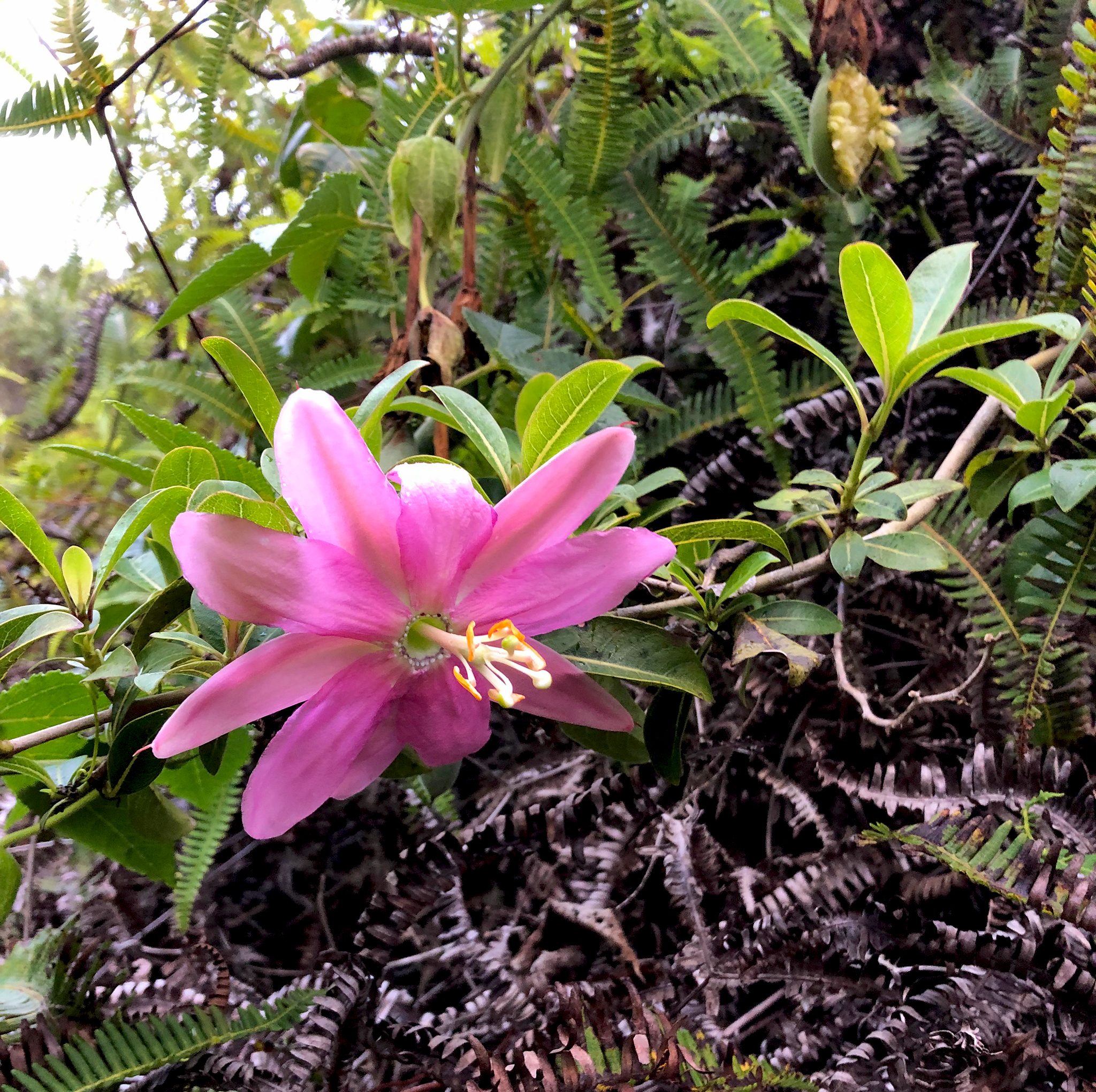
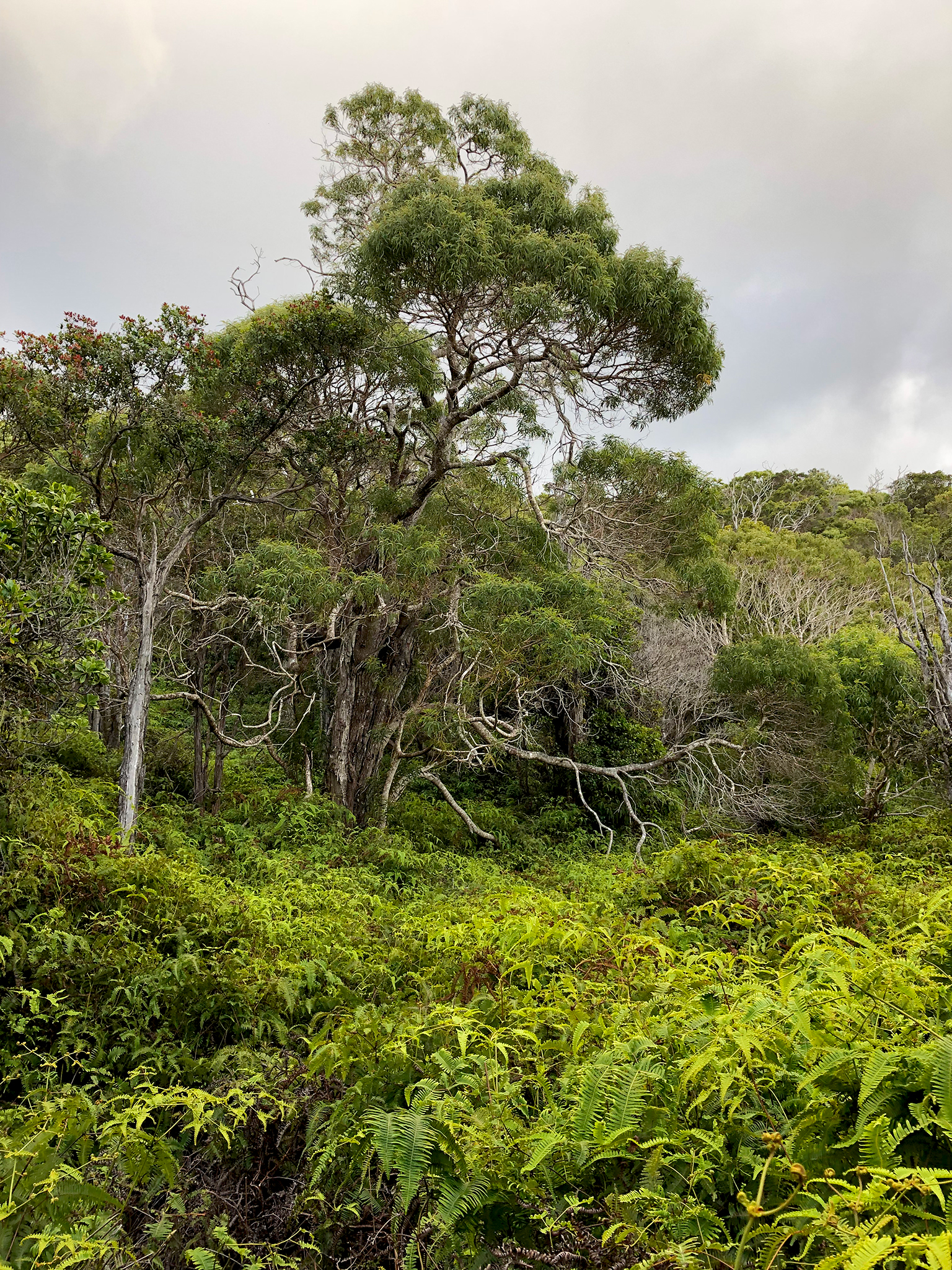
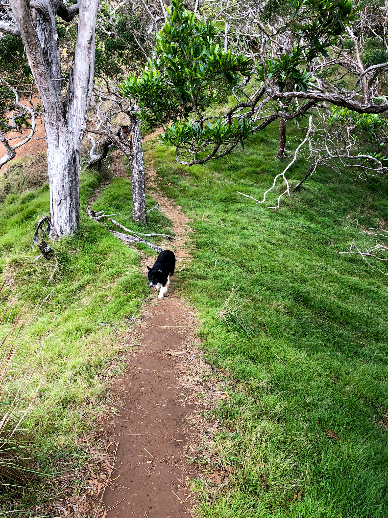
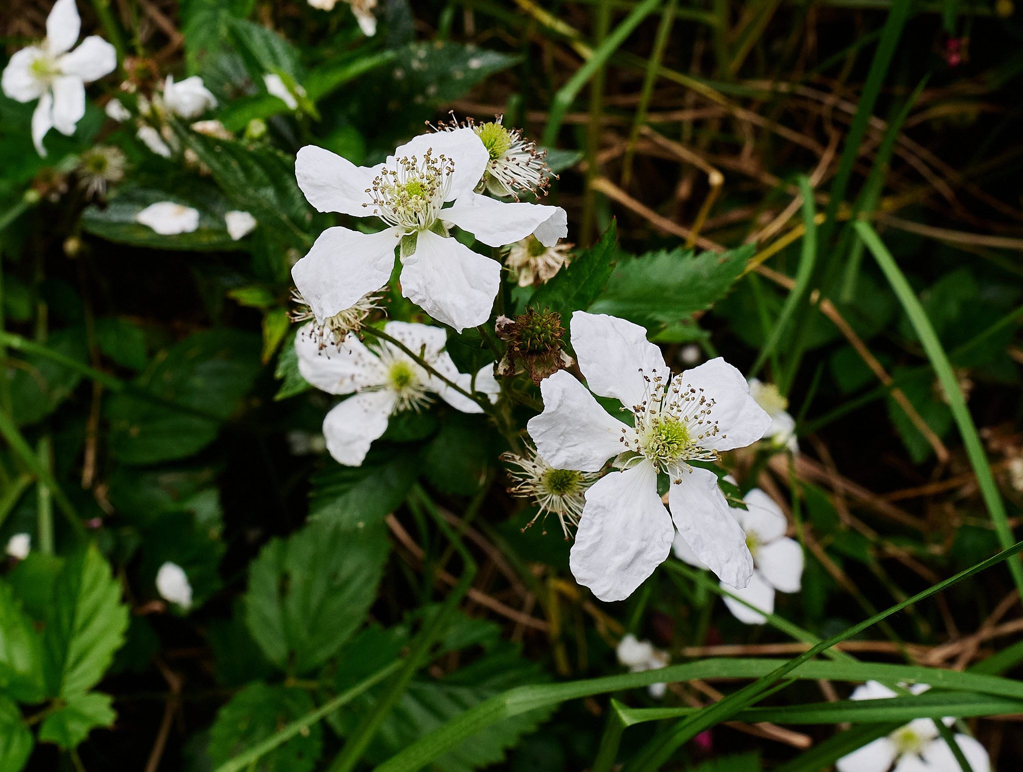
The Nu’alolo Trail offers deep forest, lush tropic wetlands, flowers, sweeping vistas, and knife’s edge ledges.

The Trip

The first mile and one-half of the trail provide the forest, flowers and tropical wetlands experience. This first section of the trail is uphill for a short burst from the trailhead. and moderately downhill thereafter.  The next mile of the trail is relatively flat.

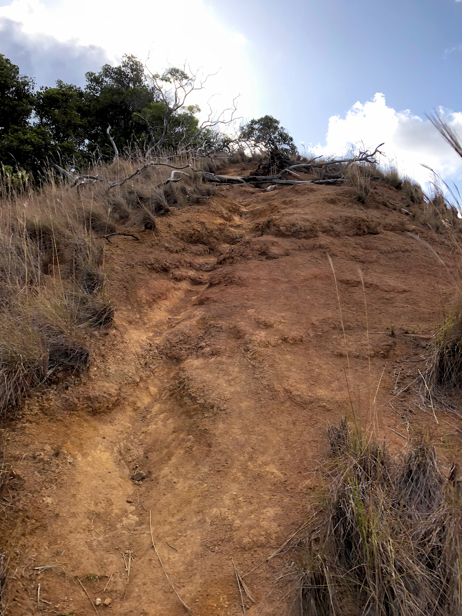
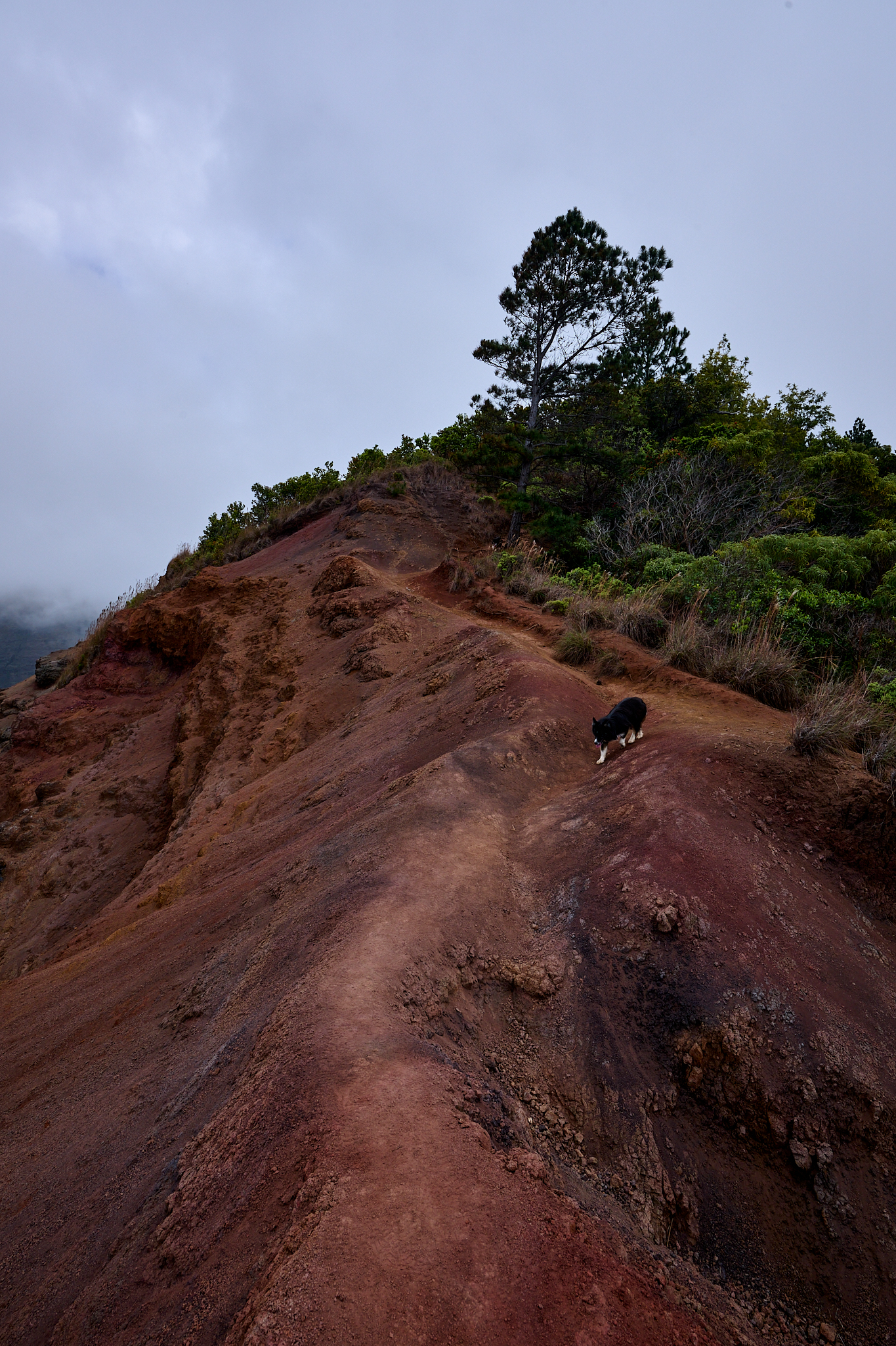
At about 2 miles into the trail the terrain begins to change its feel.  Ridges covered in native grasses become more prevalent, and the trail is more up and down in nature.

At 2.8 miles the Nu’alolo Trail meets with the Nu’alolo Cliff Trail.  The Cliff Trail provides a cross canyon route (2.1 miles) that joins up with the Awa’awapuhi Trail on the other side of the canyon.  If linked together, the effort becomes a mostly round-trip experience.  However, this effort requires a car-shuttle or 1.5 mile walk on Highway 550 to return to the originating trailhead.

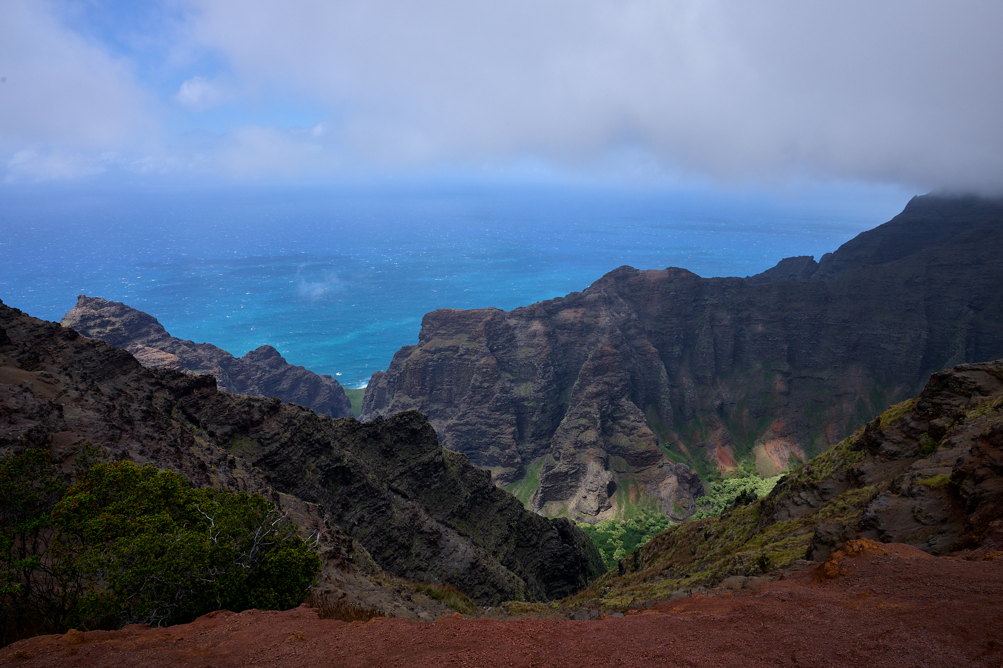
The one-mile in travel from the junction to the Lolo Vista is a downhill effort that is material in nature.  The route straddles the ridgeline.  The winding Nu’alolo Canyon becomes the center-piece of views.

At the 3.8 miles from the trailhead, the Lolo Vista is a big platform of ground and provides superb views. 
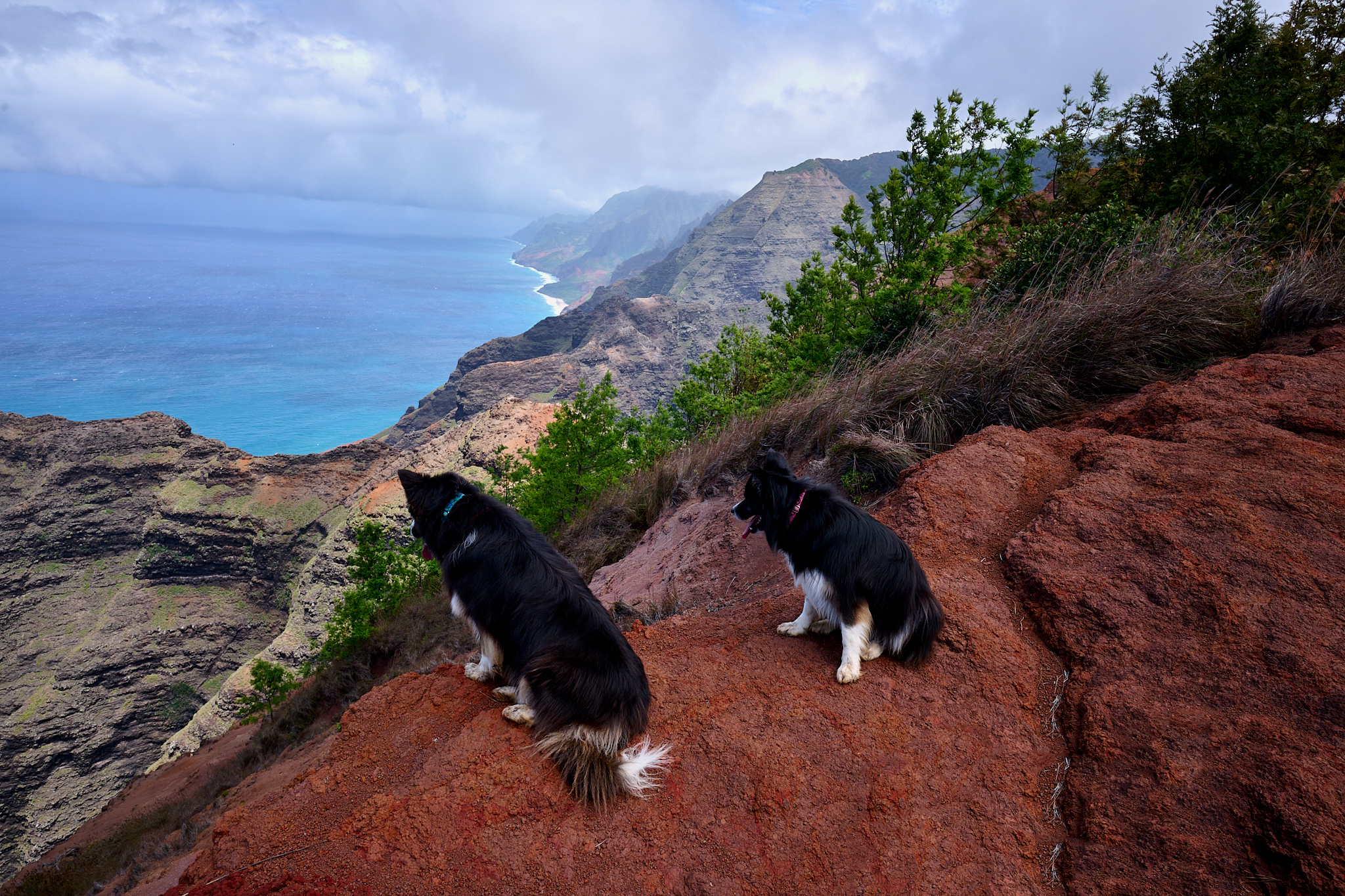
The Trip off Trail

Lolo Vista is not going to be the end point for me and The Border Collies on this day.  We will travel beyond the trails-end, and traverse the ridgelines out to the farthest stable point possible (within practical reason).

**** Jeff’s Thoughts and Other Worthless Trivia ****

The King of The Na Pali Coast

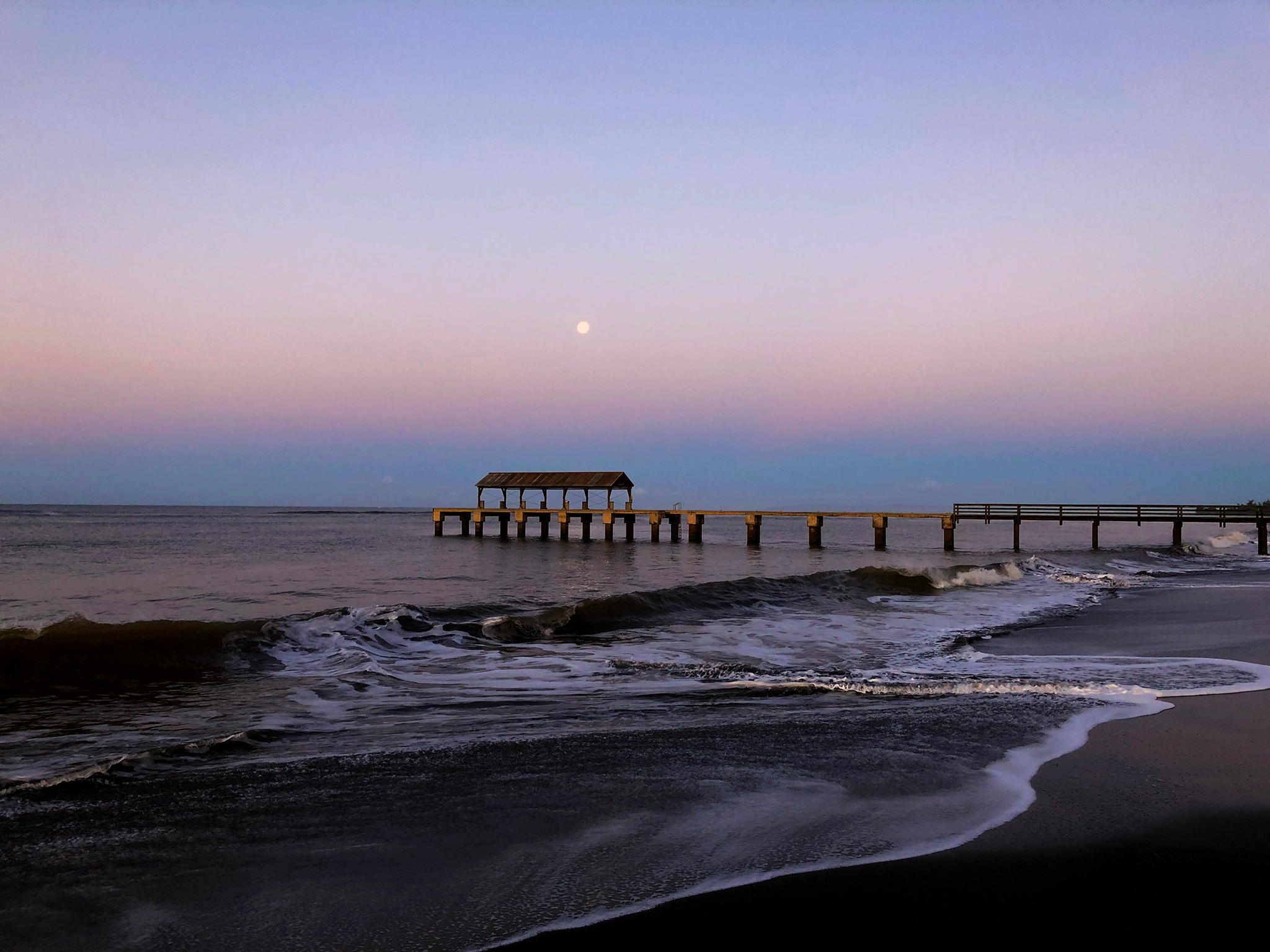
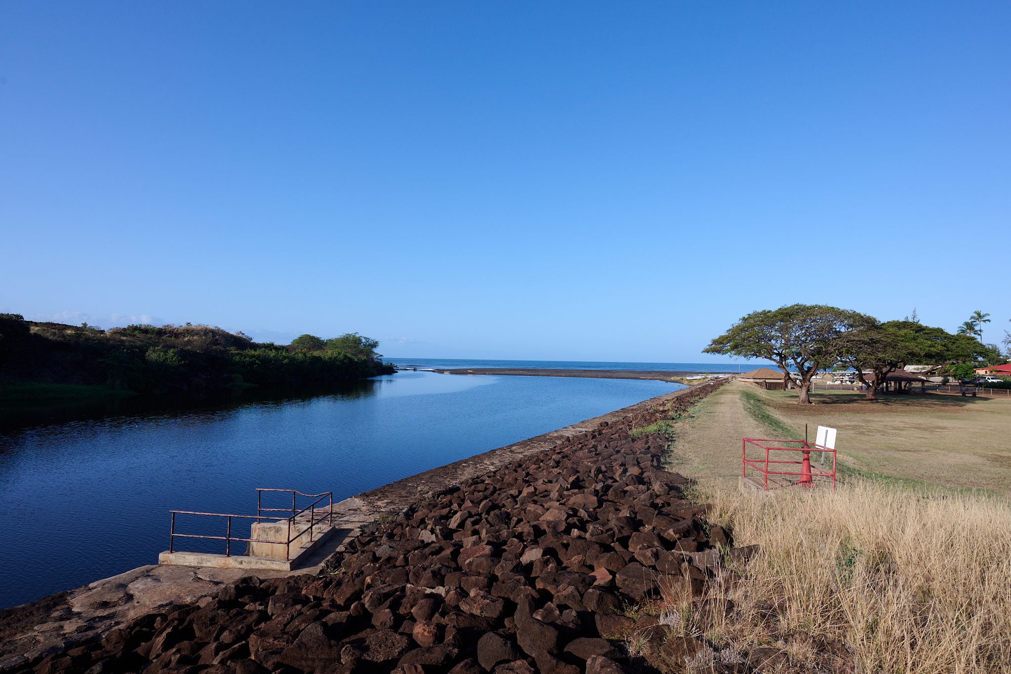
The sun ascends above the horizon on the western side of Kauai.  Linda, The Border Collies, and I are on our walk at dawn to Kikiaola Small Boat Harbor.  As we enter the harbor, the buzz is more pronounced than usual.  Orange Cones are lined up in a processional order fit for only the royalist of Royalty.

I am a commoner, but my guess is that either Queen Elizabeth II, Willie Nelson, or the winner of some top rated reality show is about to appear.  I am wrong. A Tribute to Da Ambassador and The King of the Na Pali Coast and his life is about to occur. There is good reason. Why? Well, Paddy Boy Malama “Da Ambassador” and “The King of the Na Pali Coast” has past away and a celebration of Paddy Boy, his life, and what his legacy represents to all of us who live in the area will happen on this day.  In order to avoid doing a disservice to Malama I ask that you read the story located [here].

Fast forward… On an an afternoon run to Kikiaola Small Boat Harbor, The Border Collies, and I happen upon Preston Lee and Jackie [nee Malama] Lee. 

Preston Lee is seeding and watering the grass surrounding pavilion area.  Lee is not an employee of the State Parks System.  He is doing the work with no fanfare, and to demonstrate respect to his late Father In Law.  Lee tells me that he plans on painting all the the tables in the pavilion – which are worn down by the heavy volume of people.  I offer to assist with the painting.  Two days later, I assist Preston with painting the tables in the pavilion.

In one of those quirky you cannot explain why kind of situations, a friendship is established. I am the beneficiary of the relationship. As most of you will attest, the Lee’s will be hard-pressed to prove (in a Court of Law or Public Opinion) the same by knowing me.

The bottom line is that Nu’alolo is special and sacred to Kauai.  It is special and sacred to the Daughter and Son-In-Law of Da Ambassador and The King of the Na Pali Coast.

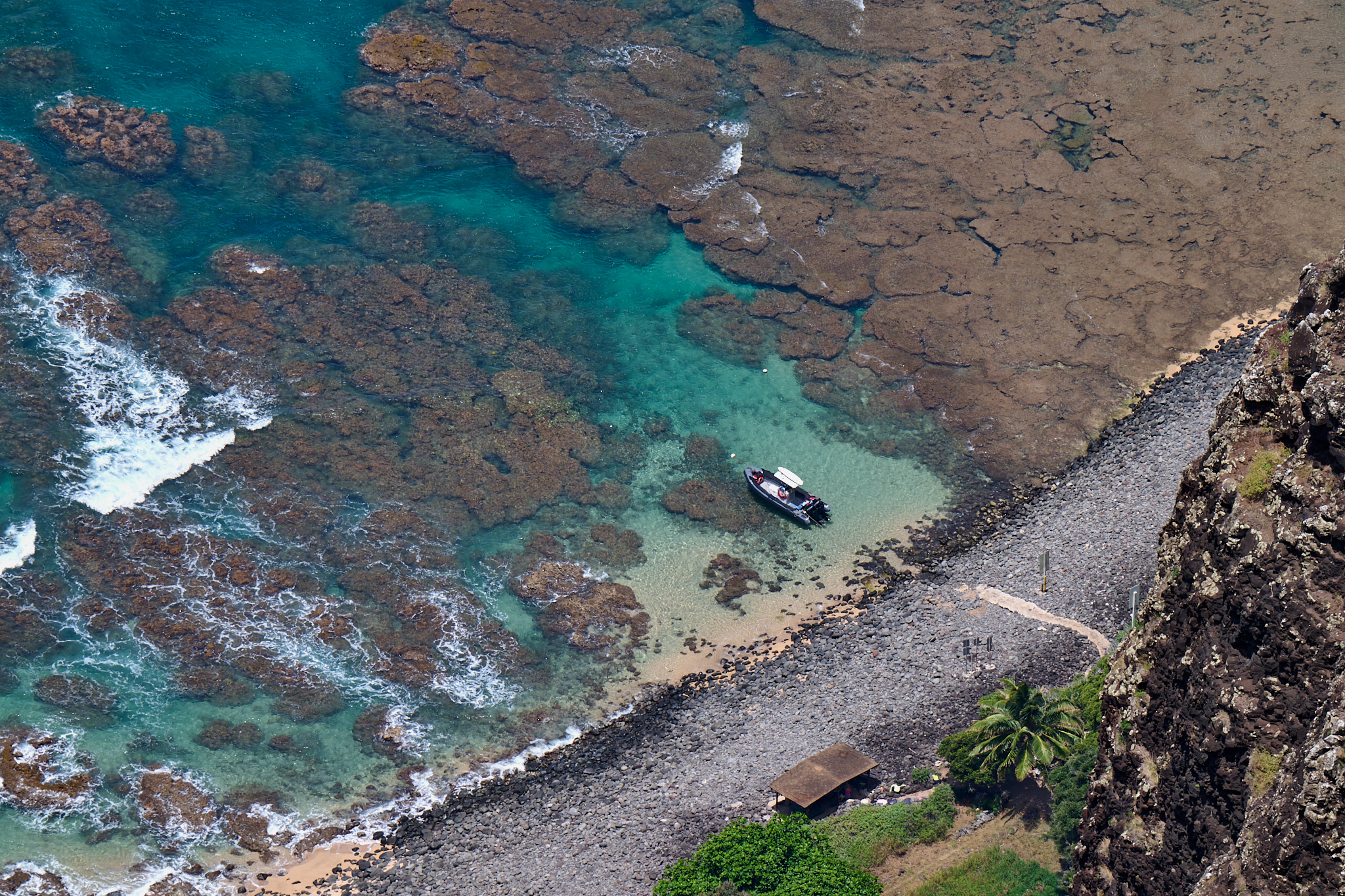
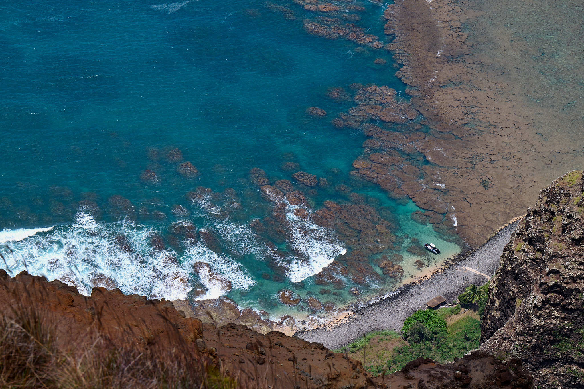
In the images (above) of the pathway, the beach buildings, and trails up the Nu’alolo Stream were built by the people of the West Side of Kauai, the Father of The Father of the Na Pali Coast, The Father of the Na Pali Coast, Preston Lee, and his friends. Today, all of us are the beneficiaries of this effort.

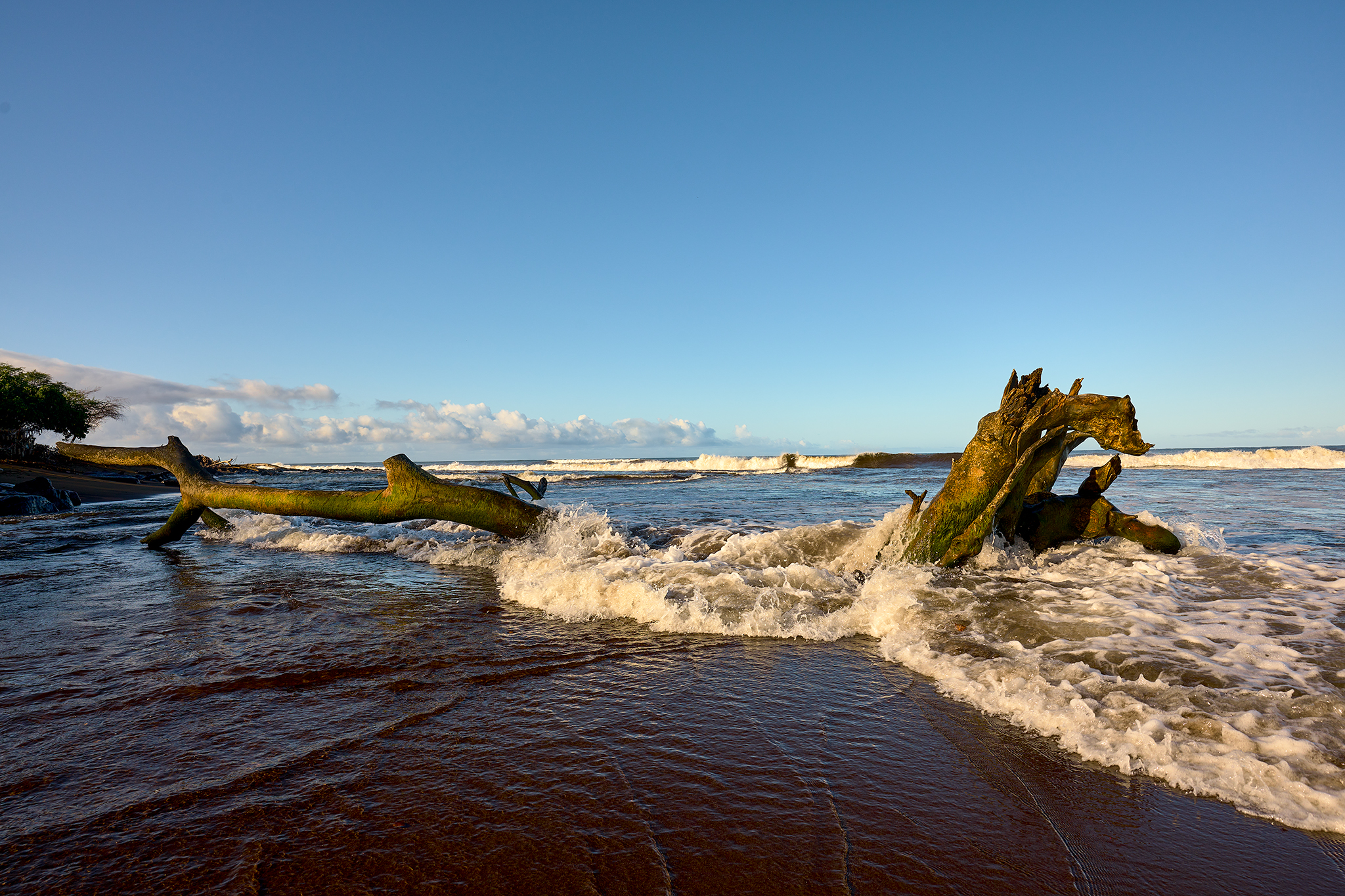
It should be noted that access to the beach is via water only.  There are no paved roads, freeways, turnpikes, subways, elevated trains, Disney Express Passes, or even hiking trails to Nu’alolo Kai Beach.


Capturing Kauai – Stellar Day on All Fronts

Full Moon at Sunrise Waimea Pier

The day begins with a walk on the beach where the Waimea River Canyon meets the Pacific Ocean on the island of Kauai in the State of Hawaii.  It ends with a hike at the top Waimea River Canyon where it meets with the Na Pali Coast.

The Na Pali Coast from Honopu Ridge Late in the Day.

The beach walk is to the Small Boat Harbor at Kekaha. The Waimea beach is comprised of black sand, laced with red volcanic sprinkles.  It rarely receives the rave reviews as those of the golden sand at Polihale or the Lithified Cliff’s at Poipu – except for its exceptional sunrise and sunset.  However, if you live on Kauai and love to walk or run on the beach – there is nothing superior to this four mile trip to and from Kikiaola. 

This trip to the Na Pali Coast is along the Honopu Ridgeline Trail.  There are few hikes like this one. Based on the willingness to traverse a steep ridgeline, the out and back route is 3-5 miles in length.  It encompasses up to 2,200 vertical feet of gain and loss.  The trail’s surrounding environment is highly varied.  It includes dense forest, thick and colorful vegetation, and exposed knifelike cliffs.  The views of the Na Pali Coast begin at about 1.5 miles out from the trailhead.  Most hikers turn around at this juncture.  The most compelling views are at 2.25 miles out on the trail.

The Honopu Trail is no longer maintained by the State of Hawaii.  The State believes the trail is too difficult and too hard to manage after Hurricane Iniki.  Therefore the Honopu Trail is not an official trail with any kind of signs or mileage markings. The Trailhead is 17.25 miles up the canyon road (550) from the town of Waimea. There is no trailhead sign. There is a pull-out and limited space for parking. It is located on a curve in the road one-quarter mile past the Awa’awapuhi Trailhead.

Dense Forest.

Flowers

Big Trees, Bigger Ferns

Parklike Sections

Steep Exposed Sections

One of many Helicopters entering the canyon

Helicopter in the canyon.

One of Many planes entering the canyon.

The place is busy.

Making the turn and heading back home.

Capturing Kauai – The River Meets the Ocean.

The Sun rises and begins to shine on the mouth of the Waimea River and Pacific Ocean on Easter Sunday.

The Waimea River and the Pacific Ocean have a give and take relationship.  The mouth of the Waimea is located on the south side of the Island of Kauai in the State of Hawaii, in the United States of America. At 22 miles in length, the Waimea is the longest river on Kauai and 3rd longest in the State of Hawaii.

The Waimea River from the Highway 50 bridge.

The river mouth has a bit of history tied to it.  The beach on the north side of the river, is where Captain James Cook becomes the first European to land on the Hawaiian islands (1/20/1778).  The Center Eyewall of Hawaii’s worst Hurricane in recorded history – Iniki – slams into Kauai at the mouth of the Waimea (9/11/1992).  The peak sustained winds are 160 MPH.  The Pacific Missile Firing Range (PMFR) operation on Makaha ridge records peak winds of 217MPH.  The device has not been calibrated recently, so the measure is not official.

On this day, rains provide a soaking to the south and west side of the Island.  Later on this day, the wood in the photo above is entirely underwater at 5PM.

—Jeff’s Thoughts and other Worthless Trivia —

Our home is located on the beach three houses north (or west) of the Waimea River.  With Weather and surf, the conditions can change dramatically and quickly.  I am constantly looking to see what is going on at the mouth of the river.

The top of the Waimea River Canyon rises 5,000 + feet above sea-level in less than 20 air miles. It often receives the most rain on earth in any given year (460 inches on average).  The combination of conditions is remarkable.  Therefore, Flash Floods can be an issue for the town of Waimea and at the mouth of the Waimea River. Flooding is a major problem in the area prior to the 1970’s.  The town floods to 4-8 feet in height in 1949 and again in 1975.

However, the Federal Government changes laws and funding.  In the 1980’s the Waimea River Flood Plan receives material protection.  Ironically, the Army Corps Engineers Recommendation of Plan A (i.e. greatest protection) is adopted, funded, implemented, and completed in 1984. So flooding in the town of Waimea and at the house would require an major, major event – such as another Iniki.

This does not mean water levels cannot change quickly and to dangerous levels. Especially, if you are on or in the river.  Linda and I experienced the greatest change to streamflow in any three-hour period first-hand.

During a winter storm on March 18, 2020 the streamflow increases from 69 ft. 3/s to 1240 ft. 3/s between 3AM and 6AM.  While the flood control works as planned, the change in streamflow is as large as has been ever recorded.


For Photographers…

In 2022, for the most part, we have the photographic gear and the tools.  For the scenario above, I have all that is needed.  I either get this shot, or I do not.  It is up to me to make this happen. If there is a miss – look to the photographer.

I choose to shoot with the Z9 and the Z 20MM 1.8 S lens. As backup, the Z S Line 35MM 1.8, and 50MM 1.2 are at the ready.  Normally, I would also take this shot with the PHASEONE IQ 4 150 and the XF Body and 35MM Blue Ring Lens or Cambo RS Technical Camera and Rodenstock 32MM lens.

If I hit the shot Dead-On, the result from the PHASEONE is the winner 10 out of 10 times.  16 Bit Color, and 151 Mega Pixels can make you look so very good.  However, lets not get too carried away.  At 20 Frames Per Second and 14 Bit Color, I get the shot with the Nikon Z9 that is very well not realized with the PHASEONE.

I am fortunate.  I desire to have the very best in 35MM and 4×5 equipment as my photographic kits.  Today that means Nikon Mirrorless Z and PHASEONE.