The sign at the both trailheads of the Po’omau Ditch Trail says all you need to know.
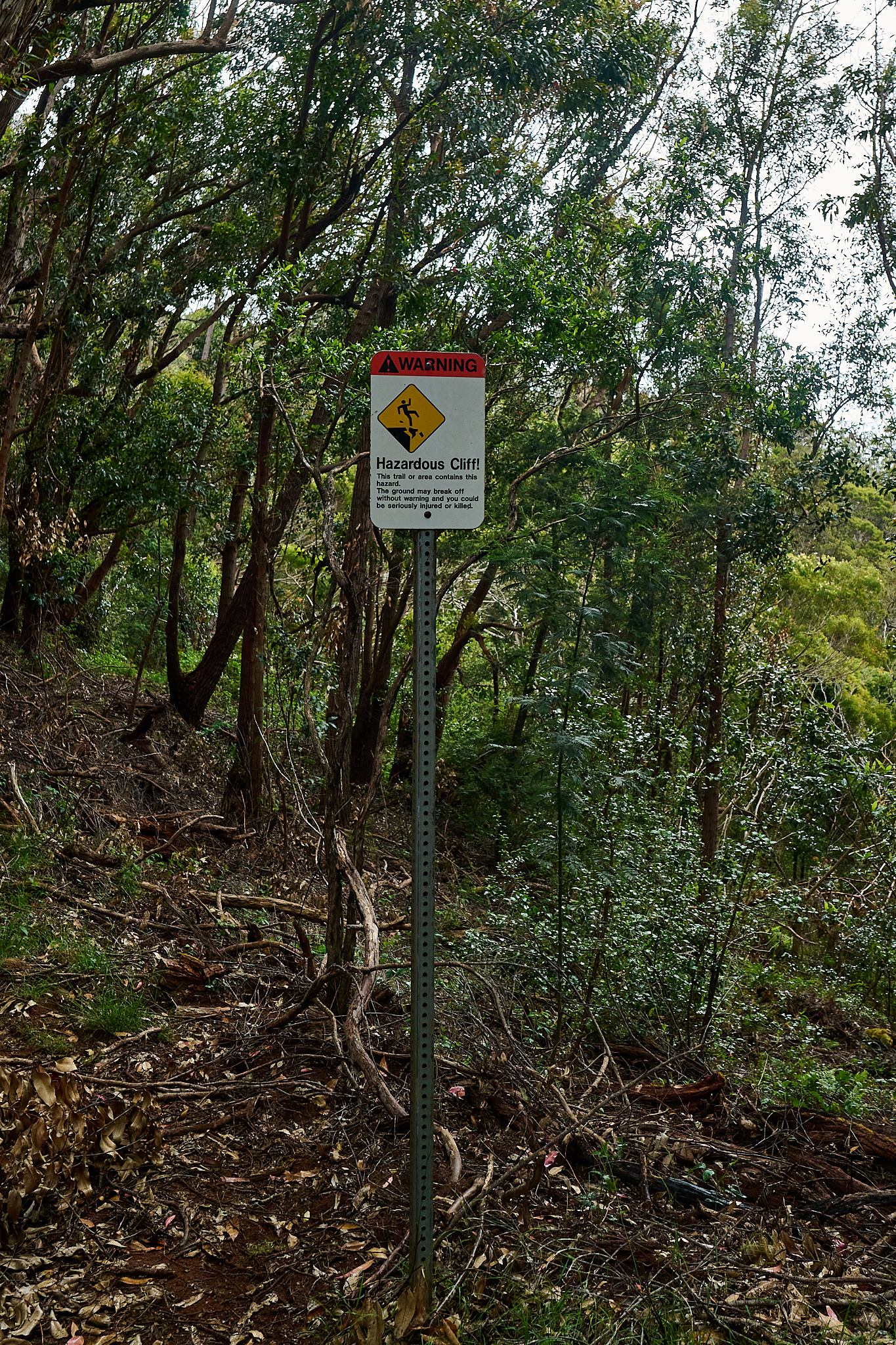
The sign reads, “Hazardous Cliff! This trail or area contains this hazard. The ground may break off without warning and you could be seriously injured or killed.”
The Po’omau Ditch Trail is a fantastic loop trail on the island of Kauai. The route is 4.25 miles in length that includes 1,780 vertical feet of ascent. If you are sure footed, comfortable with dramatic vertical relief and relatively exposed settings, the Po’omau may be for you.
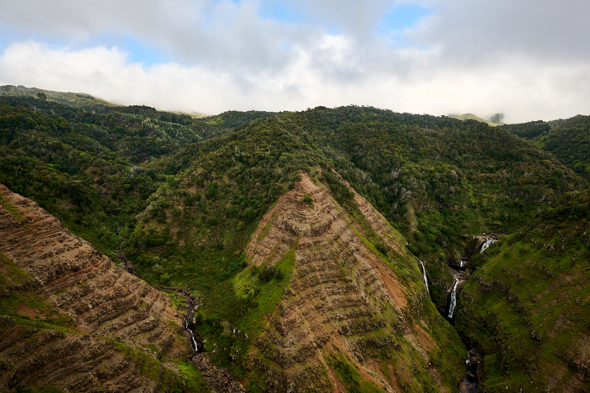
The view from the vista point at the end of the trail. Multiple streams and falls join to form the Po’omau Canyon.
The rewards of travelling the Po’omau are many. Some of Kauai’s greatest waterfalls, canyons and wilderness are presented directly for your consumption. Also, it is likely you will get to take in these sights without a soul nearby – outside of you and your party.
The Po’omau is where water drainages descend down into into the Waimea Canyon from the otherwise magnificent Alakai Wilderness and Alakai swamp. The Waimea Canyon at 14 miles in length and 3,500 feet deep, is called the Grand Canyon of the Pacific.
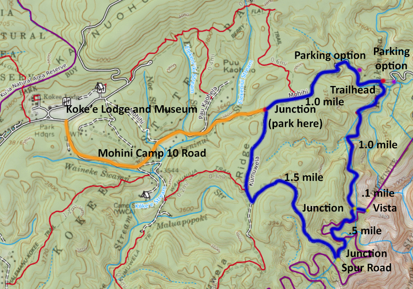
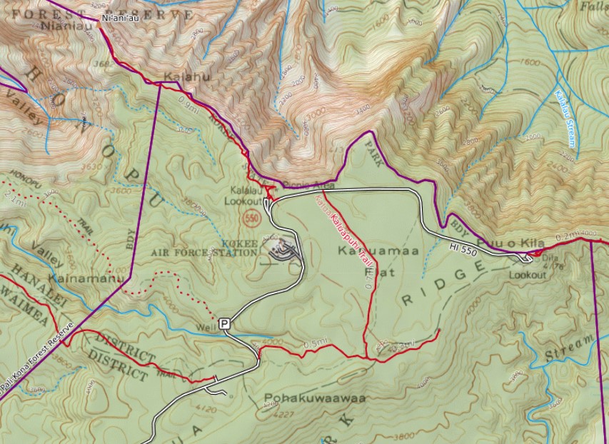
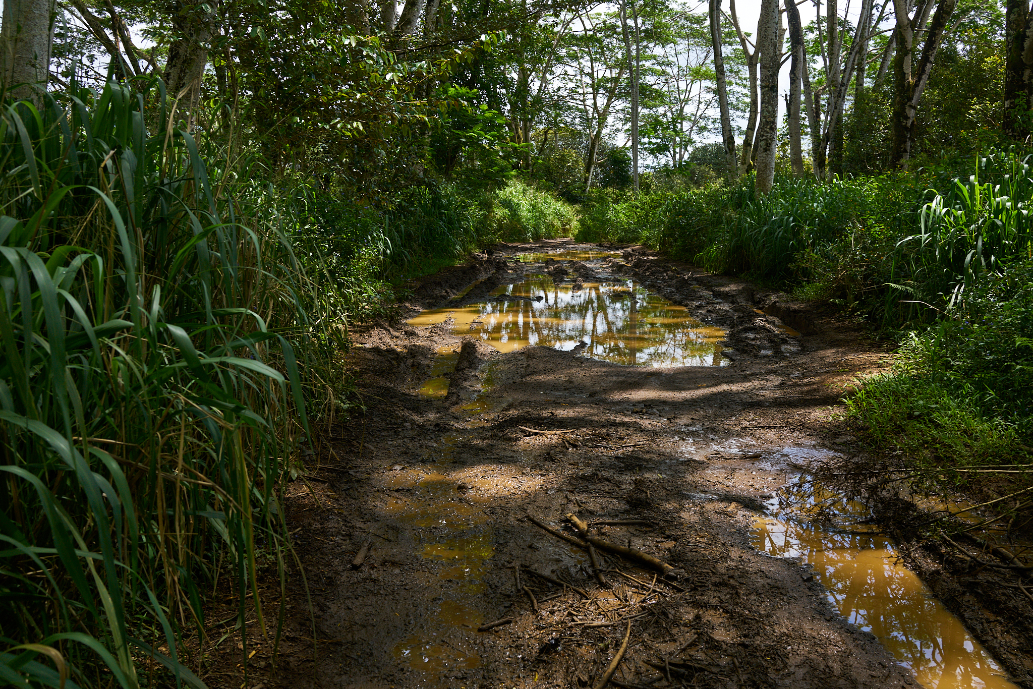
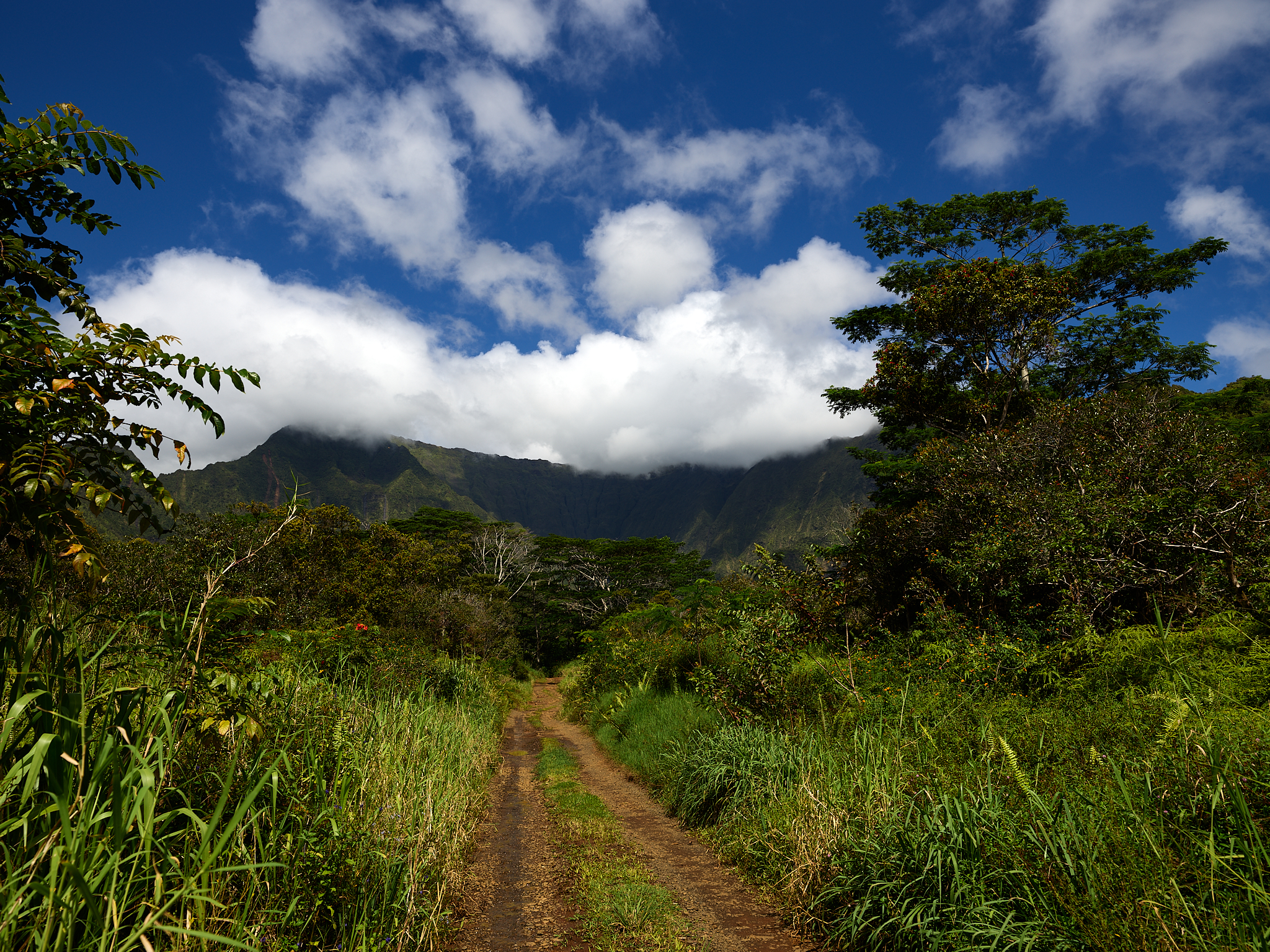
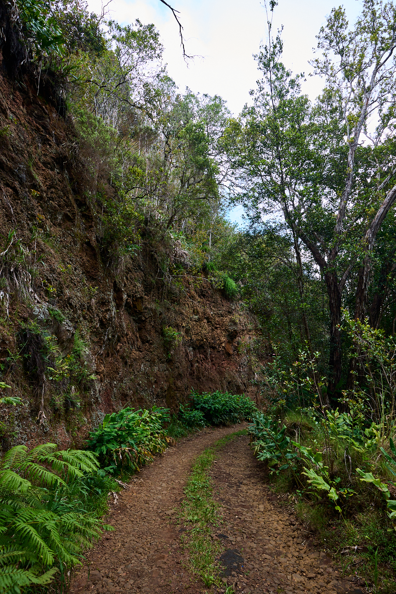
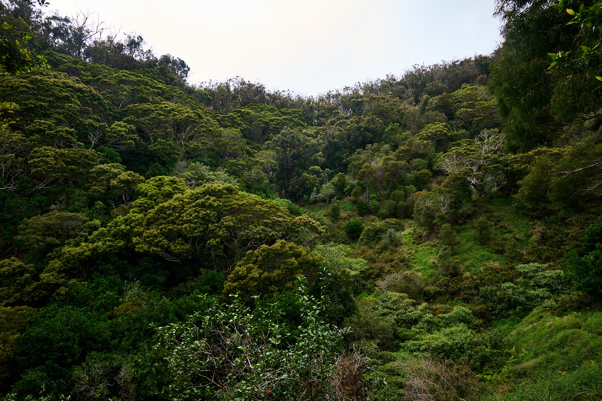
On this day, I decide to make the full loop starting at the junction of the Mohini Camp 10 and Kumuwela roads. The Border Collies, Sage and Willow Lubeck, requests they assist. The Mohini Camp 10 road is accessed on highway 550 just across from the Koke’e Lodge, Museum and Park (15.7 miles up the canyon from Waimeatown). Kumuwela Road is 1/2 mile from the start of the Mohini Camp 10 Road. There is space to park. The trip down to the trailhead for the Po’omau is one mile in length on the Mohini Camp 10 Road. On the left side of the road is a big earth wall. On the right is a stream. The Trailhead is located on the right-hand side.
The Mohini Camp 10 road on the way to the Po’omau.
The trailhead is not marked. Travel down further than one mile to what looks like a driveway (or even further) to the next bridge, and you have gone 400 to 800 feet too far. Do not stress, just turn around and hike back up the road looking to your left. The trail is actually easier to find this way.
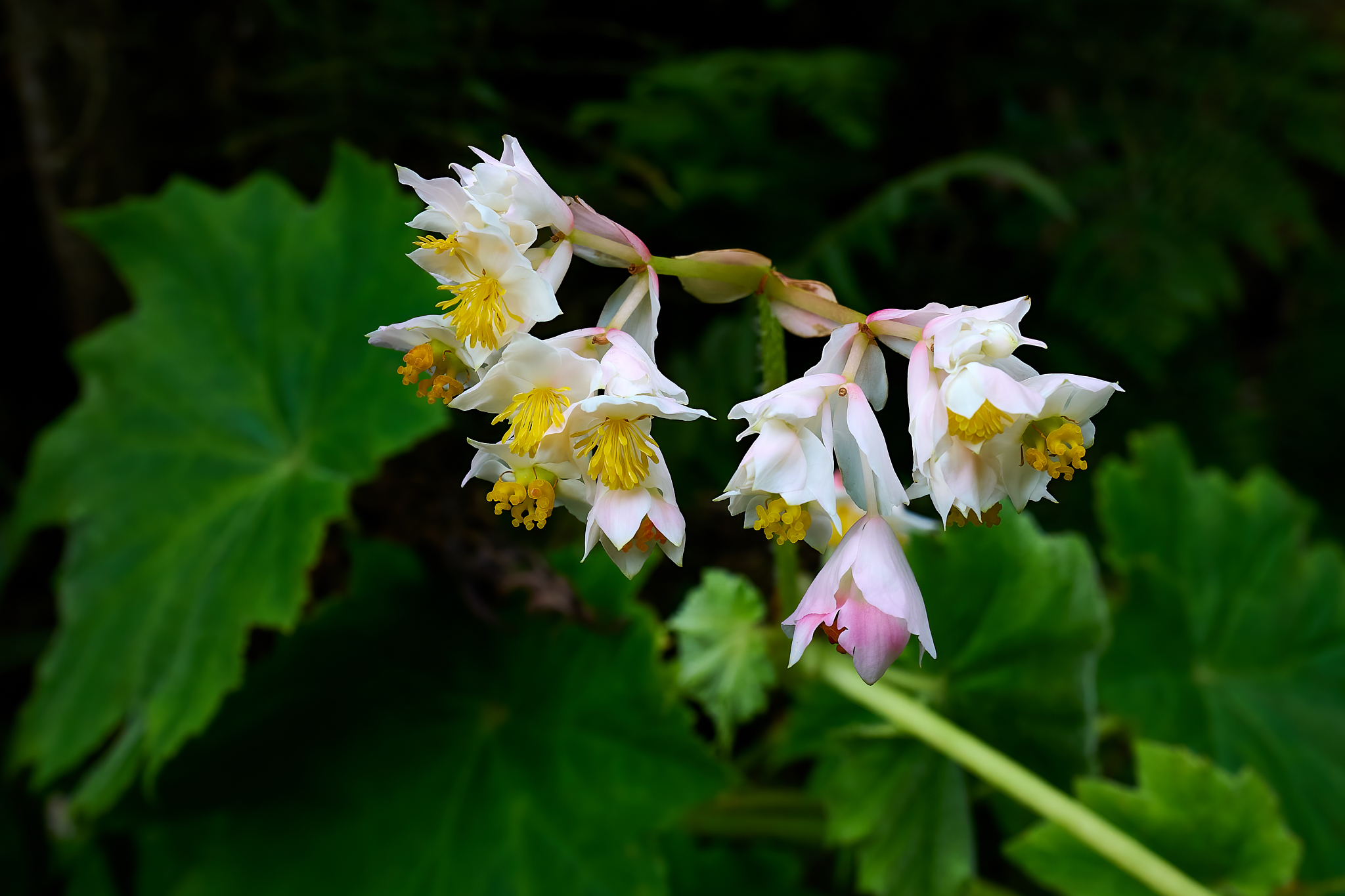
A good way to find the trail route is to identify the Warning sign mentioned at the start of this Post. The trail covers a mile of moderate up and down with a couple of small stream crossings easily handled with boulder hops. For its majority, the trail is tree covered and lush with vegetation. Flowers and songbirds are plentiful.
Take your time. Take in the flowers and songbirds. Be mindful of your foot placements and balance.
The trail is soft and highly pliable. It is easy on the feet. The vegetation and serene setting will mitigate the fact that the trail is built on a steep hillside. A potential breakaway of the trail will occur. Usually it is small and easy with which to deal. However, the implications can be much, much worse if you are not paying attention with foot placement and balance. If you keep fully aware of the surroundings, the trail route is quite enjoyable for the experienced hiker.
In the mile covered between the trailhead and the junction to the overlook there will be some solid up and down and around. At one mile the trail crests. The trail junction forks to the left and in .10 of a mile drops steeply towards a magnificent vista. If you are not comfortable travelling in steep terrain a trip to the vista may not be a good idea. However, the trail-bed is solid and the setting is a beautiful as it gets.
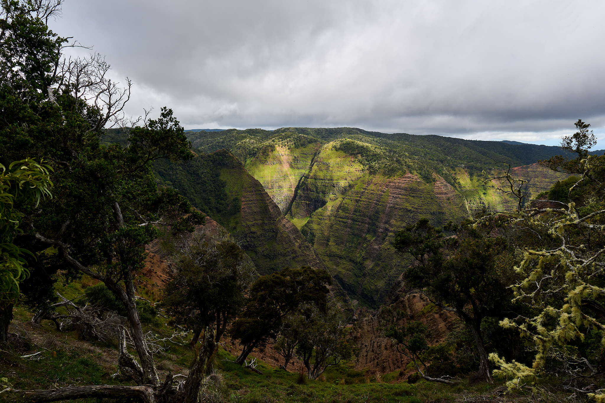
The view as the trails descends to the vista.
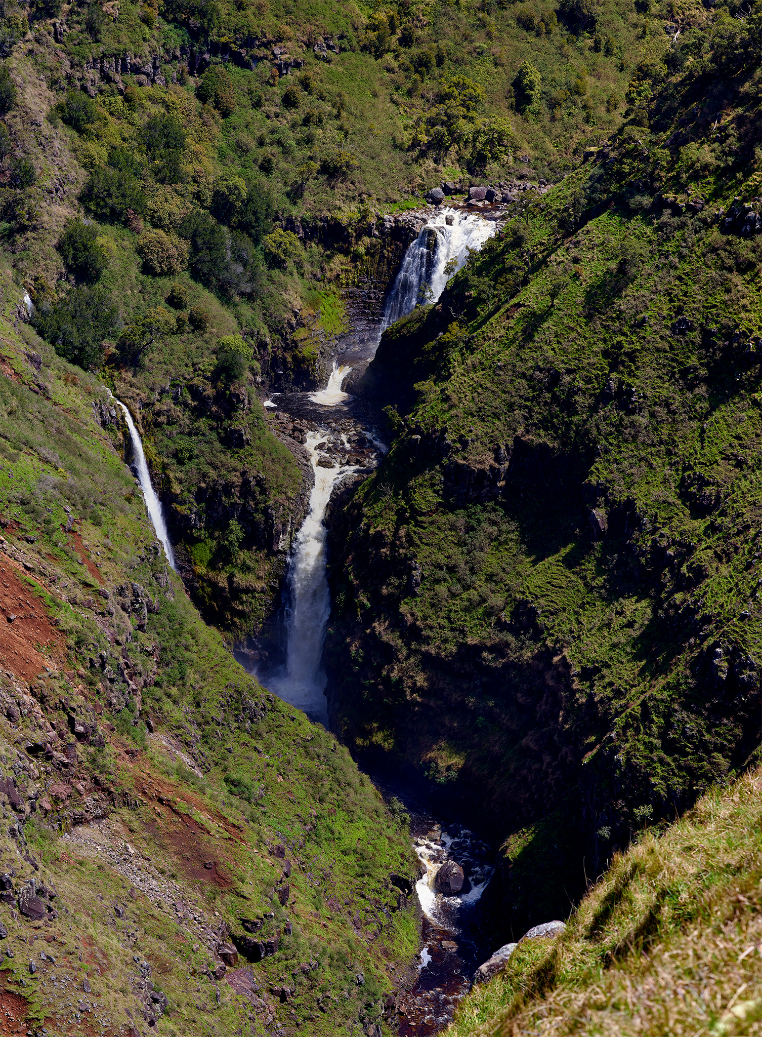
Maeloa Falls
Upon return to the junction the trail heads west for .5 miles.
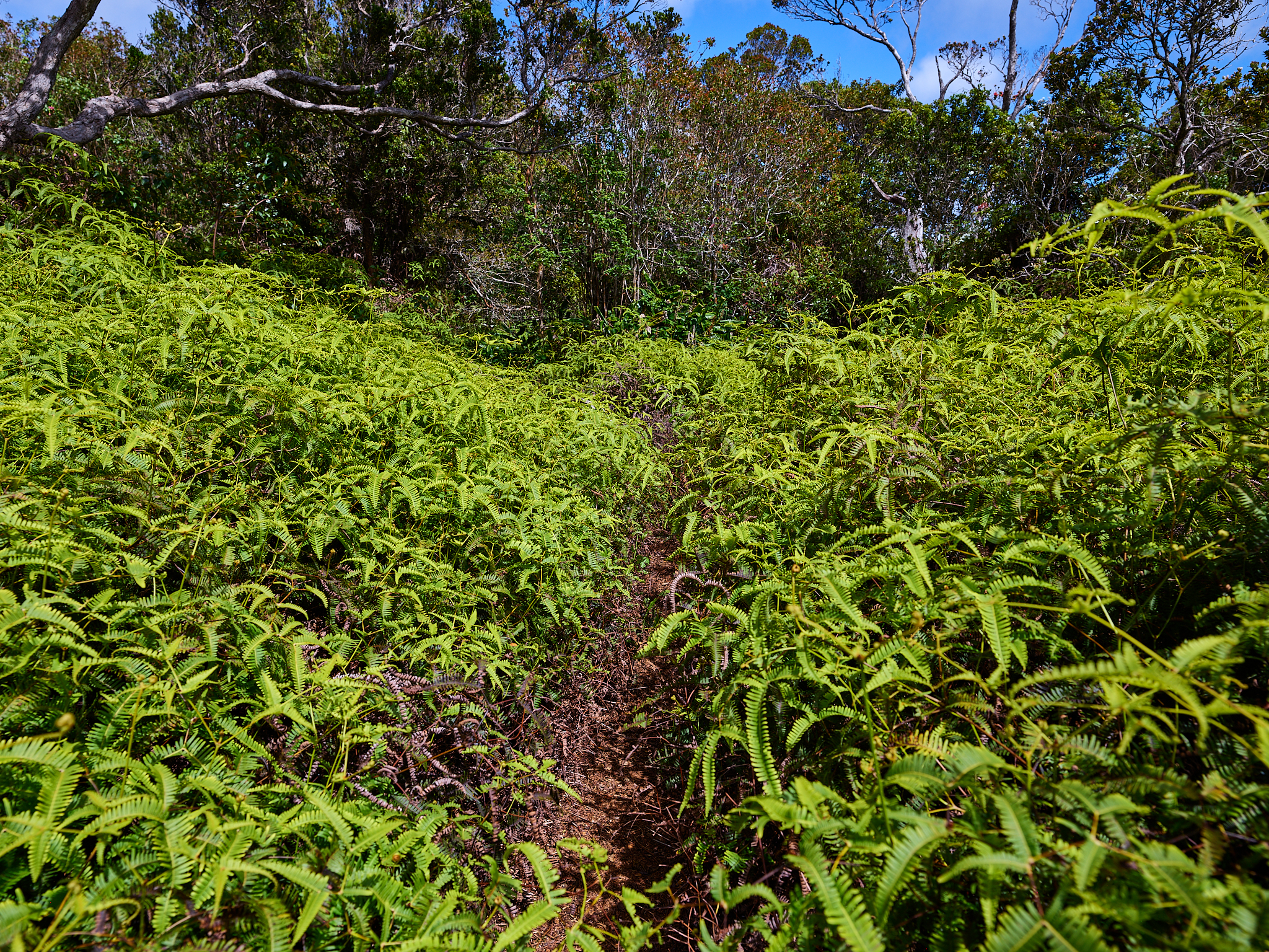
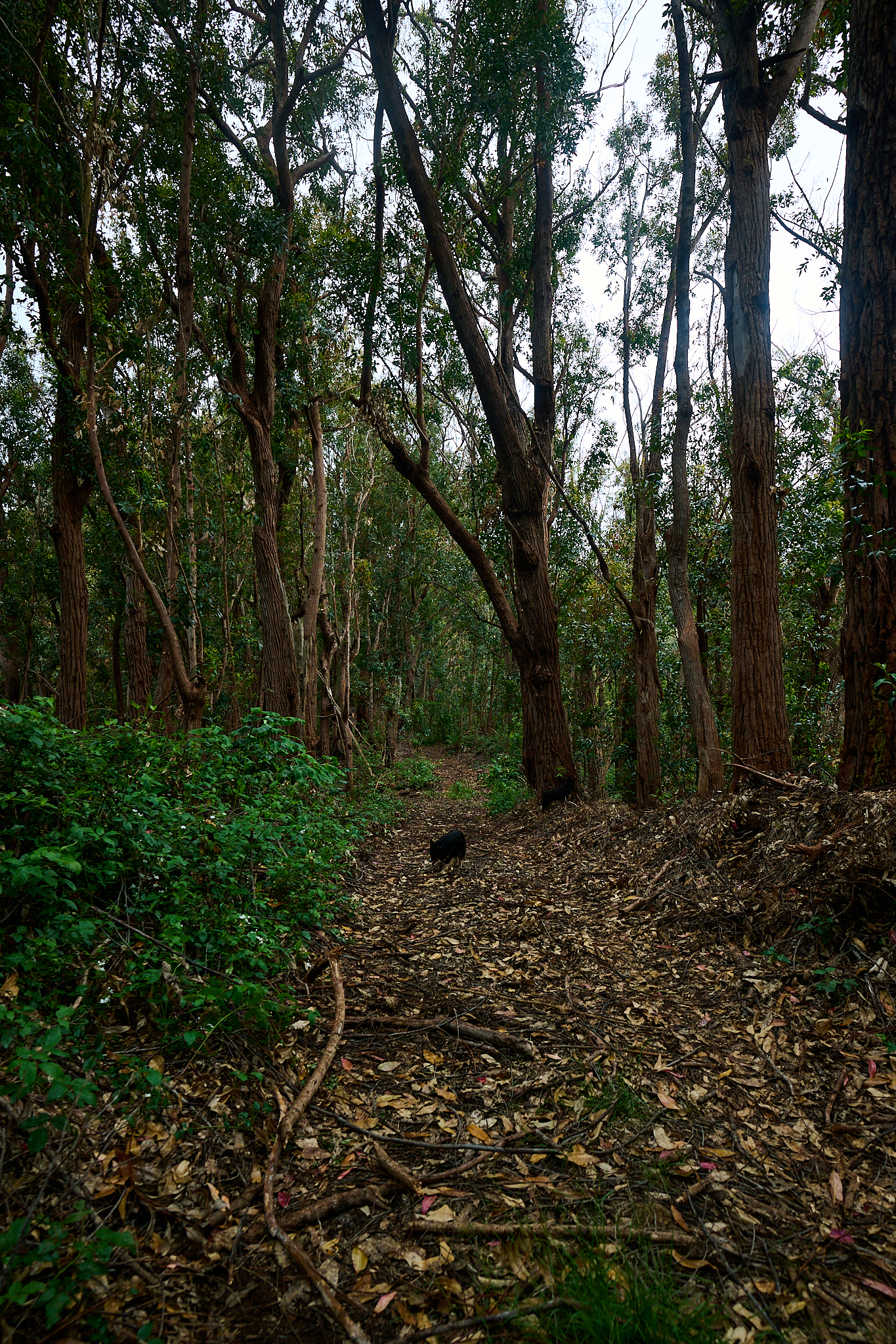
The trail at 1.25 miles (or 2.25 if on full loop). The trail is in there somewhere. I promise!
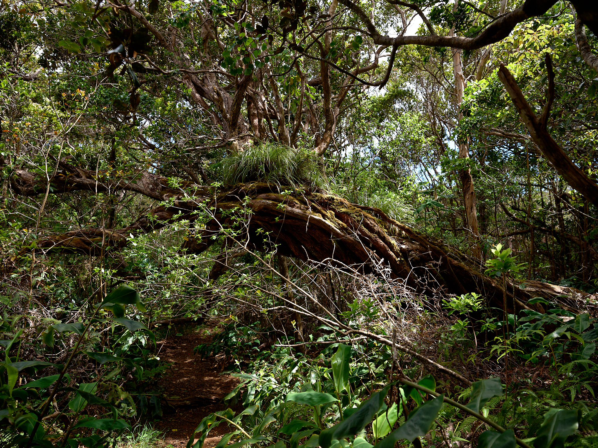
The trail from the junction to its end is materially less traveled. The area is lush and a bit overgrown. However, the setting is fantastic. The trail ends at 1.5 miles (or 2.5 if on full loop). The trail meets with the Spur road of the Kumuwela road. The return is about 1.75 miles.
The Spur Road of the Kumuwela Road.
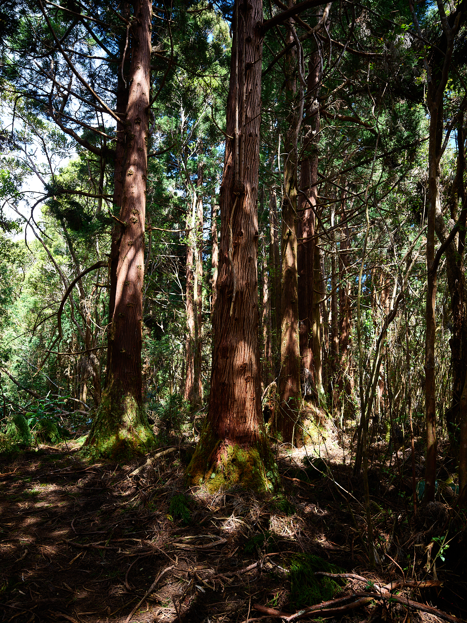
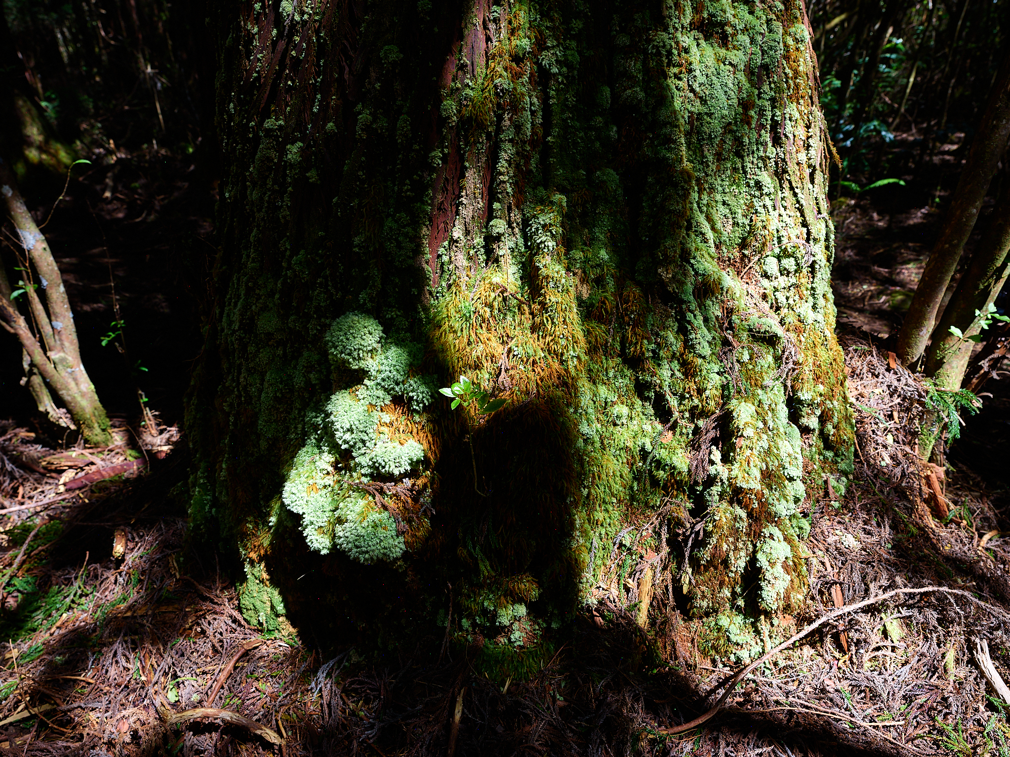
This section reveals large swaths of Sugi trees and the wilderness setting of the interior of the island. The experience is a great balance to that of the canyon. Travel on the road(s) have sections of up and down, flats, and bogs. It is straight forward. If there have been recent rains, the boggy area can slow travel and reduce the fun.
— Jeff’s Thoughts and Other Worthless Trivia —
As General “Buck” Turgidson says to President Merkin Muffley in response to the possible outcome of his plan relating to a nuclear attack in the film Dr. Strangelove, “Mr. President, I’m not saying we wouldn’t get our hair mussed. But I do say no more than ten to twenty million killed, tops. Uh, depending on the breaks.” I can find no reporting of people dying or being seriously injured on this trail. That is not to say it could not happen. Again, if you are not sure-footed and solid with balance, do not take this hike.
Similar to the six mountain ranges that are my backyard in Central Idaho, I feel the same about Kauai. I am enamored with them, and lucky to call both home. I find this trail a total joy to travel.
The Mohini Road Camp 10 Road is fantastic. There is no better road. My Post about it is [here].
Here is background on how Ditch systems were created on Kauai. Here is some background on them [here]. The Po’omau Ditch was created in 1926.
It should be noted, that as remote and isolated as these locations can be… the fact remains, you can run but you cannot hide. The first time I hiked the Po’omau Ditch Trail I ran into people upon my return. It is the only time I have seen people on the trail. The hikers were led by guy named Klayton Kubo. It turns out Klayton lives a block away from me and Linda in Waimeatown.
On this trip, I carry about 30+ lbs. of camera gear in my pack. This is a fairly lite configuration for me. The PHASEONE XF IQ4 Medium Format and Nikon Z 35MM cameras with two lens’ each are in my bag on this trip, along with an iPhone. The pack is a multi-compartment system designed by my son Kyle. I have two of these bag setups. They allow me to carry up to 55 lbs. into the back-country for a day shoot. I have used this type of bag and these systems for 10+ years.