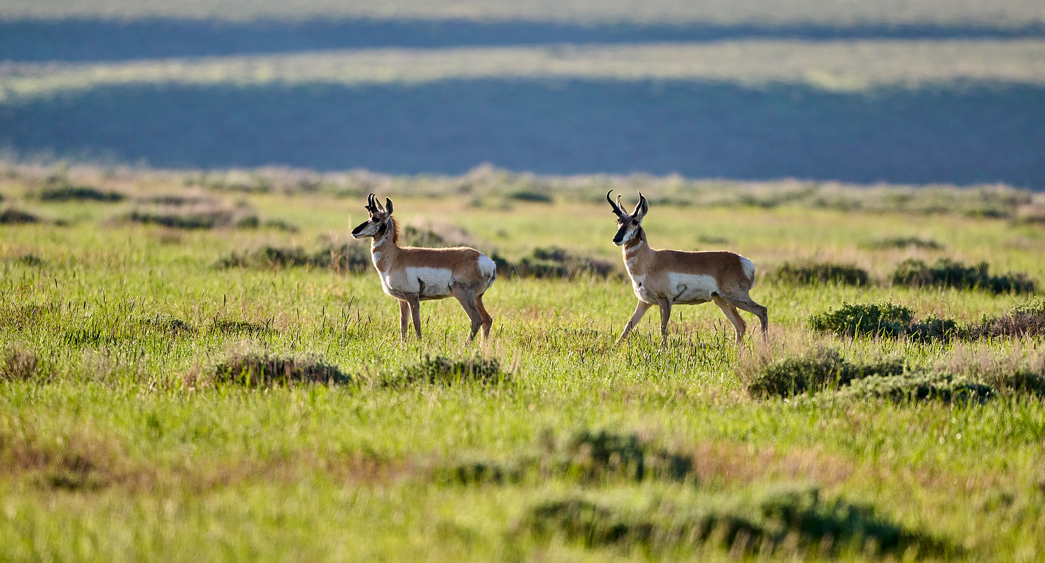
Successfully completing springtime photo-shoots in Idaho has been tough in 2023. Why? The weather has not been cooperating.
Weather in the Wood River, and Salmon River basins in 2023 has been more like the late 1980’s and 1990’s. In other words – wet with great variability. The 2000’s have proven to be much warmer and drier in the spring and fall.
Many of you are aware I like to have photo-shoots that offer something that can be observed and considered in context. For example, I like exhibits to offer images with before and after comparison or shot on an equinox or solstice.
This year I wanted to capture an iconic peak at the summer solstice for sunset, under the night stars, and at sunrise. I chose McGowan Peak an icon of the Sawtooths as the subject.
Why? McGowan is tough to capture in its most vivid possible state. It is north facing with other large peaks nearby. Therefore, only the earliest of sunrises and latest of sunsets around the summer solstice provide the most compelling light.
The plan is to photograph McGowan over a 9+ hour period on the same day. As planning (or luck) would have it there would also be a New Moon (0% moonlight) and the Belt of the Milky Way would be at its height of visibility.
The weather service predicted overcast skies with possibility for rain to start the day and moving towards Clear Skies through the rest of the night and early AM. “Great” I thought the plan is looking to stay “on Plan.”
The start of the day is not what the weather service predicts. Stanley Idaho on June 20th, 2023 at daylight is being pelted with combination of popcorn snow, sleet and rain. The temperature is in the low 20’s F.
The weather throughout the day is lousy; snow, sleet, and rain. However, while the weather service changes its hourly prediction through 8PM, it says the weather will approach clear and then clear as predicted earlier. Given the prediction, I head to Stanley Lake and McGowan Peak even though it is cold and rainy.
So… the weather service proves to be correct. I will let you judge the results.
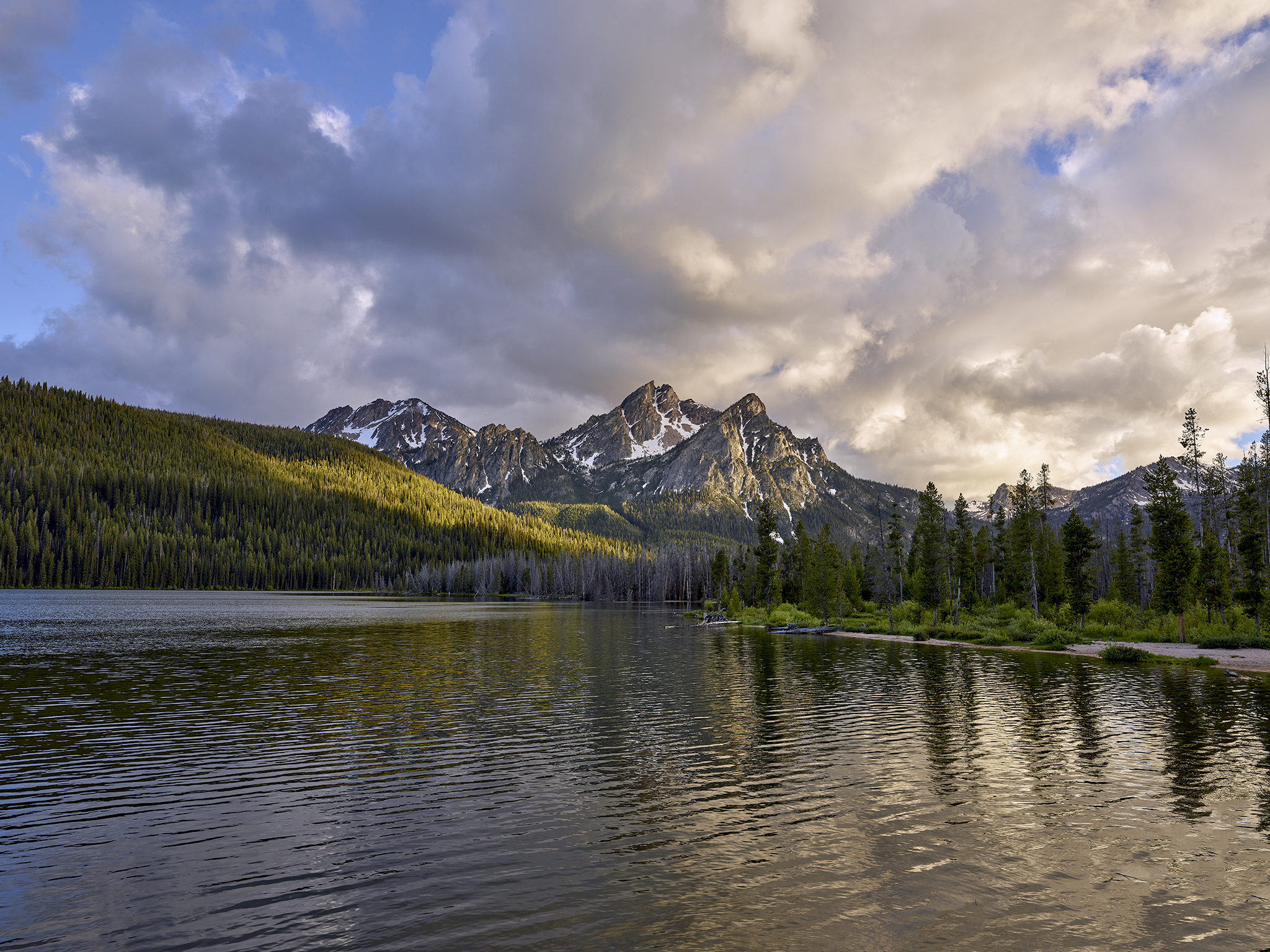
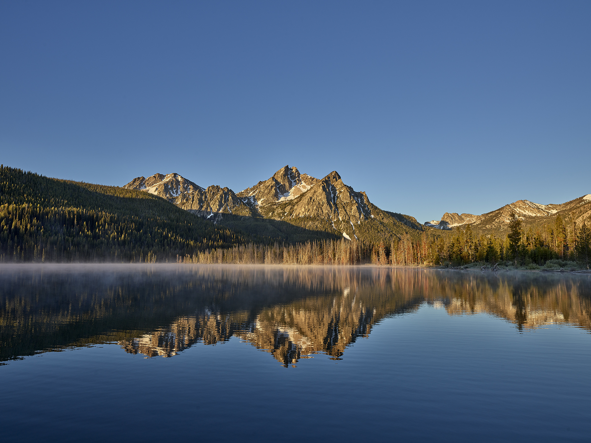
McGowan Sunset Cusp of Summer © Jeffrey H. Lubeck – MESH Art LLC – all rights reserved
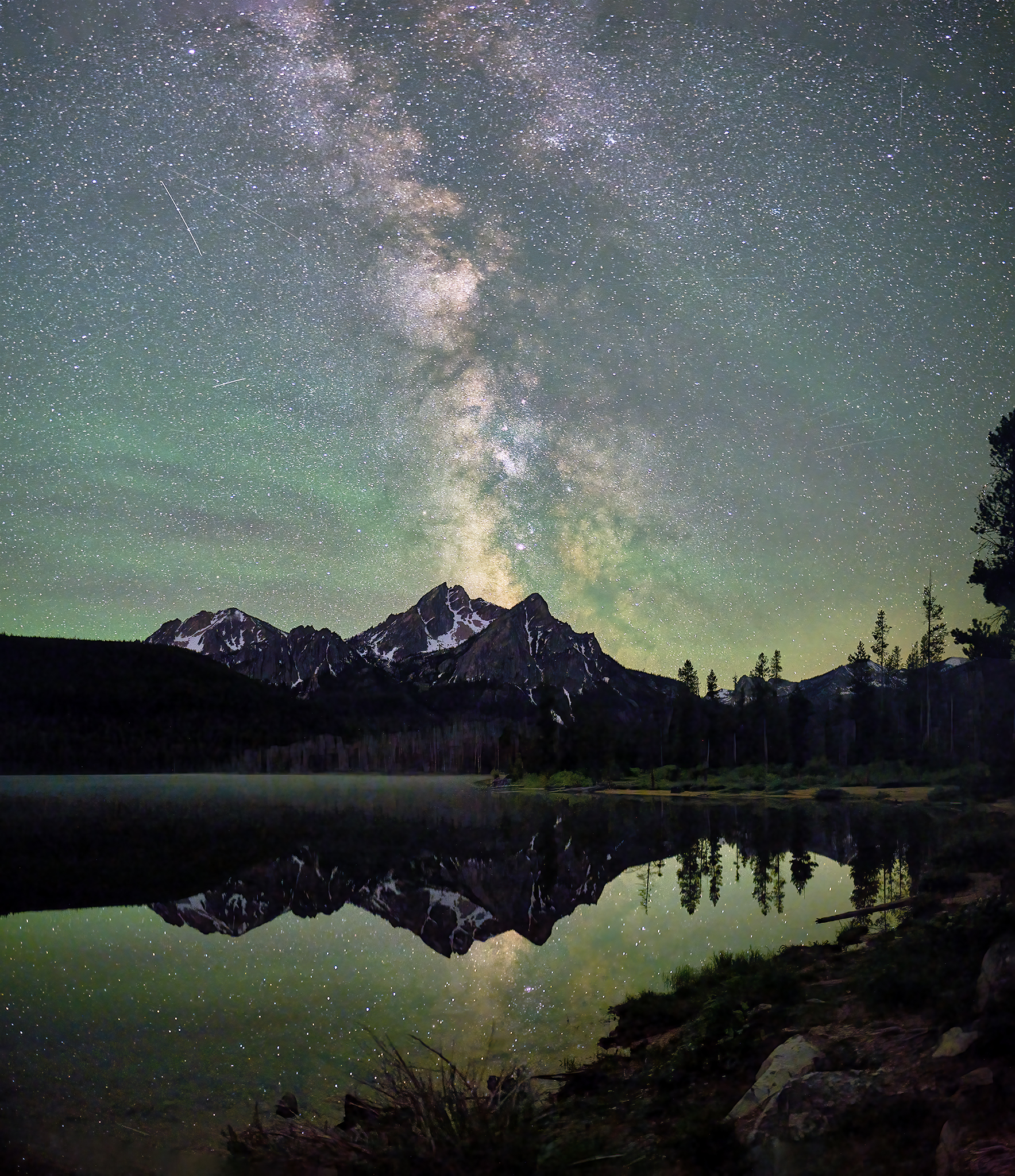
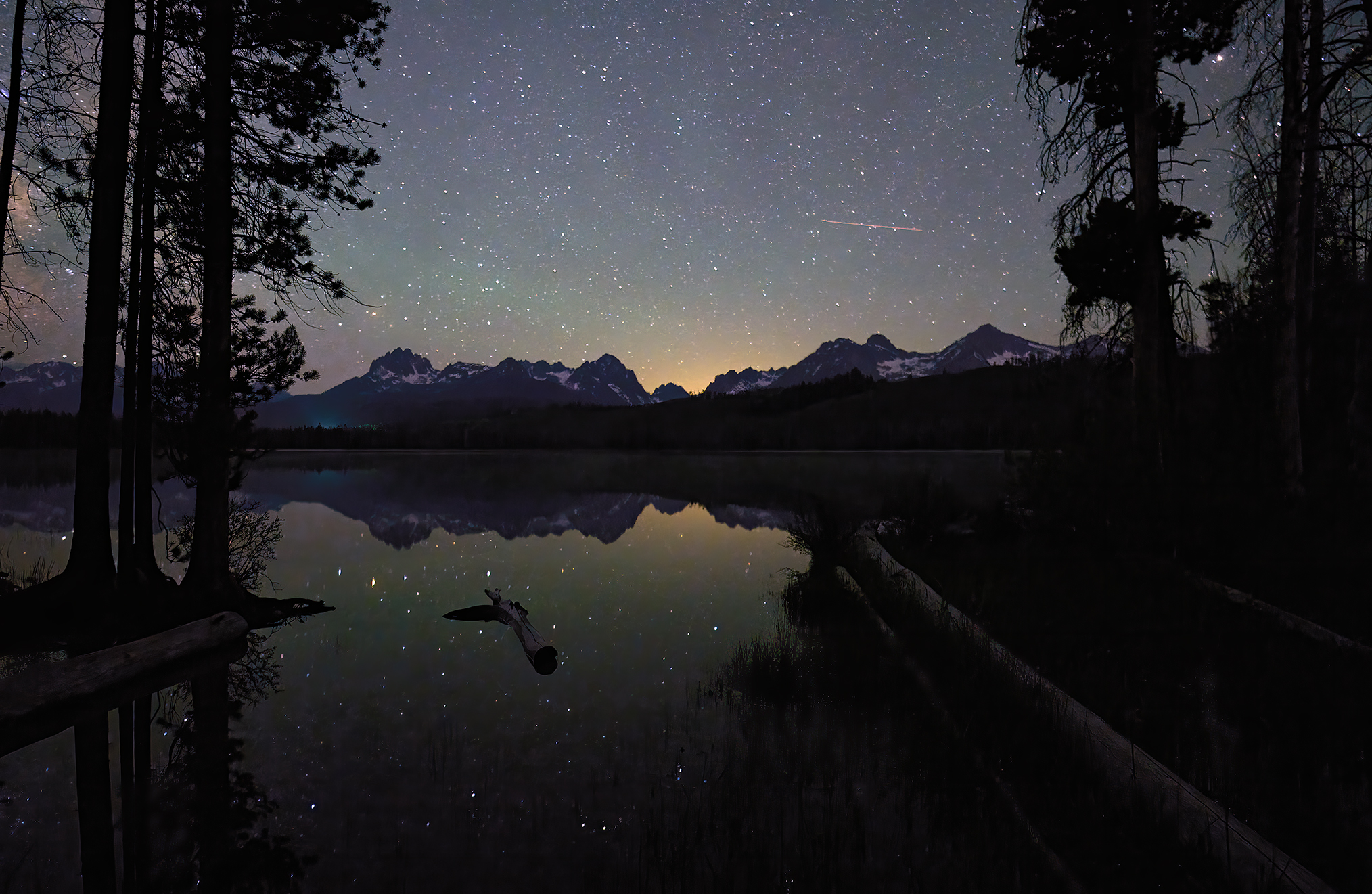
McGowan Night Sky Cusp of Summer © Jeffrey H. Lubeck – MESH Art LLC – all rights reserved
McGowan Sunrise Cusp of Summer © Jeffrey H. Lubeck – MESH Art LLC – all rights reserved
*** Jeff’s Thoughts and Other Worthless Trivia ***
McGowan Peak is often misspelled. It is named for one of the earliest residents in the Sawtooth Basin, George McGowan. Many travel maps, tourism companies, and historical websites misspell it to be McGown Peak. Official records of the U.S. Geographical Board have the name designation of “McGowan” submitted by the United States Forest Service on February 21, 1916, and approved on June 7th, 1916. Relatives of McGowan living in Challis, Idaho have confirmed McGowan to be the correct spelling.
A story about the naming issue in the Idaho Statesman is [here].
An example of not getting my trifecta (i.e., sunset, under the stars, sunrise) in the same photo-shoot is Little Redfish Lake. The weather would not cooperate. While all the shots were good, the sunset and sunrise where not of the compelling brilliance the location can provide. I did, I think at least, get a solid under the skies image.
Little Redfish Under the Night Sky © Jeffrey H. Lubeck – MESH Art LLC – all rights reserved.