October 2026
M T W T F S S
 1234
567891011
12131415161718
19202122232425
262728293031  

On Top of the Boulder Mountains – Ryan Peak

At 11,714 feet in elevation, Ryan Peak is the tallest of the Boulder mountains of Idaho.  From the North Fork of the Wood River trail-head in the Sawtooth National Recreation Area (SNRA), Ryan Peak rises almost a mile in the sky (5,172 feet).


Ryan Peak from the east.

Ryan Peak from the east – courtesy Summit Post.

On Saturday morning my son, Kyle and I decided to take on the challenge of summiting Ryan Peak.  In about three and one-half hours we covered five and one-half miles in distance and almost mile up in elevation to reach Ryan Peak for a delightful lunch.
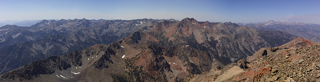
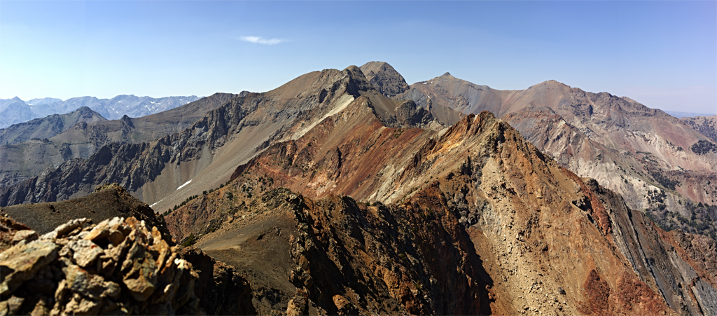
Looking west at Glassford Peak (11,602) from the top of Ryan Peak.

The effort to reach Ryan Peak does not involve climbing of a technical nature (i.e., ropes and other rock climbing tools).  However, the hike to West Fork Saddle (10,004) is strenuous.  Depending on route choice, the remaining 1,710 feet of gain can be a very demanding Class 3 Rock Climb.  We chose a direct route which is clearly the steepest and kept us using all fours simultaneously most of the time.  Once on the ridge line of the mountain what appears to be a Class 4 effort to the top is actually a stunning Class 2+ hike.  However, it does involve establishing some careful hand holds and foot placement on rock. A slip likely means a fall and unplanned descent of a few thousand feet.
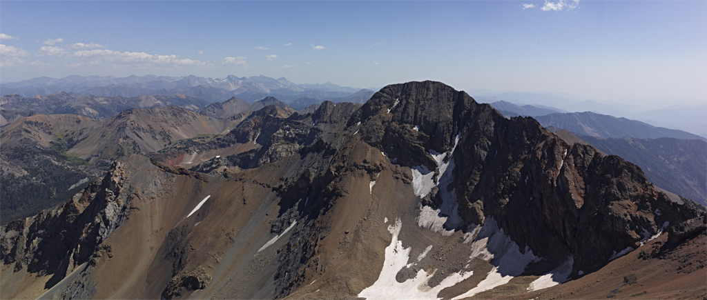
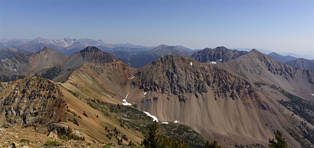
Looking south at Kent Peak (11,664).
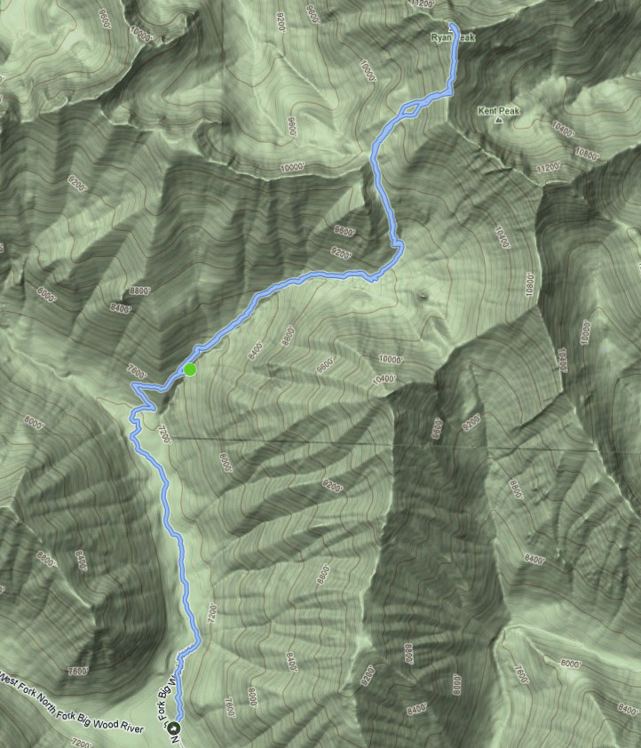
 

Our route up and down Ryan Peak as recorded on my Garmin Forerunner 405.


Standing the Test of Time – The Bourne Legacy ****

The Bourne Legacy is a winner on virtually every front.  With the Bourne Legacy, brothers Tony, Dan and John Gilroy demonstrate they can continue their Pulitzer prize winner father Frank’s legacy of great story telling as well.

File:The Bourne Legacy Poster.jpg

The Bourne Legacy is not a reboot or retread of the series adapted from the Robert Ludlum novels – all of which were adapted for the screen by Tony Gilroy (W/D of Michael Clayton).  Instead, with Tony in the role of Director, The Bourne Legacy proves to be a superbly crafted extension of, and arguably an improvement on the earlier films.

Jeremy Renner (Mission Impossible, The Town, The Hurt Locker) as Aaron Cross is a trained assassin for the United States Government categorized as Outcome agent at the time Jason Bourne is last seen (escaping) in New York.  The government decides that Pam Lundy’s upcoming testimony before Congress could mean the demise of the various programs.  Therefore, it is decided to mothball the programs’, eliminate the agents and deny anything exists.  Cross is not very agreeable to the idea of dieing.

However, Cross has a very real problem with a time-limit for solution. Enter Rachel Weisz (About a Boy, Enemy at the Gates, Runaway Jury) as Dr. Marta Shearing.  Shearing is the lynch-pin to the solution and thus begins a globe crossing journey.

This installment of the Bourne film series contains significant background, a great storyline and compelling dialog that act as accompaniment to thrilling action.  The supporting cast is extensive and of high quality.

Notes:

The Bourne Legacy actually scores only a 3.875 out of 4 because the Canadian Rocky Mountains (Banff area) are depicted as the remote mountains of Alaska.  For all the time and money spent on the glamorous side of these pseudo travelogs the Producers could they have made the effort got this logistically and visually correct.  Thank goodness the storyline did not include Seattle or I would have had to sit through looking at the streets and skyline of Vancouver as a bad substitute.

Weisz could have conducted a fair amount of preparatory work with a super-agent while staying at-home.  She is married to James Bond lead Daniel Craig.

Saturday Amongst the Boulder Peaks

The Boulder’s are one of five mountain ranges that come together in what I consider my backyard and most others think of making up the Sun Valley area.  Along with the Boulder’s, the Pioneer, Smoky, Sawtooth and White Cloud mountains consist of over 1.1 million acres of protected land.  The Boulder’s have a plethora of peaks reaching between 10,000 and 11,714 feet in elevation.  The Boulders are just north of town and for the most part sit in the Sawtooth National Recreation Area (SNRA).

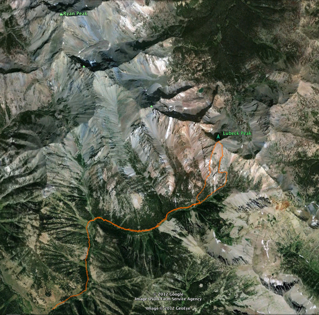
Ryan Peak at 11,714 feet is the tallest in the range and leads one rib of four peaks all sitting around 11,000 feet in elevation.  The first three (Ryan, Kent, Perkins) in this rib are named. The fourth and farthest east peak in the rib is unnamed. Although not in our original plan for the day, Kyle and I scaled the fourth peak on Saturday.  For the moment we named the peak for ourselves.

Perkins, Kent and Ryan peak as seen from Lubeck Peak.

It should be noted that Linda and I have a small rule – no more technical mountain climbing for Jeff.  In short this means no routes involving classification four or above as defined by the Yosemite Decimal system (YDS) in terms of technical difficulty.  This agreement came into place after two climbers died descending from the summit of Mt. Rainier on the same route I was using a few hours earlier.  I have held true to the agreement for over 20+ years.

On this day, I would push the limits, but not break the rule.  The last mile of the ascent gained about 2,500 vertical feet.  This portion was a steep class three rock scramble.  For me, the only real difficulty was that I had a load of camera gear on my back and it was sometimes tricky keeping my balance.  Kyle set a great pace and both of us never felt over extended despite the high elevation, elevation gain over well over 4,000 vertical feet and temperatures (80’s F).

The Boulders and Pioneer’s in the distance (Hyndman Peak 12,062 feet) from Lubeck Peak.


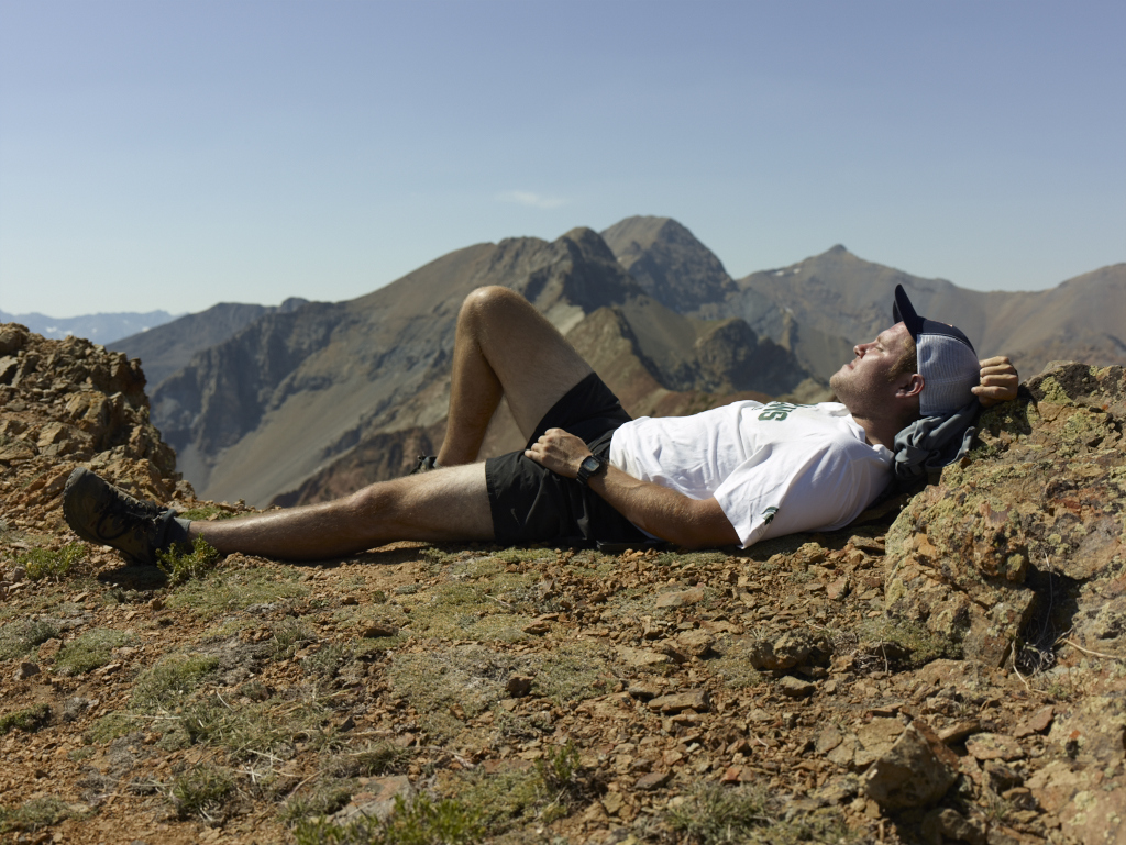
The 360 degree view views at the top was terrific.  I took photos while Kyle napped and got some sun.

Kyle and the Spartan’s rule the day.


For the descent we chose a more direct and somewhat trickier route.  Given that the vast majority of accidents on mountains take place on the descent, Kyle and I took great care.  Once back to the valley floor we were reminded how much different it was from the top.  The valley is heavily forested with old growth and laced with waterfalls.  The trip was a little over 11 miles in length round-trip.

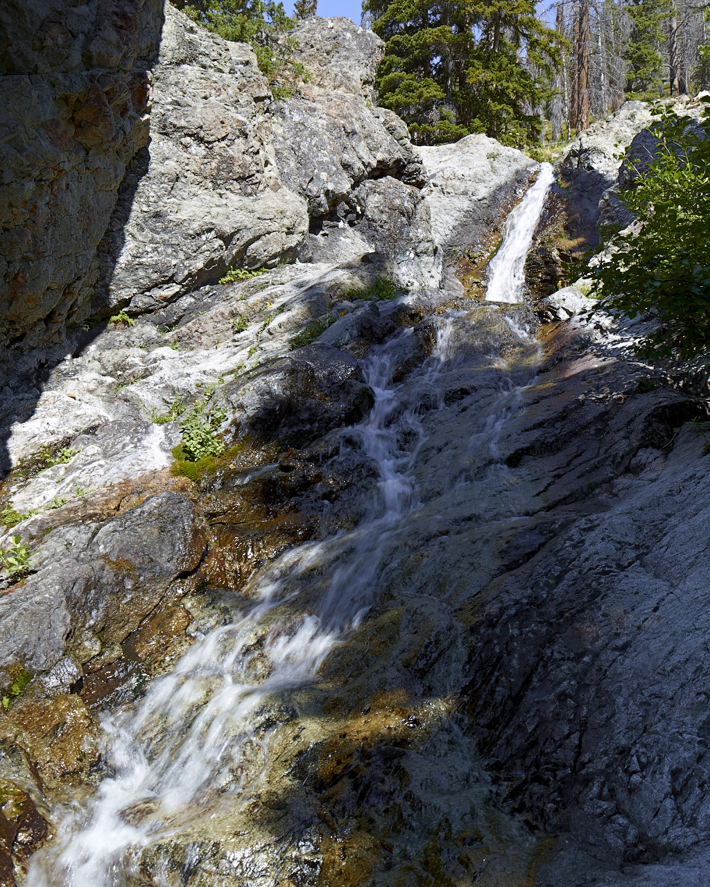
A waterfall at which we stopped for a short rest on the way up and down.


The view from Google Earth.