The challenge is significant.
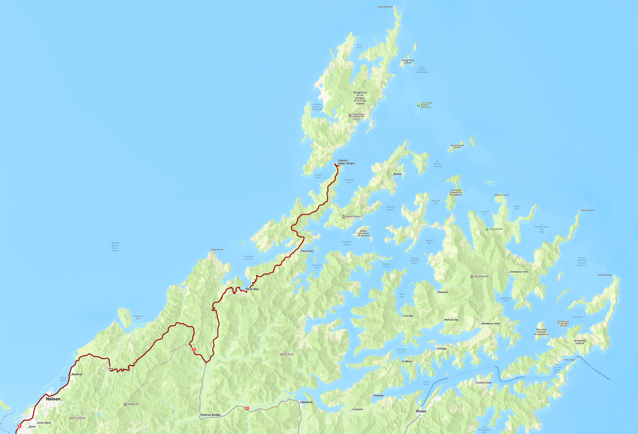
To capture images I have dreamed about for years, option one is to stay the course and reach the iconic French Pass in New Zealand. Option two suggests that driving in the rain, in unfamiliar territory, in a foreign country, on a precarious backcountry road amid dense fog might not be advisable, and it would be better to return home.
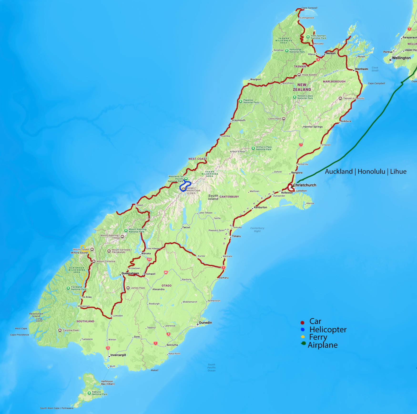
French Pass is a narrow strait of water separating the northern part of the South Island and D’Urville Island. Locals use words such as treacherous and deadly to describe it.
Linda, my wife of 44 years, is sitting next to me. We enjoy traveling together to the fullest.
White Knuckle Time
Out of the car, I can see 25 feet ahead of the hood before the fog swallows everything in view. The one-lane dirt road is solid. The goal and conditions are not new to us. As I get back into the car, Linda gives me a nod of approval. We are 70 miles into a 75-mile one-way drive. We’re headed to French Pass, white knuckles and all.
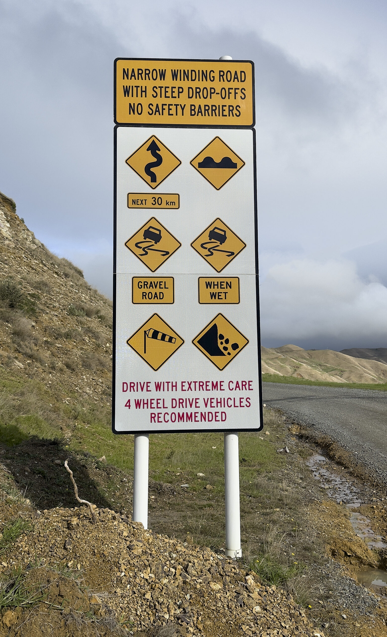
Warning Sign
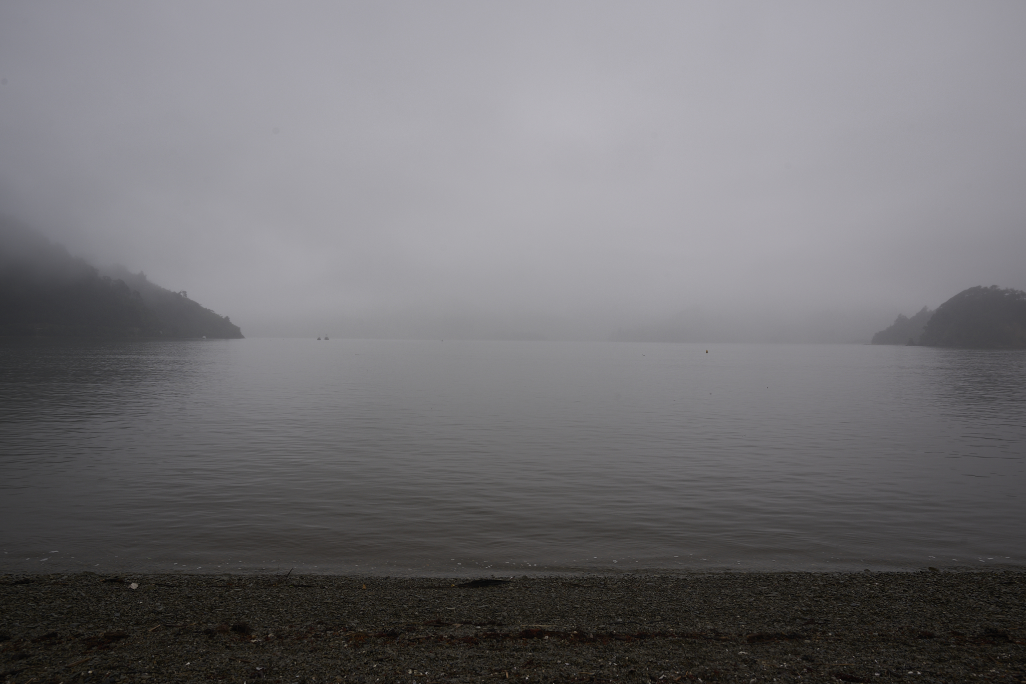
Fog in Route at Okiwi Bay. The conditions get worse as we head up to Bobs Peak.
 |
 |
 |
A photography principle I follow is to execute the plan fully. Our aim during this expedition is to witness and take in the sights of French Pass, provided there’s no personal danger involved.
Singular Experience
The last five miles to French Pass are a singular experience. Dense forest gives way to bare, rocky ground, which then transitions into tall native grasses. The change repeats three times.
As the last half-mile approaches, the fog clears and the clouds break. A change such as this in a mountainous maritime setting is not uncommon. It is partly why I always keep driving to the endpoint.
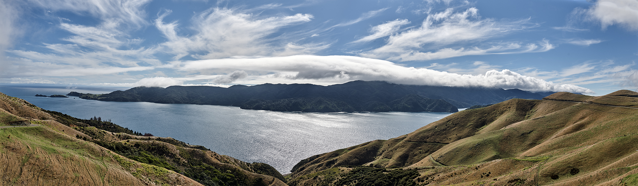
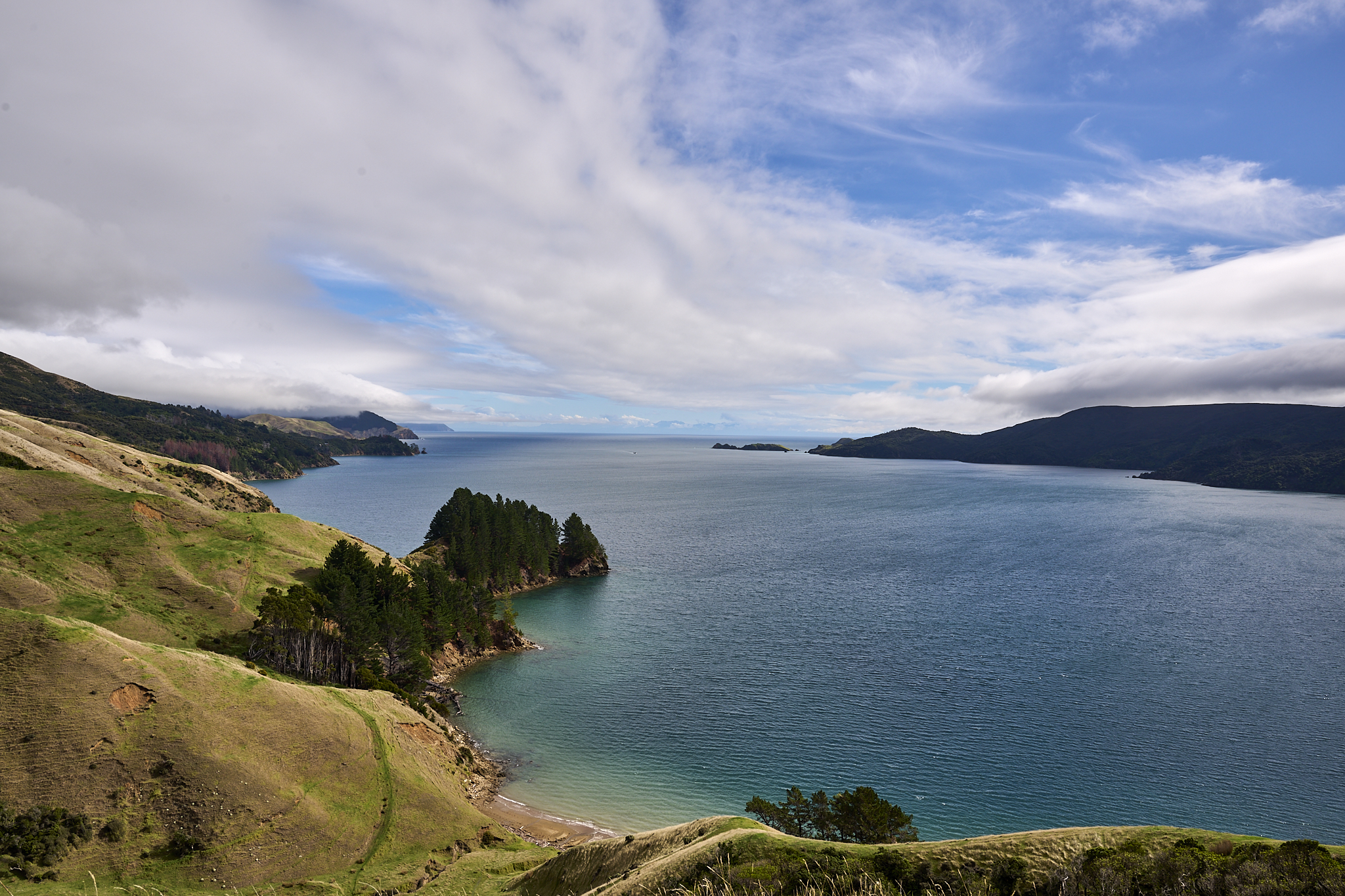
Green hillsides are now accompanied by the sounds of sheep grazing. A narrow strait of swirling, churning blue water rushes before me.
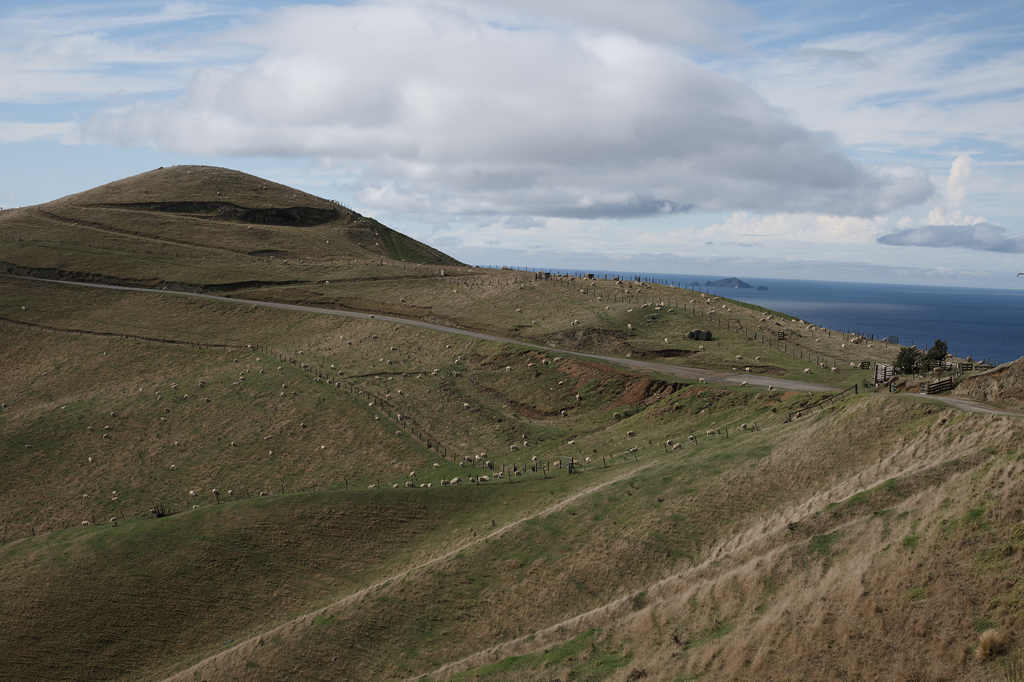
Clouds Part Sheep Graze
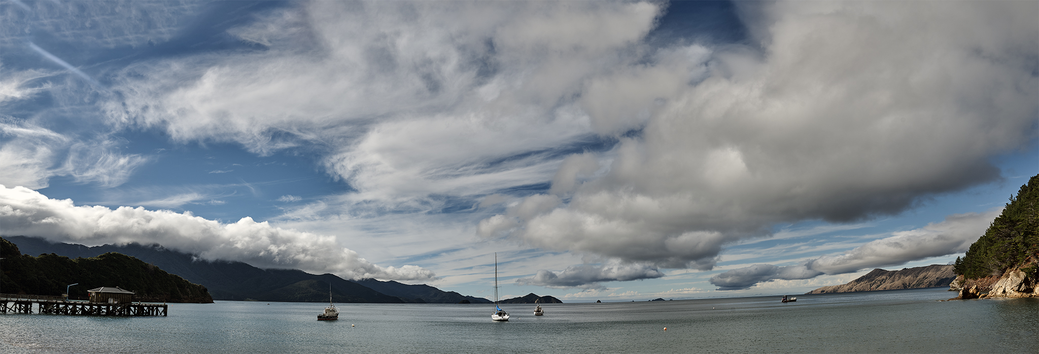
At its narrowest, French Pass is 330 feet across. The water rushes by at an unimaginable pace. It is near high tide, which means the water is flowing below me faster than in any other place in New Zealand.
French Pass Gazing
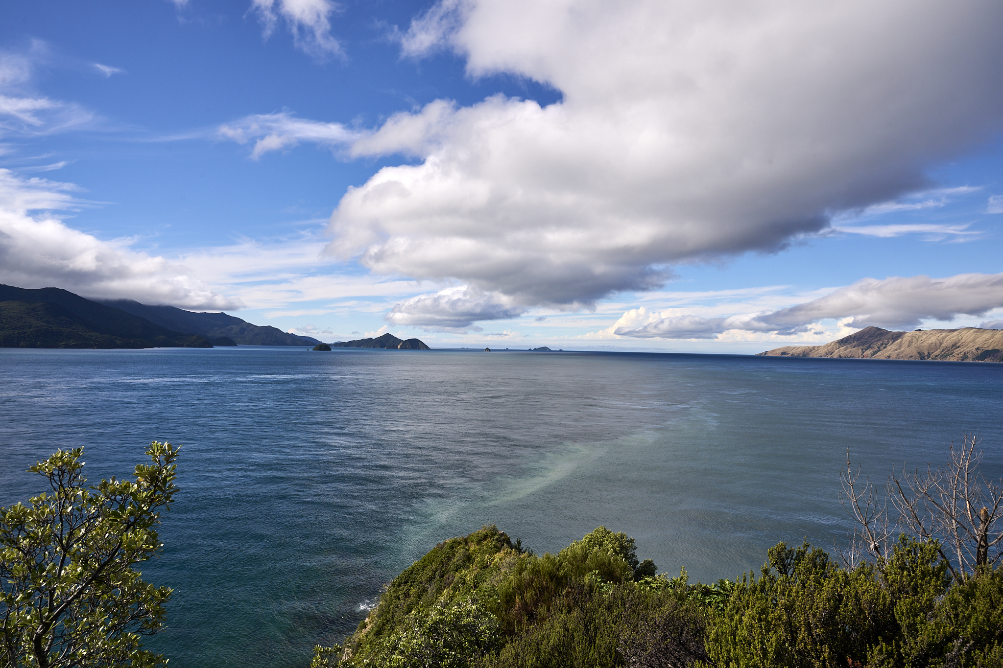
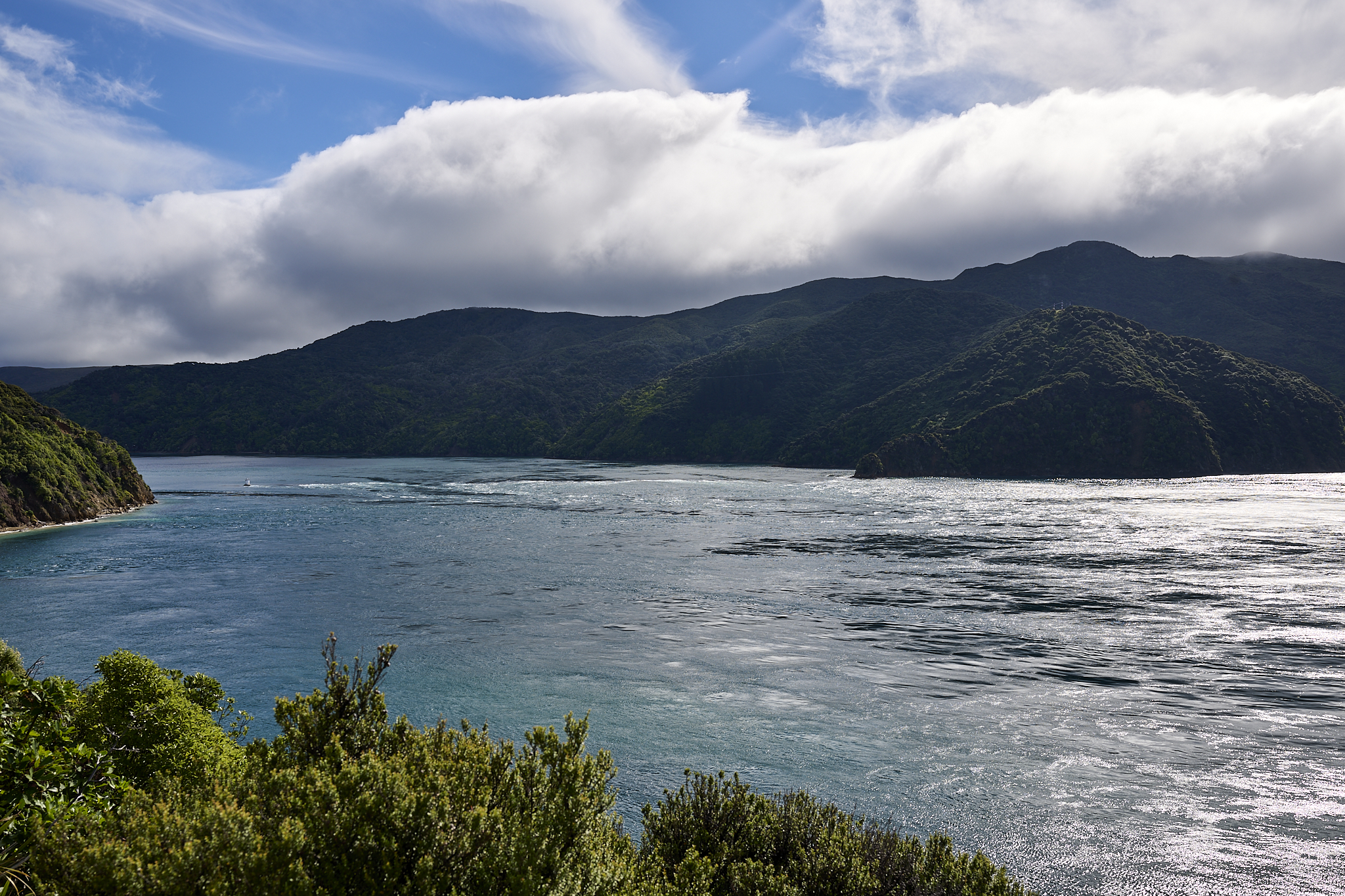
On the left, you can see Tasman Bay, and on the right, Pelorus Sound. The Tasman view shows bright skies, green mountainsides, and blue water merging with steep cliffs and broken reefs. The Pelorus is a reverse experience, except that it ends with the open seas feeling of Cook Strait.
French Pass looking towards Tasman Bay. A car. ferry boat is a tiny speck in the distance.
French Pass looking towards Pelorus Sound.
French Pass at High Tide.
A car ferry comes into view. It is attempting to transit out of Tasman Bay through French Pass to a dock on D’Urville Island. Its struggle to overcome the current at high tide is obvious as it wavers to make forward progress. In the end, the car ferry reaches the dock without incident.
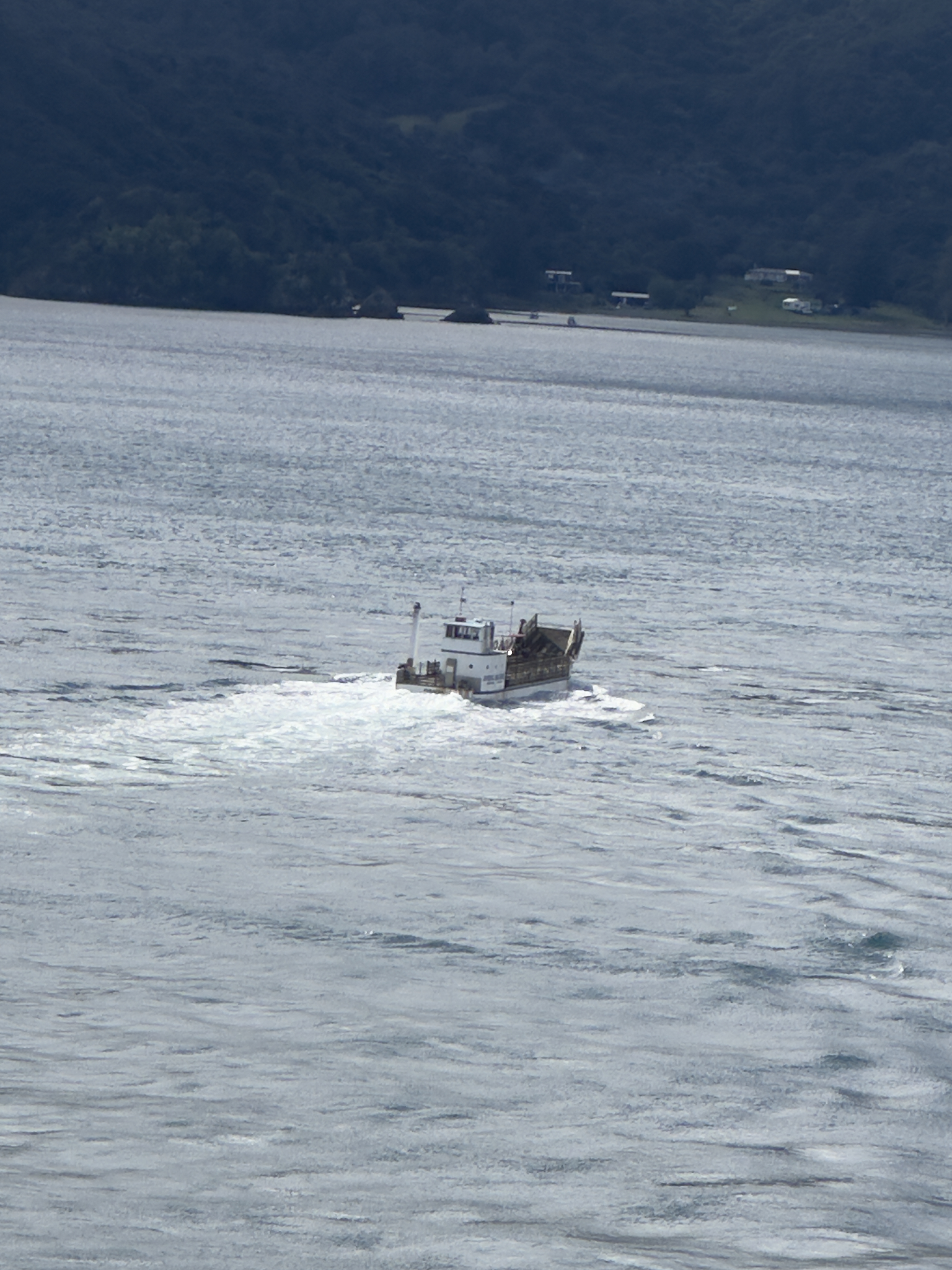
Car Ferry working hard to reach home.
The French Pass surrounding offer short hikes, a lighthouse, and several lookouts. It is worth taking the time to explore and experience each one.
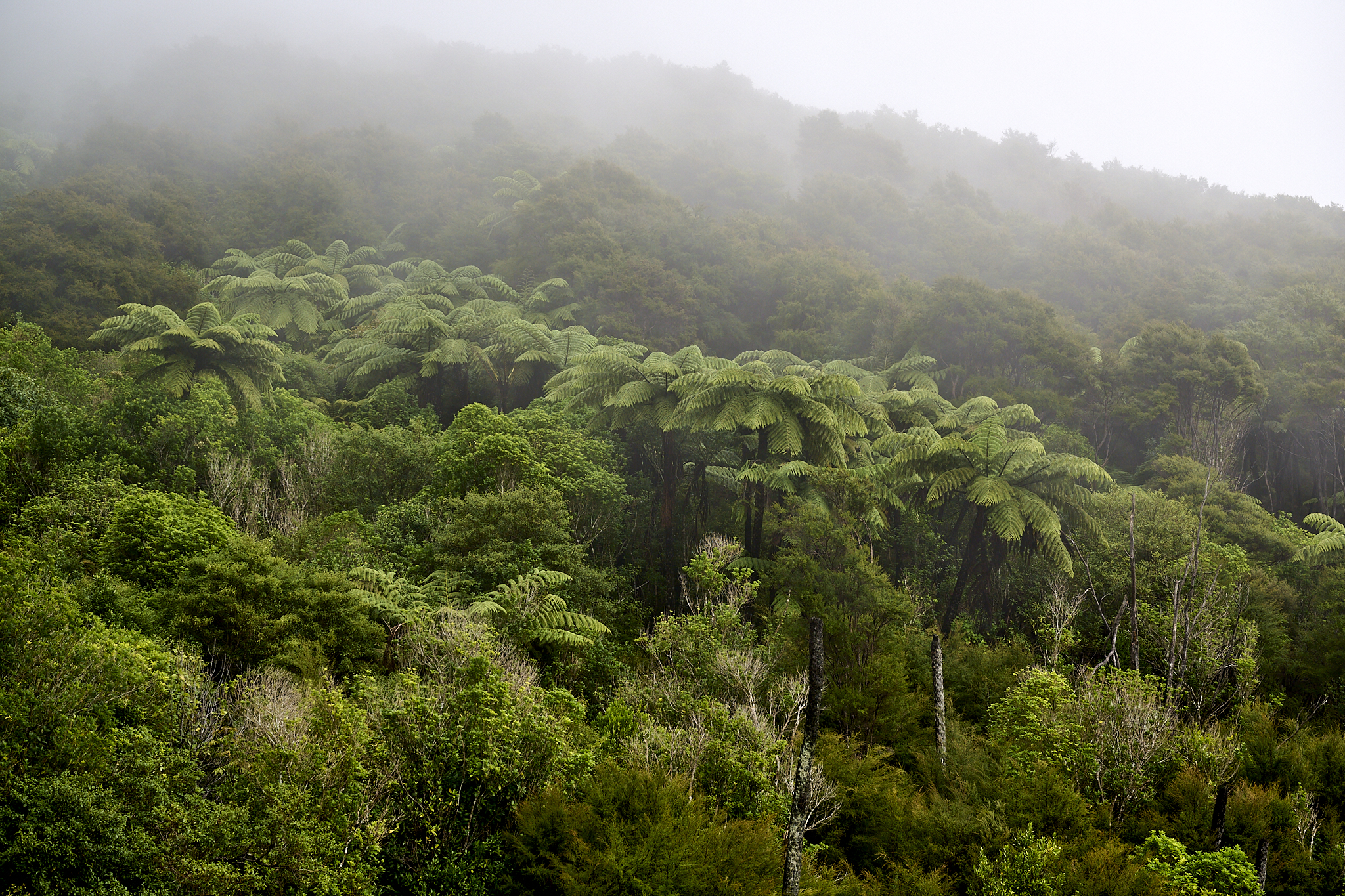
Fern Trees.
All ready to go.
Serenity is At Hand
The next and final stop on the trip is the village of Anaru. It is a few minutes’ travel to the south and east of French Pass. Facing Admiralty Bay, the village provides shelter from French Pass. A serene fall day, calm and sunny, is a great place to finish.
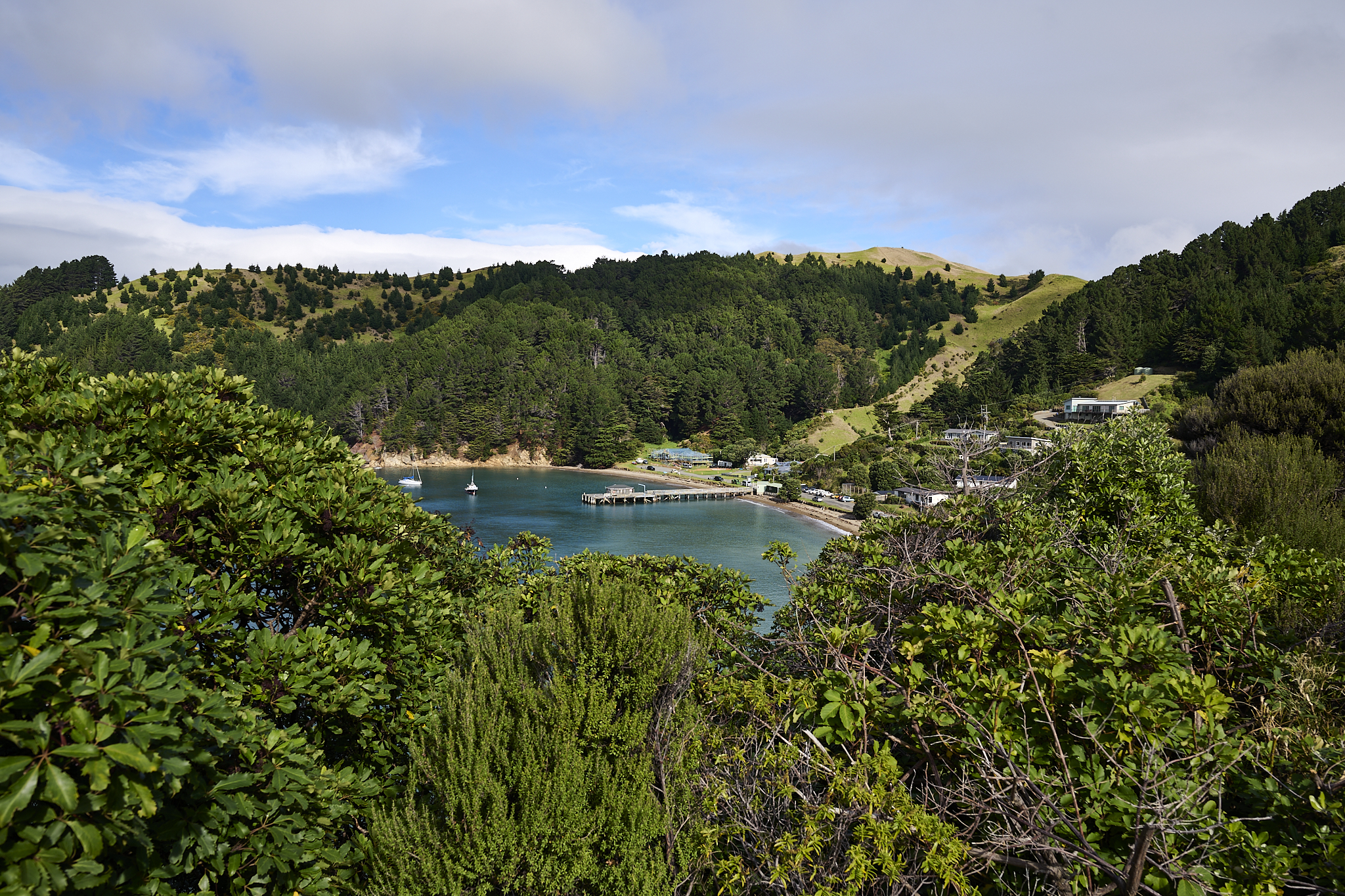
Anaru from French Pass Lookout.
The view from Anaru.
*** Jeff’s Thoughts and Other Worthless Trivia ***
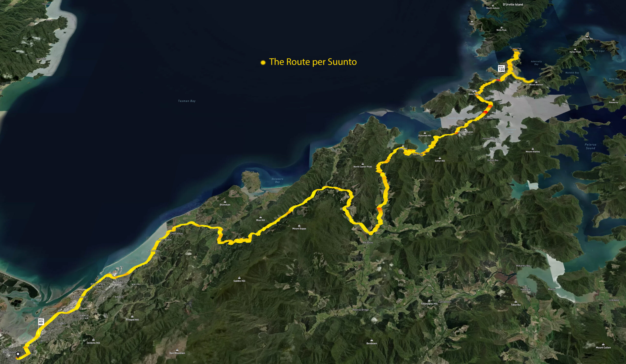
I decided to put my watch (Suunto) to use. I had it track the trip to French Pass. The route is in Yellow. The places we slowed down or stopped are in Red. The two numbers represent my lowest (49) and highest (125) pulse rate during the drive. As you can guess my low was near the start of the drive and high was at White Knuckle decision time.
All of the the images I have captured and displayed in the Post are Copyright Jeffrey H. Lubeck – MESH Art LLC – all rights reserved.
What an adventure! Great images (of course). Loved the tracking with accompanying heart rates. Have fun!