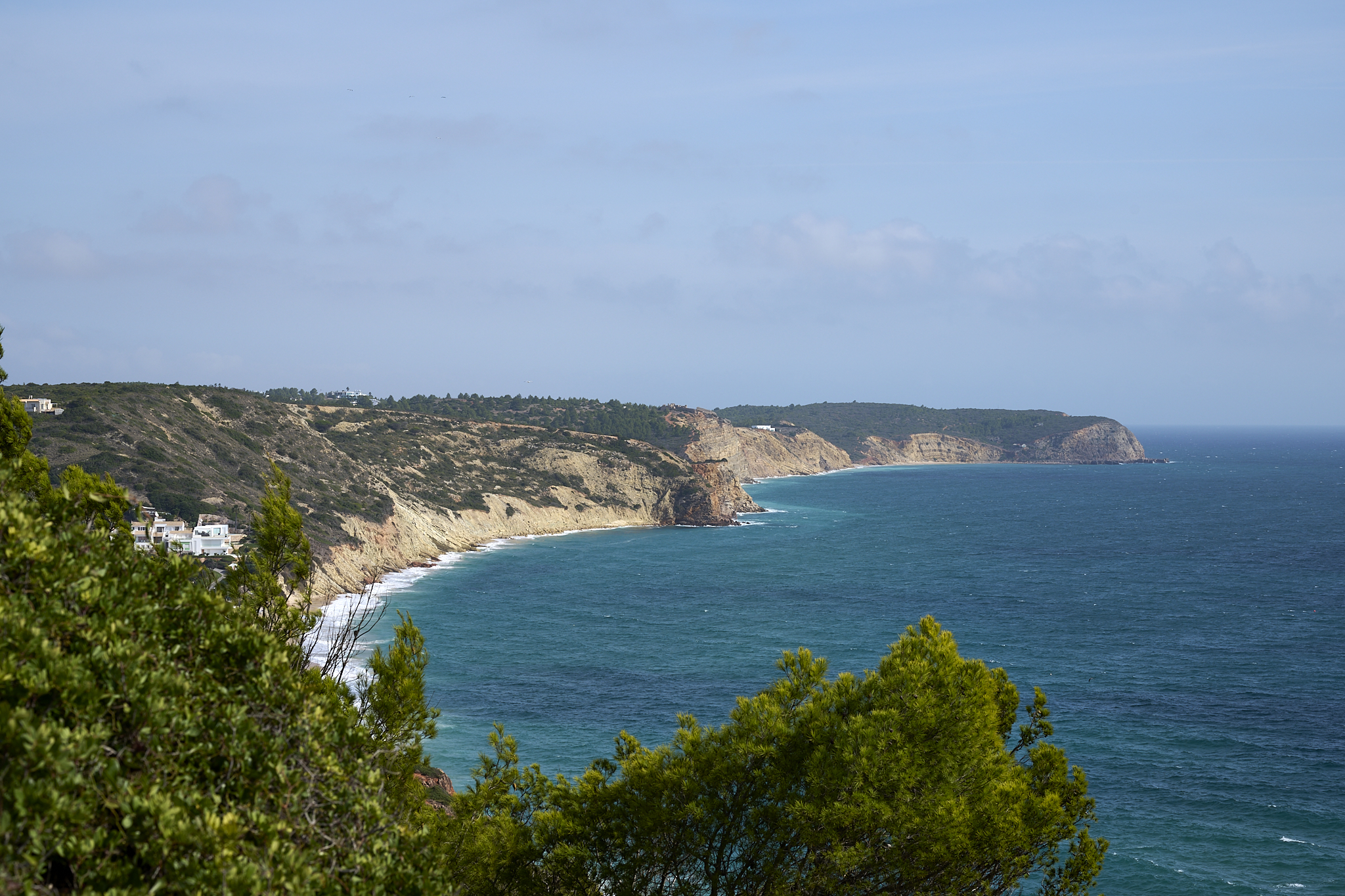
Portugal’s Algarve region is breathtaking. The variety in its terrain is surprising. It includes sunny white beaches, rocky coastlines, sea caves, steep cliffs, and a lush tree-covered countryside.
The Algarve is in southern Portugal, on the Atlantic. The coastline extends to the Spanish border. It stretches from Odeceixe in the northwest to Santo Antonio in the southeast.
The Algarve’s history has its roots in the Paleolithic and Neolithic periods. The Algarve has been home to many cultures and occupiers. It includes Portugal’s Dom, Algarve’s Kingdom, Portugal, Brazil, and the Algarves, First and Second Republic.
These cultures still have some influence here. However, tourism, migration, and vacation homes have greatly reduced the historical culture in the 21st century.
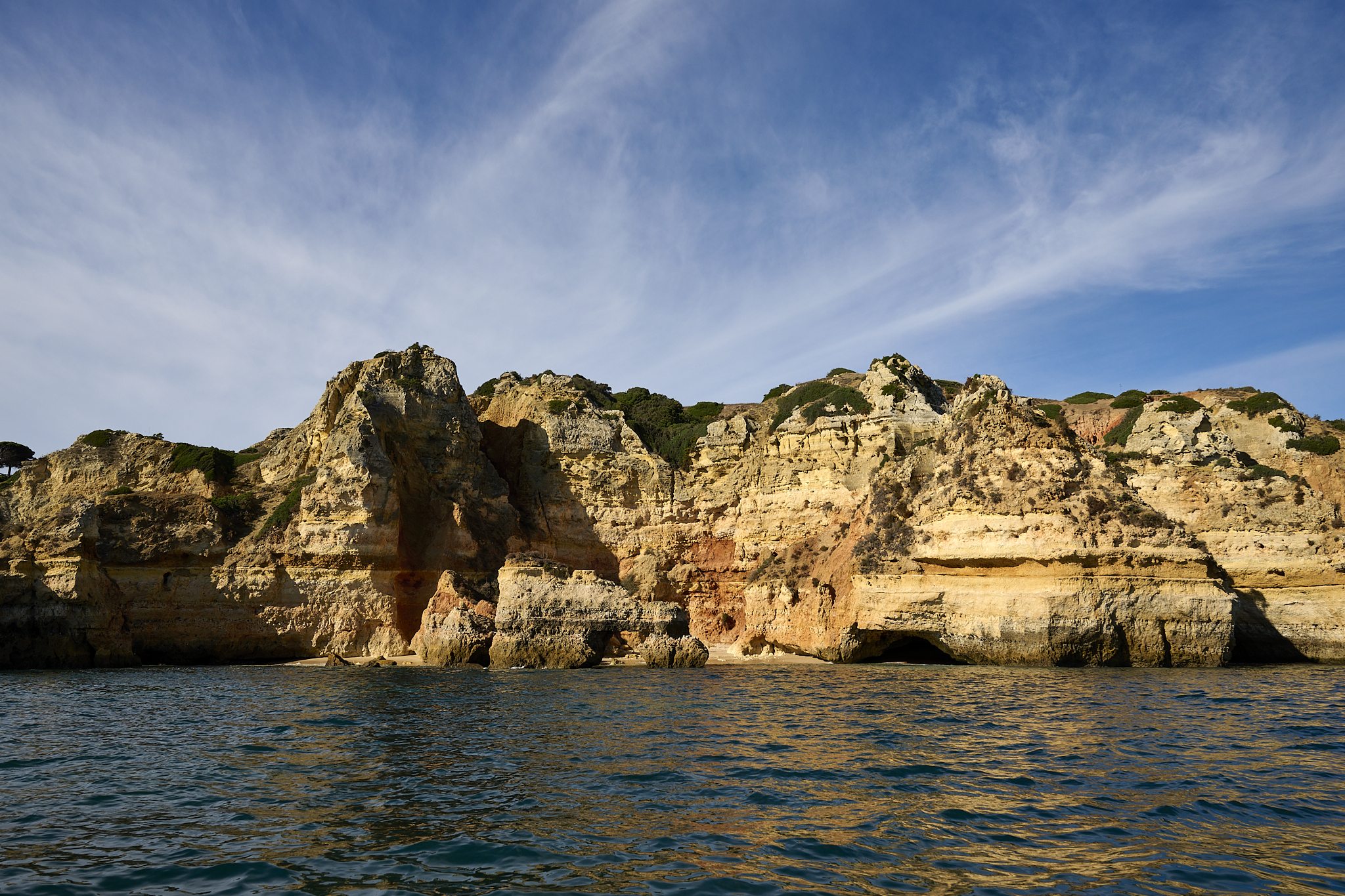
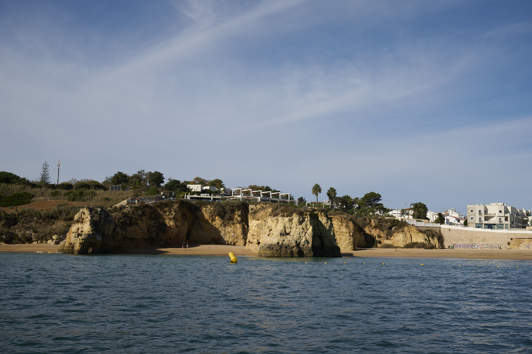
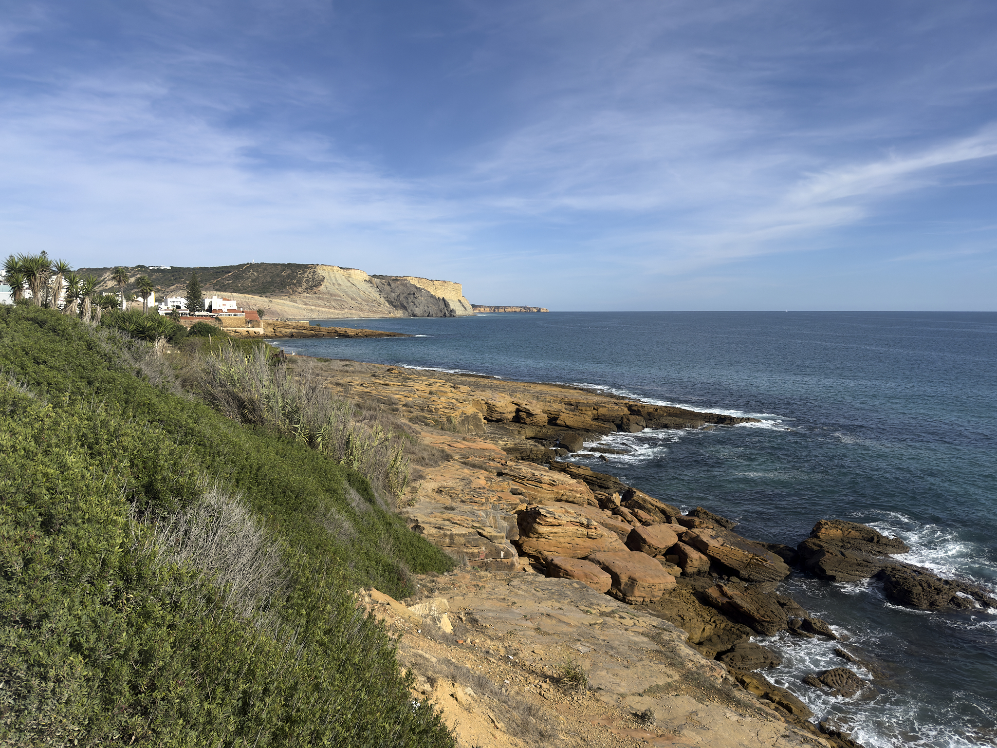
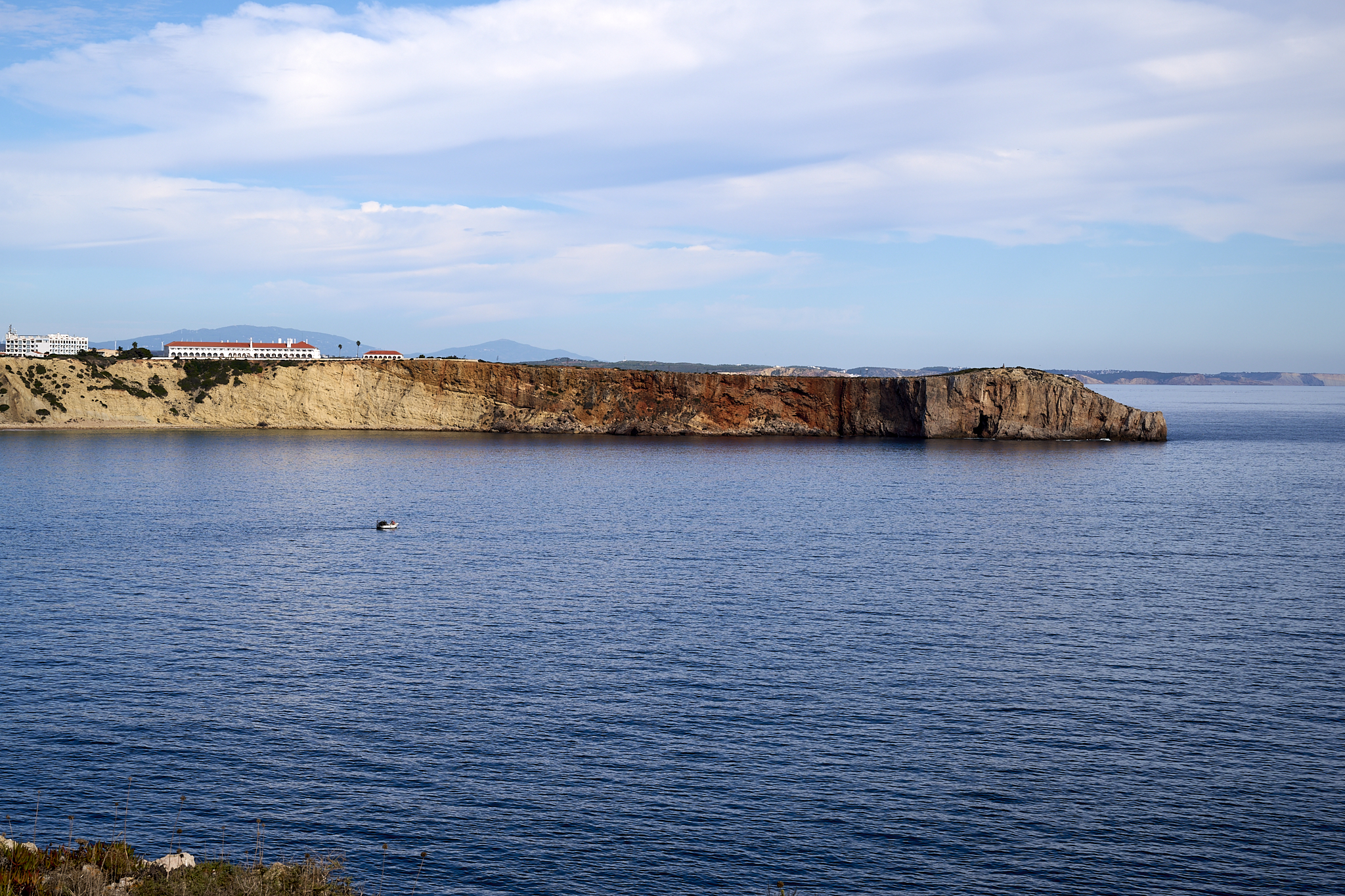
The Coast near Luz and Lagos.
 The Algarve |
 Portugal |
When and Where to Visit
Certain sections of the Algarve are urban and busy. The off-season population stands at 400,000. At its peak, the population swells to 1,200,000. The population in certain areas more than triples then. Ouch!
Rick Steve, a travel writing specialist, presents an honest account. Says Rick, “Choose your home base carefully. If you go to the places featured in travel blogs (the middle stretch, roughly between Faro and Lagos), you will find it much like Spain’s Costa del Sol: paved, packed, and pretty stressful.” A link to Rick Steves Portugal is located [here].
Linda and I prefer traveling during the shoulder season. The weather is likely to be pleasant, and the tourist population is small.
A Visit to Lagos
Swapping homes in Luz, near Lagos, from late October to early November, would be ideal for this trip. This spot is an excellent starting point for discovering the Algarve. Lagos has a complicated past. Today, there’s a lot going on in the city and nearby.
Lagos played a key role in world trade and exploration between 1400 and 1600 AD. People know the era as the Golden Age or Age of Discovery.
Through Prince Henry, Portugal rose, became dominant, and its language went global. The Lagos market saw the start of the African slave trade in 1444.
Earthquake and Tidal Wave
Starting November 1, 1755, Lagos would be different. A magnitude 9.0 earthquake, among history’s strongest, hit the area. It was located 50 miles offshore of the Algarve. The earthquake and tsunami destroyed cities from Lagos to Lisbon.
The tidal wave exceeded the height of Lagos’ city wall (image below). The earthquake and tsunami caused around 40,000 to 50,000 deaths. Portugal, as a result, would not regain its former power and influence.
Today
Lagos’ off-season population is roughly 31,000. The population of Lagos reaches about 130,000+ during the tourist season.
Tile is an important architectural element in Lagos. Narrow, clean, and bright alleys are typical of central Lagos.
To have fun, hike the Fisherman’s Trail in Lagos, followed by a boat tour. You can use multiple methods of water travel in Lagos.
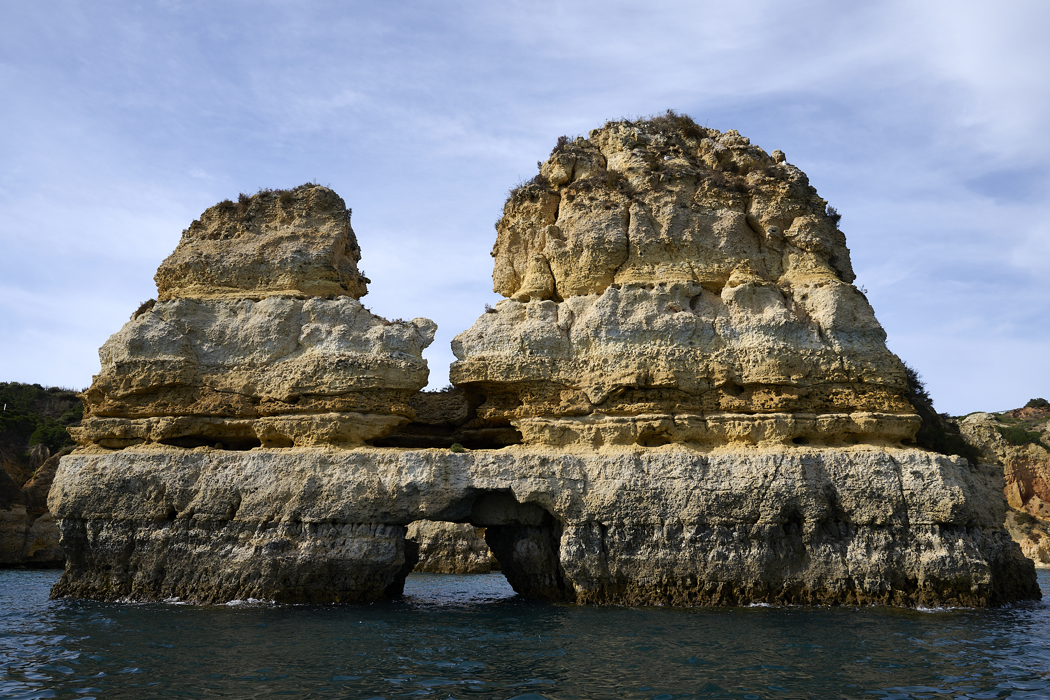
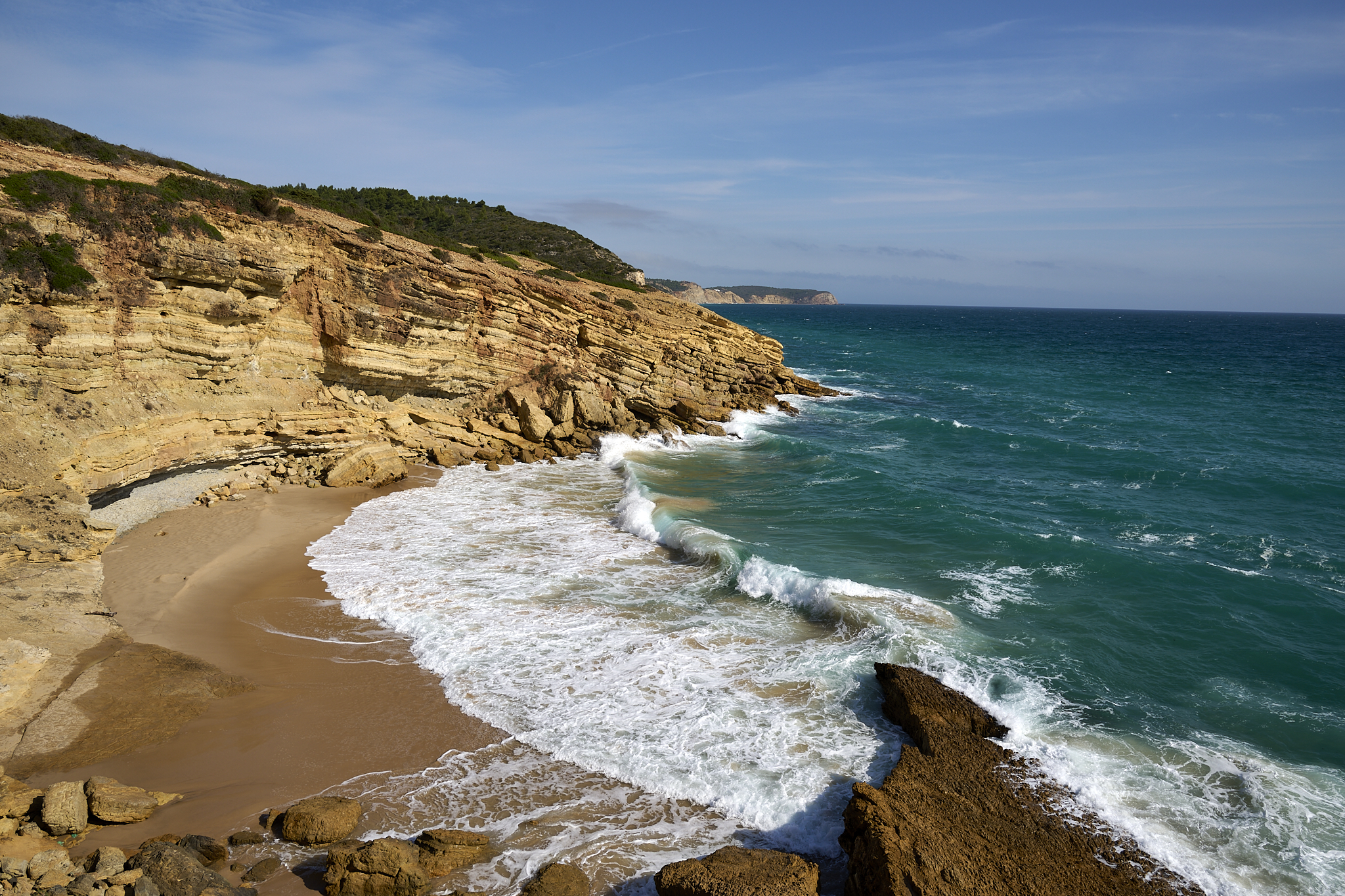
The coastline west toward Luz has what seems like countless sea-caves.
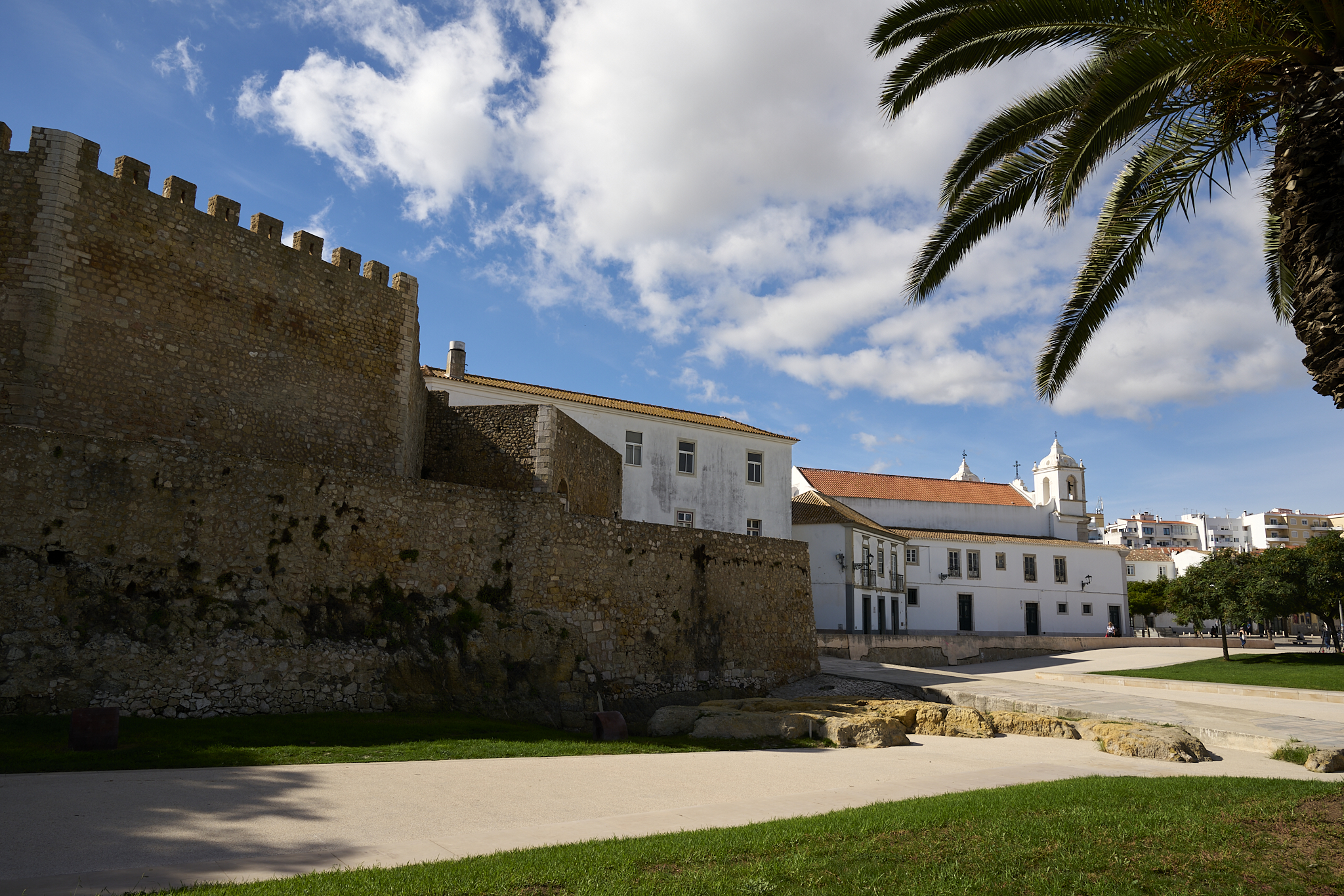
Lagos The Walled City
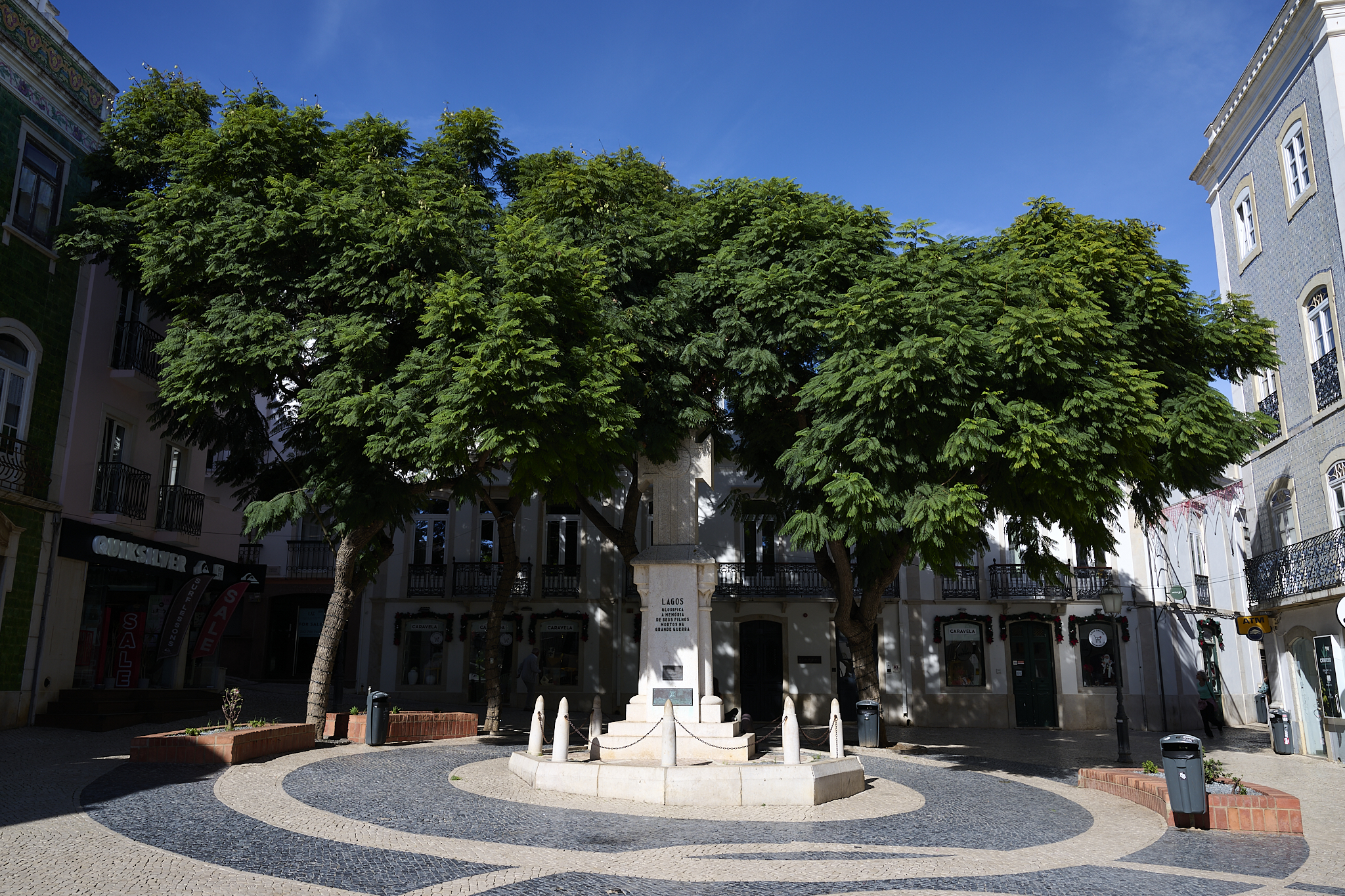
The Center of the old city,
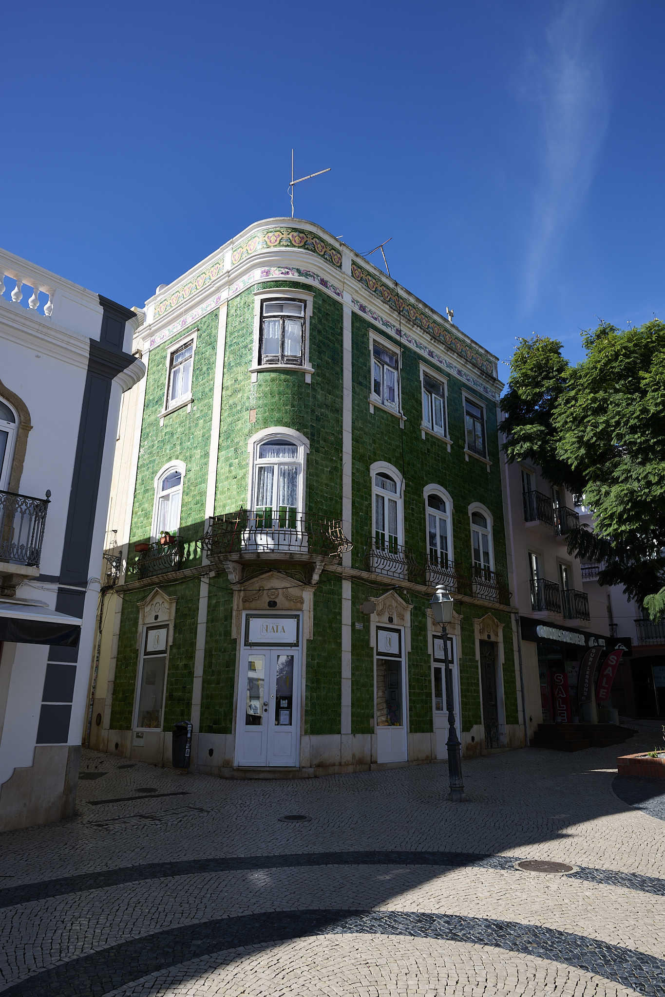
Tile is the theme in Lagos and Portugal.
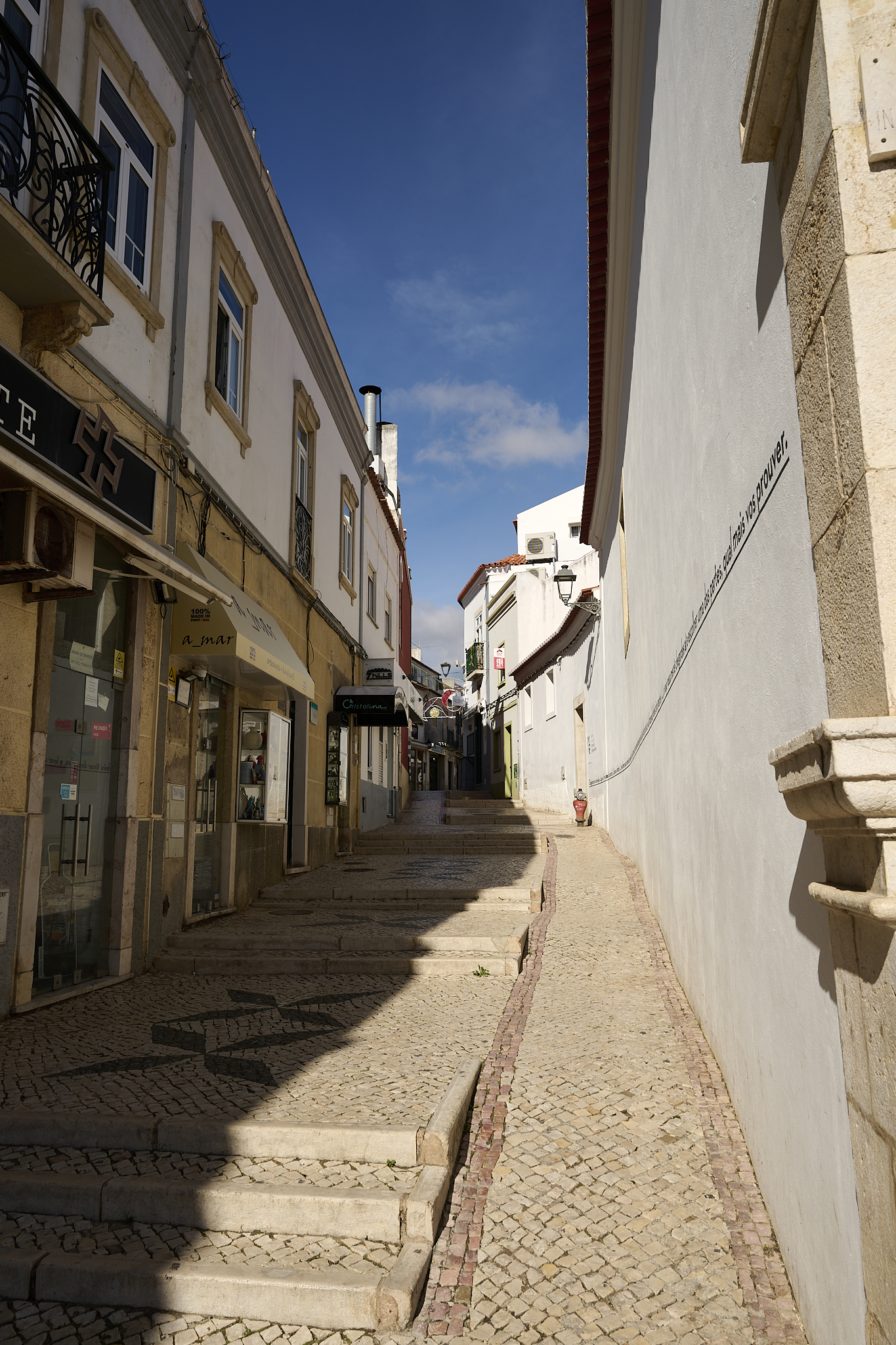
Clean and bright narrow alleys in the center of Lagos are the norm.
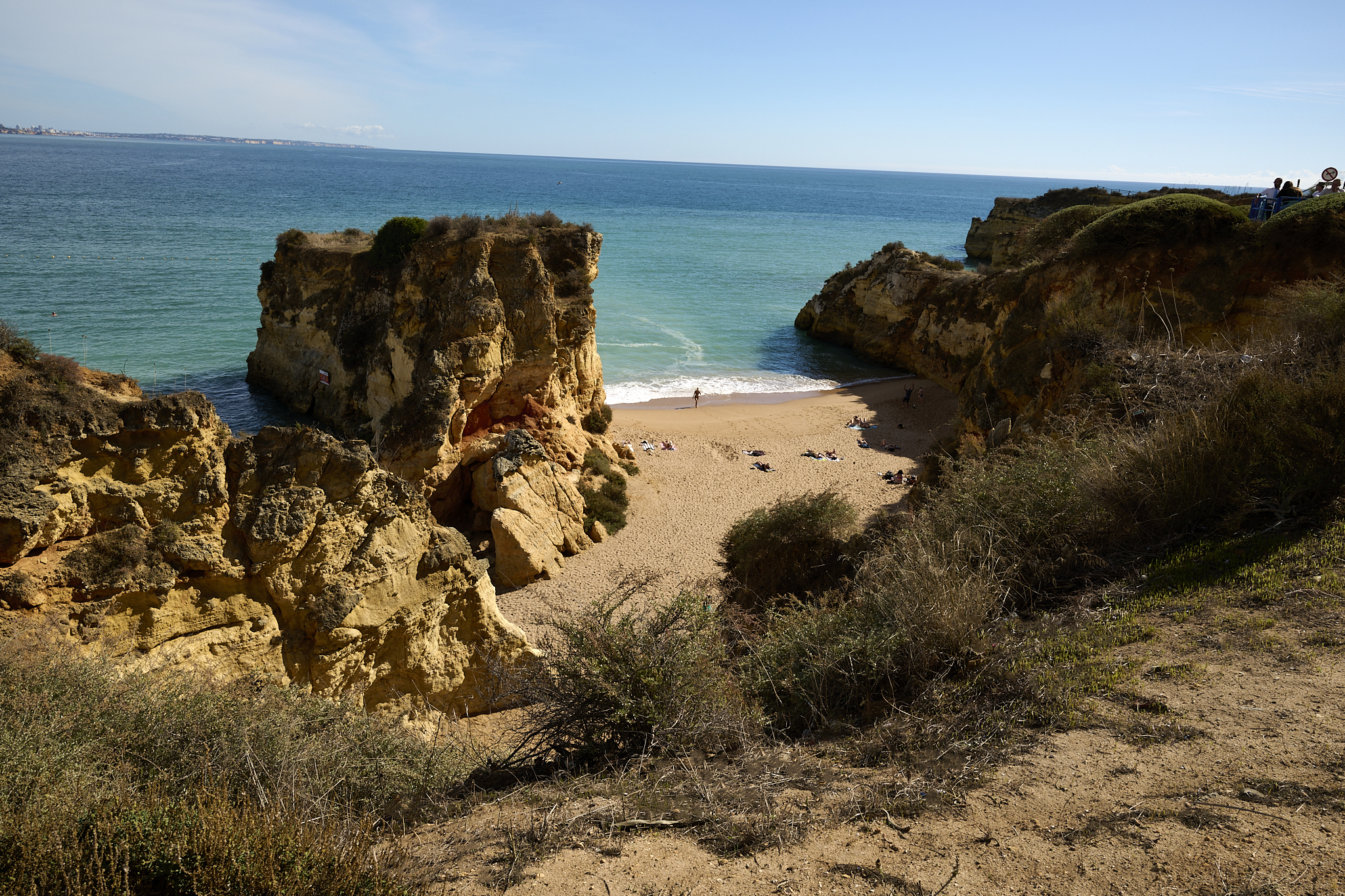
Beaches accessible to the public dot the rugged coast line at Lagos
Waterfront walk in Lagos. Lagos is the end point of the 125 mile Fisherman’s trail. The Lagos stretch of the trail are filled with nicely paved walkways, condominiums, restaurants and trophy homes. The walk is enjoyable and striking.
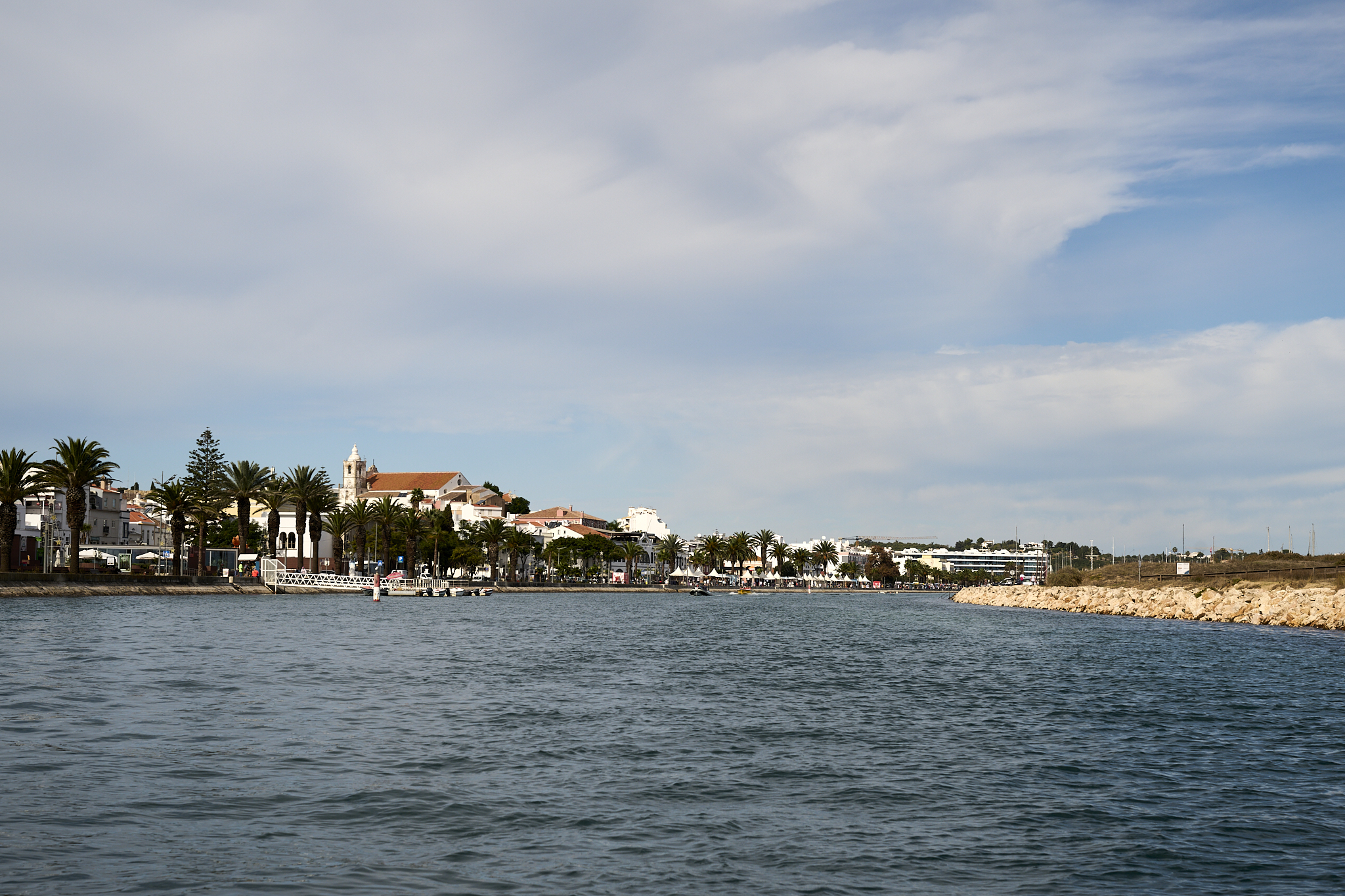
The Bensafrim River acts as the riverfront for downtown Lagos and entry point to the Atlantic Ocean
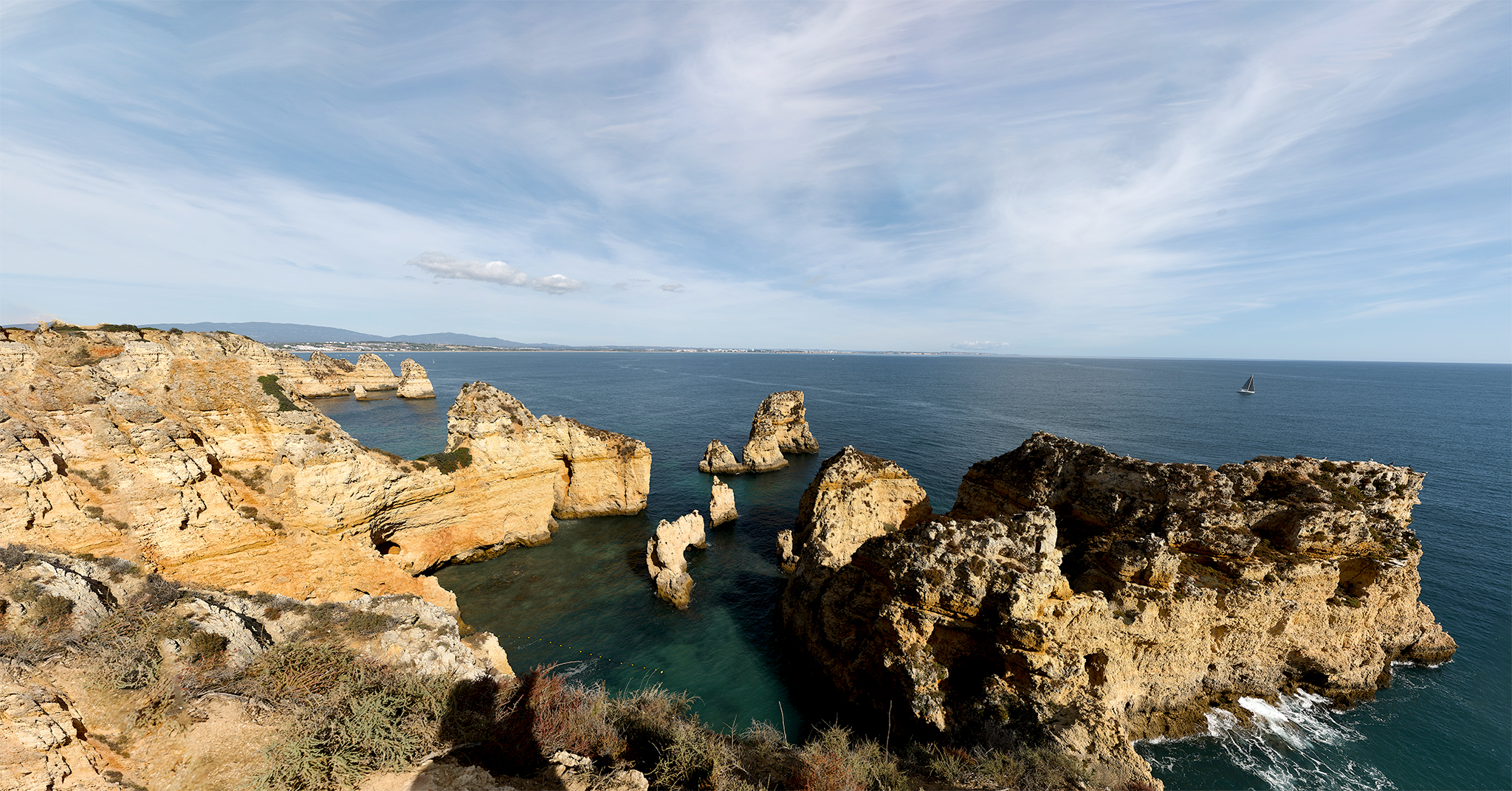
Ponta da Piede La Lagos Portugal is one of many overlooks on the Fisherman’s trail in the city of Lagos
A fun thing to do is walk the Fisherman’s trail in Lagos, followed by a trip covering the same area but on the water. There are a multitude of options for travel on the water at Lagos.
The Algarve from an overlook in Lagos.
The Algarve from the water in Lagos.
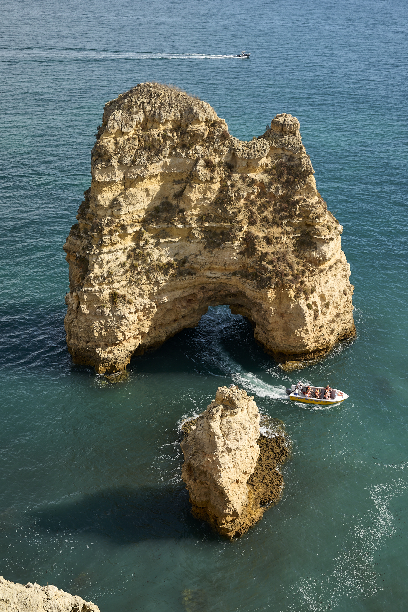
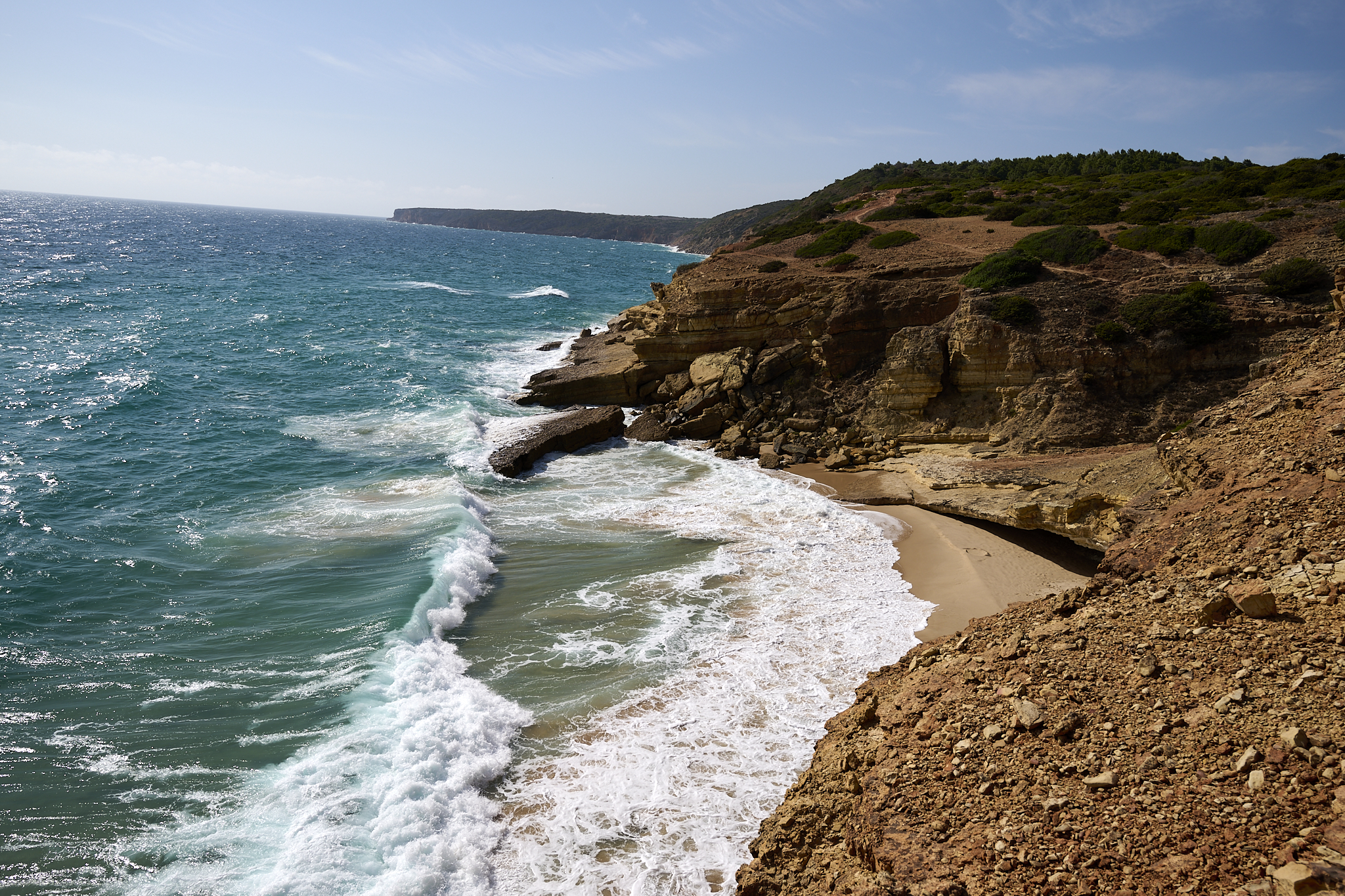
There feels to be an endless number of sea-caves on the coast line when moving west towards Luz.
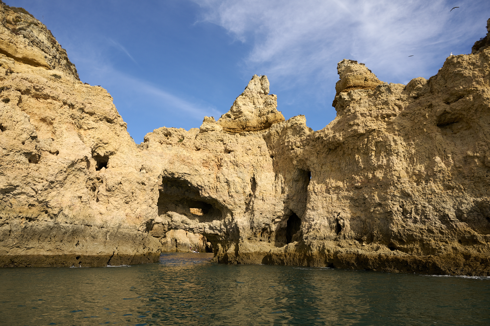
Approaching a sea-cave
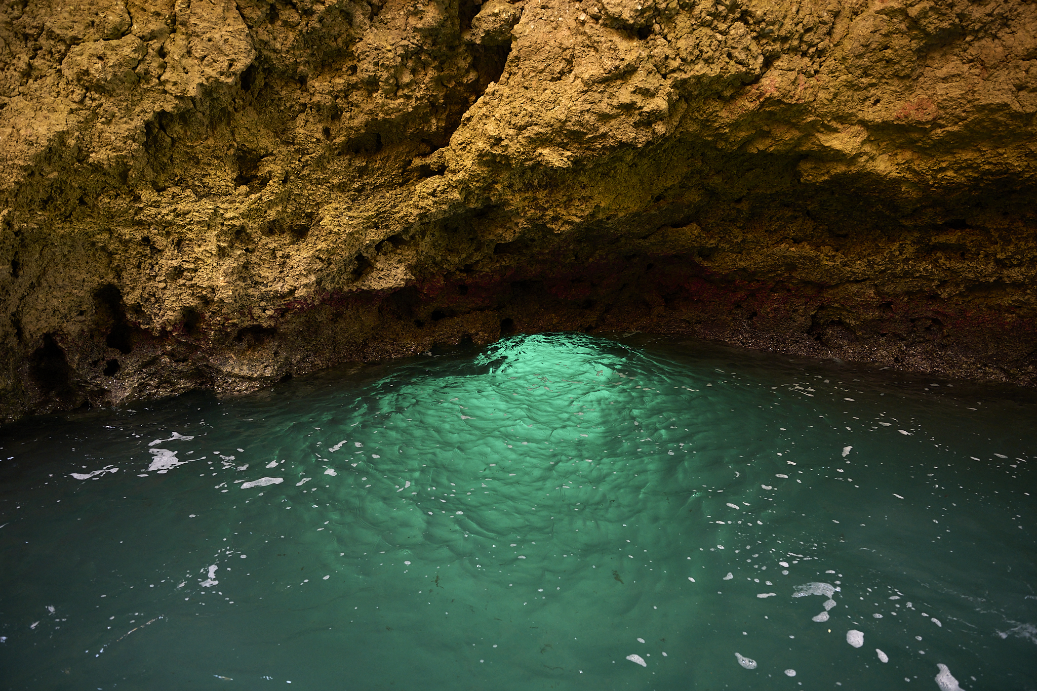
Inside a sea-cave
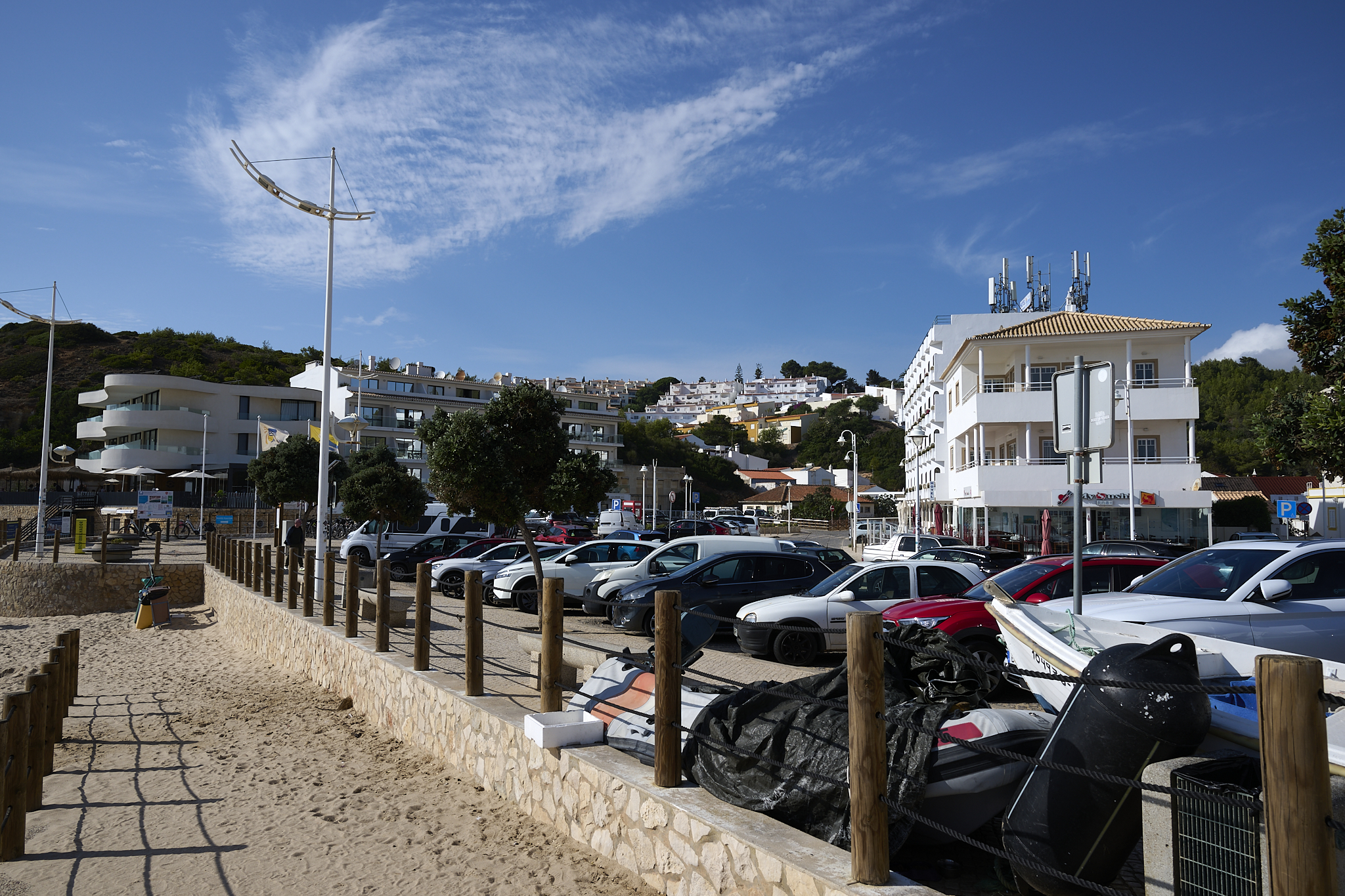
Staying in Luz
Linda and I like city centers, but only when we can skip the car. Or we’ll try to find a nice place that gives us easy access to other places. Luz was the latter.
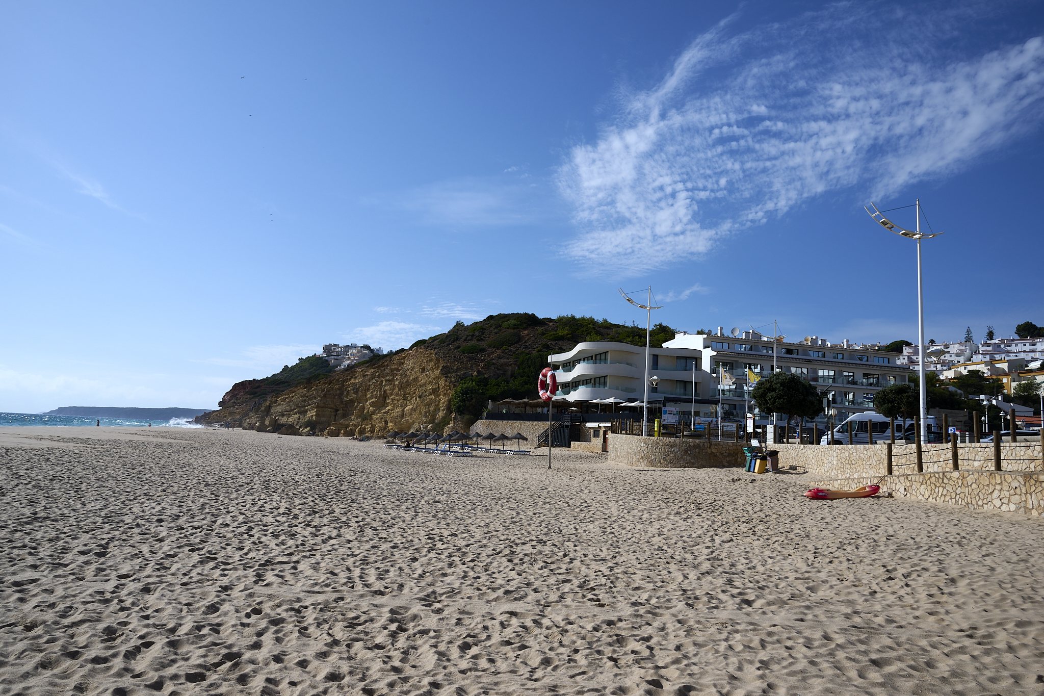
The beach town of Luz is near Lagos and is rather small. Luz’s offerings (beach, water, shops, food, stays) are available, but on a smaller, more personal level. All within walking distance of each other.
We did a HomeExchange with Jacquie. Her apartment faces the ocean in Luz. It was a great place to stay and exchange.
What makes it ideal for traveling the Algarve is that the Luz waterfront has superb access to primary and secondary roads. Taking secondary roads to Salema and Sagres is much more fun and interesting than via the main highways.
We enjoyed our trip to Salema, which took us from Luz through Mata Procas, Burgau, Barracão and Boca Do Rio. The route uncovered the routines of daily life. Travel time was only a few minutes longer than using the highways.
Jacquie’s place near the oceanfront in Luz Portugal
The overlook at Jacquie’s place in Luz Portugal
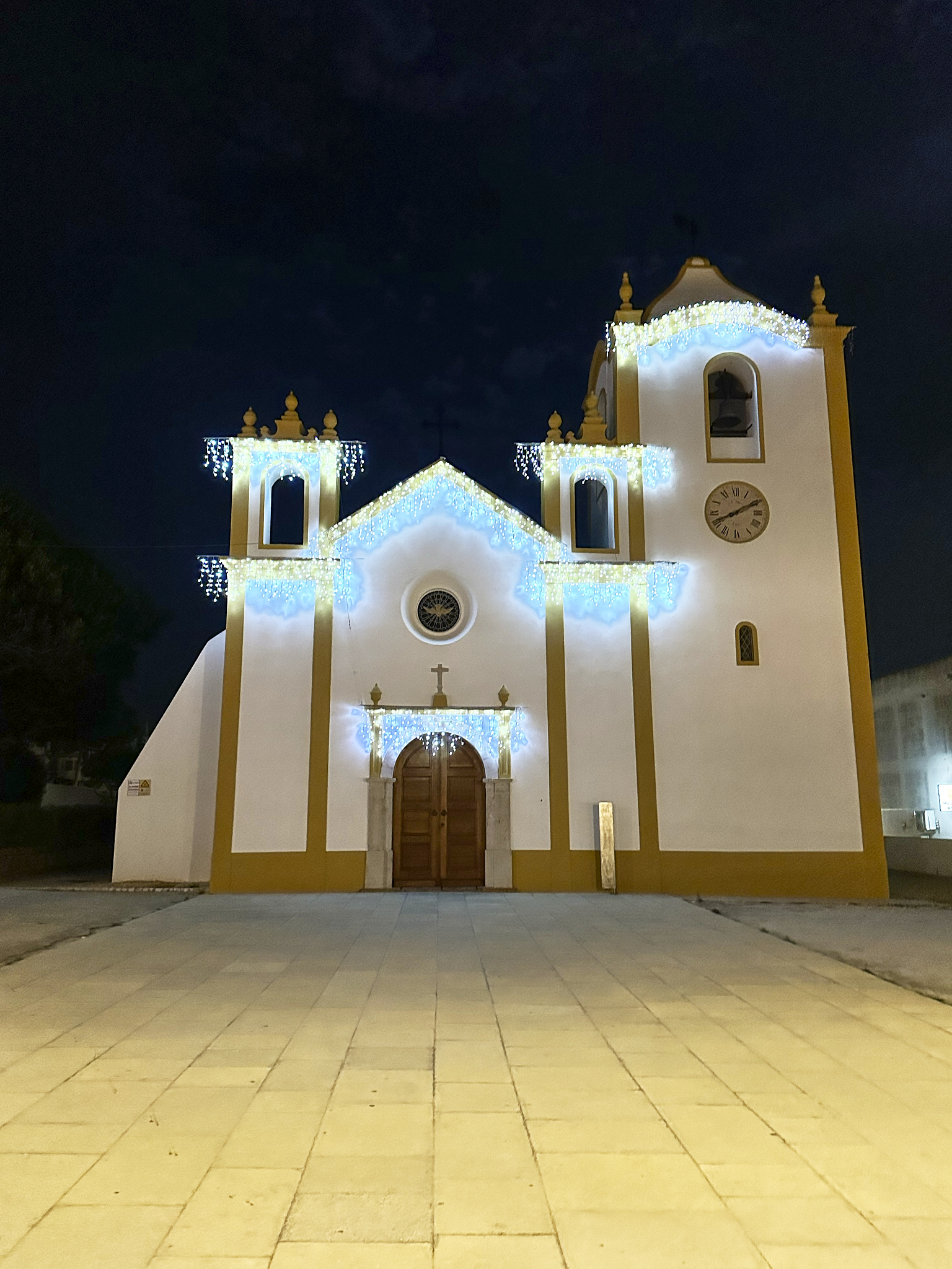
Church of Our Lady of Light on the waterfront in Luz Portugal.
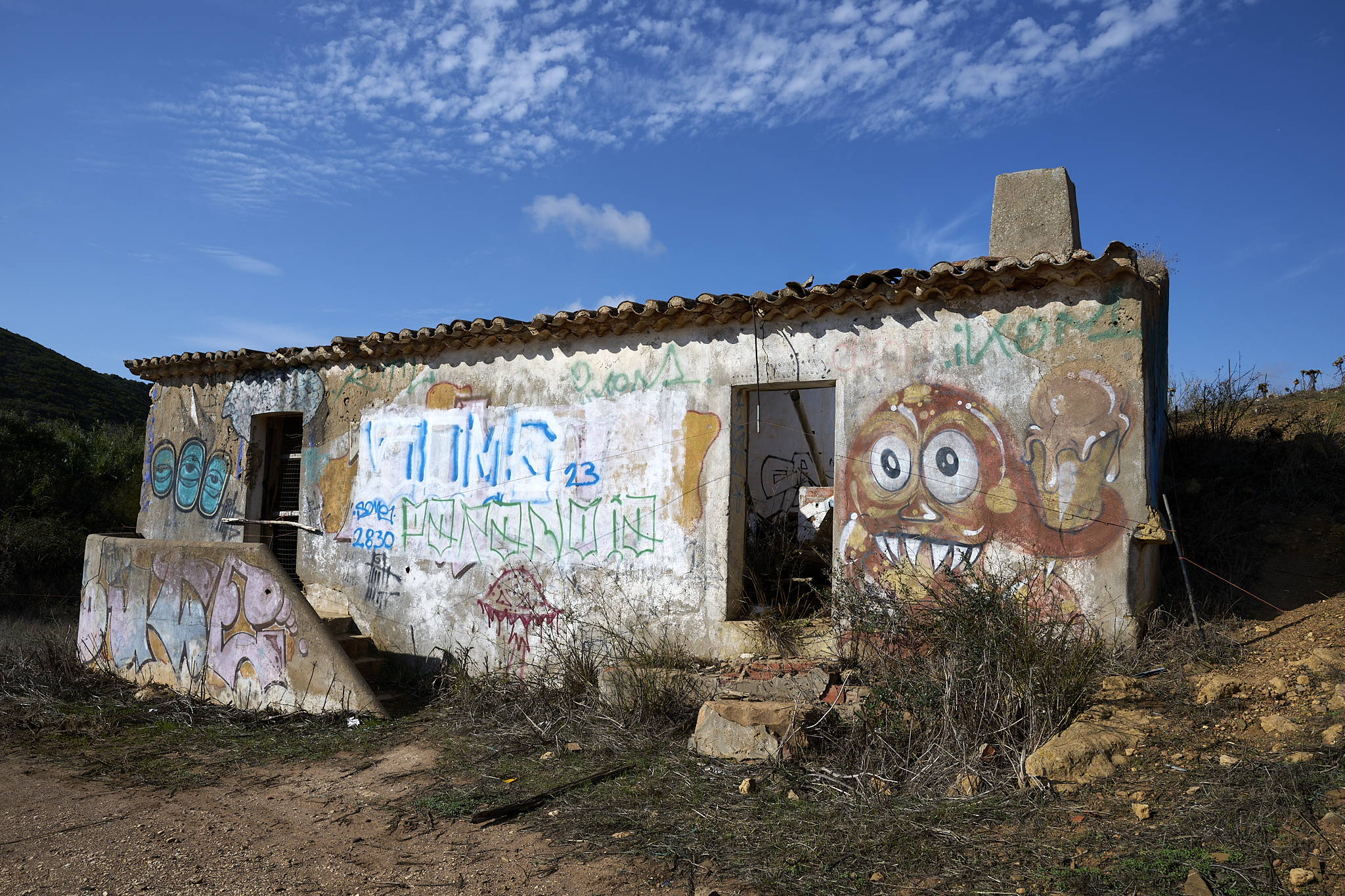
Abandoned building near Boca Do Rio Portugal
Salema
Salema is a beach village towards the western end of the Algarve. It is a cherished spot for surfers and travelers hiking on the Fisherman’s Trail of Portugal. Salema is teeny-tiny. It feels almost shutdown in the off season. I can imagine surfers planning to live here forever.
The Beachfront
Salema’s beachfront is massive. It’s wide, big, and deep. On this day, few travelers are in Salema.
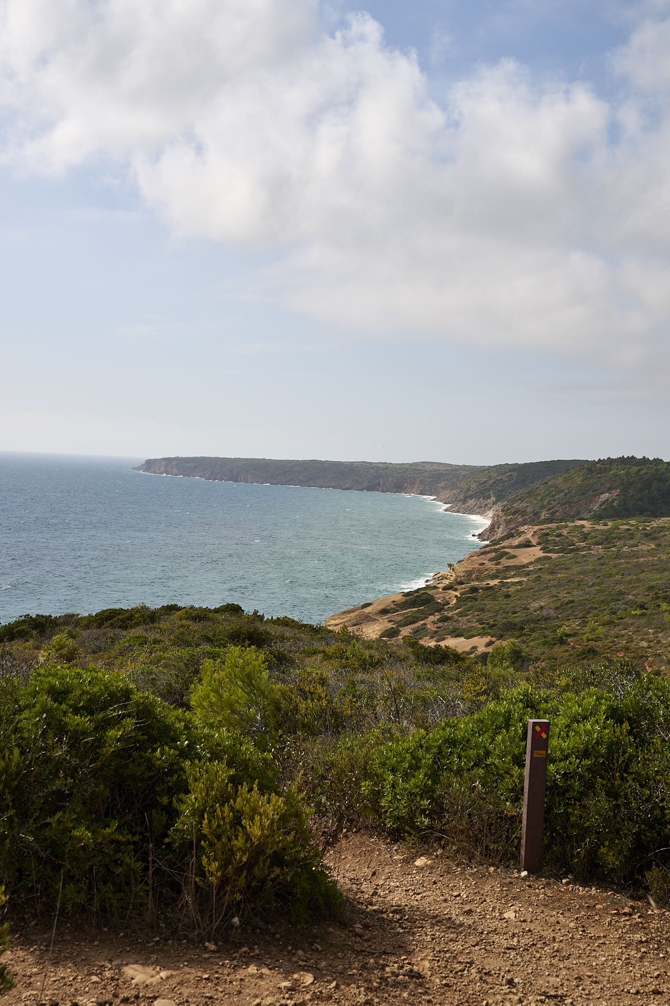
The Fisherman’s Trail.
The 25-mile section of the 125-mile Fisherman’s Trail between Salema and Sagres can be demanding. However, this section of the trail provides access to some of the world’s most scenic cliffs and beaches.
Salema Beach Portugal
Salema Village
The Fisherman’s Trail.
The 25 mile section of the 125 mile Fisherman’s trail between Salema and Sagres can be demanding. However, this section of the trail provides access to some of the world’s most scenic cliffs and beaches.
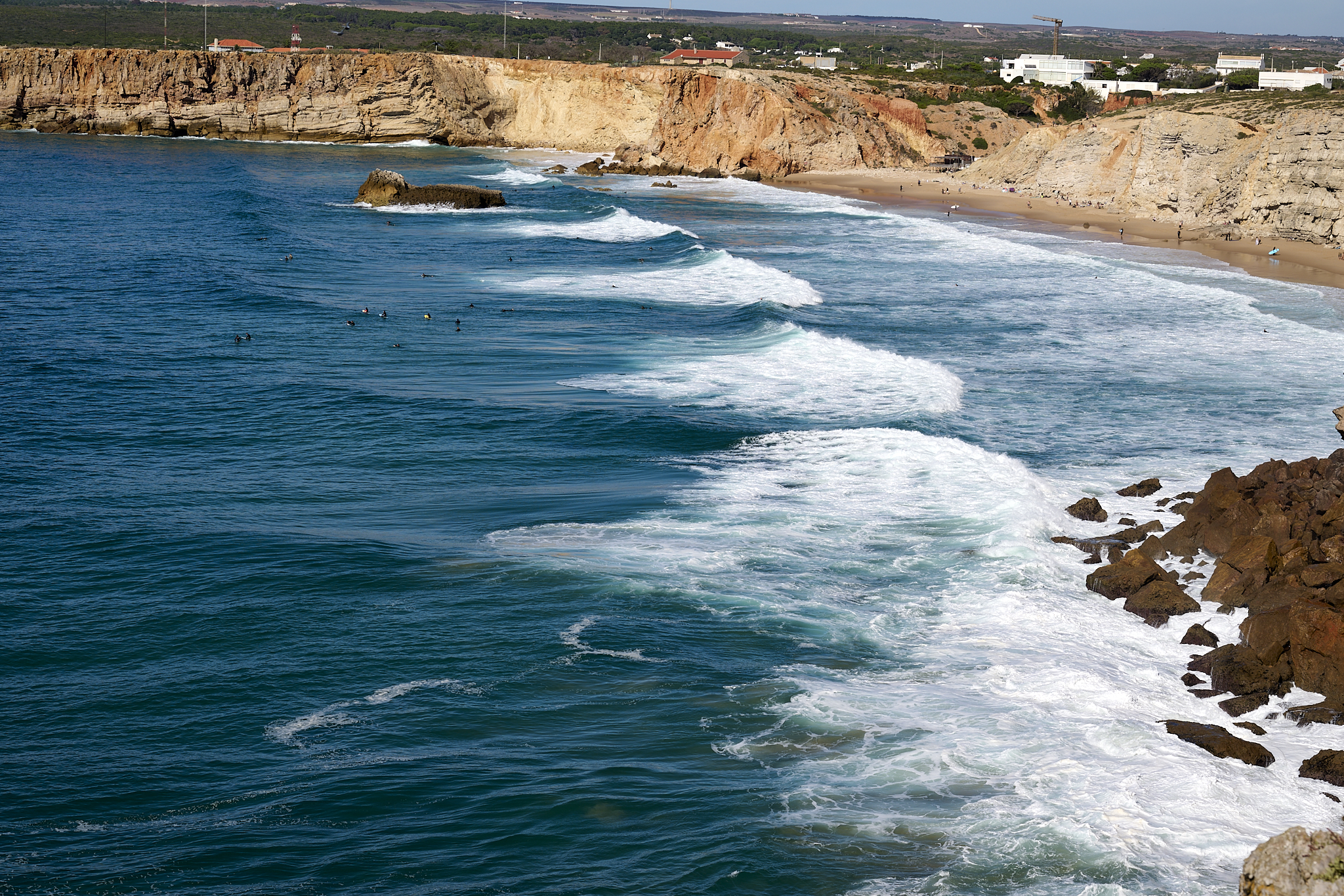
Looking east from the Fisherman’s trail directly above Salema Beach.
The view west from the Fisherman’s trail directly above Salema Beach.
Figueira Beach on the Fisherman’s trail west of Salema Village Portugal (looking west)
Figueira Beach on the Fisherman’s trail west of Salema Village Portugal (looking east)
Cape Sagres
Conventional thought prior to Columbus held the Earth was flat. Back then, people considered Cape Sagres in Portugal to be the closest land to the world’s edge. Even though it’s the 21st century and the world isn’t flat, Cape Sagres still feels like the edge of the world.
This journey includes Sagres village, Fort Sagres, Cape Sagres, and Cape St. Vincent.
It’s a remote, empty, parched, windy, and stony place. The area has massive cliffs. Waves from the Atlantic hammer both the cliffs and beaches.
Sagres and Prince Henry the Navigator.
Prince Henry the Navigator was the son of King Joao and Queen Phillipa of England. He let his brothers take the lead in the royal court and become kings. Prince Henry was brilliant and devoted to his religion. He was the head of the (wealthy and powerful) Order of Christ.
The Order of Christ comprised monks who were crusading soldiers based in the city of Tomar, Portugal (i.e., Knights Templar). Prince Henry the Navigator was the mastermind that ignited Portugal’s world leadership during the Age of Discovery. He was not a sailor, but an organizer, scholar, fundraiser and motivator.
The unprecedented and otherwise miraculous sea voyages were because of Henry’s vision and making. He convinced his sailor followers to enter and return from the Sea of Darkness only after discovering unknown places.
Prince Henry established a navigational school at Cape Sagres. After Henry’s death, the next generation of Portuguese would find and establish commercially successful routes to India, China, and circumnavigate the globe (a.k.a., The Golden Age). Ironically, the 1755 earthquake destroyed the school.
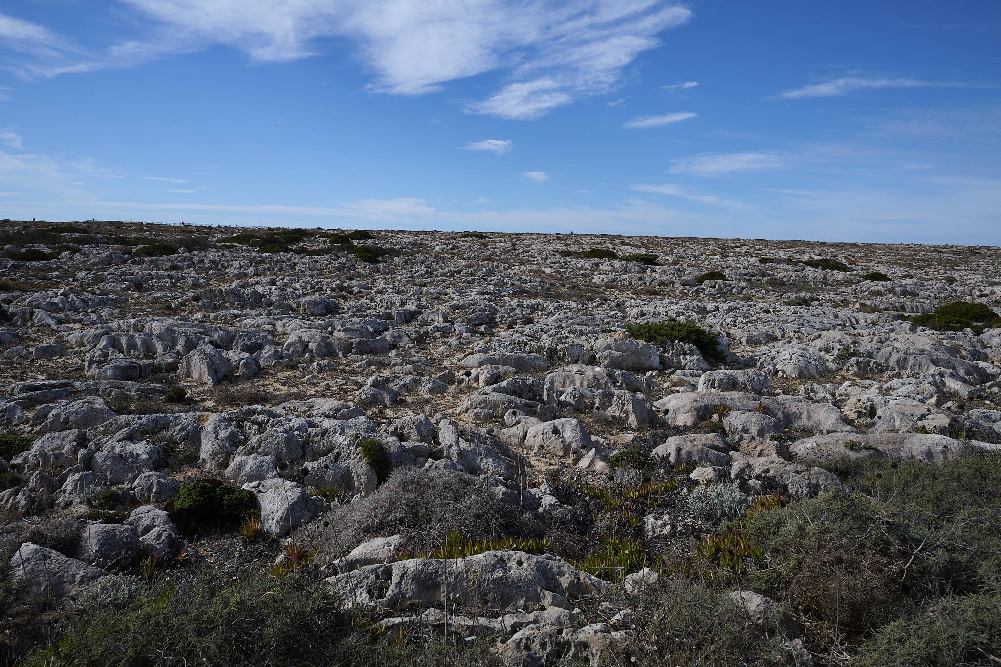
Windswept and barren the land of Fort at Cape Sagres Portugal
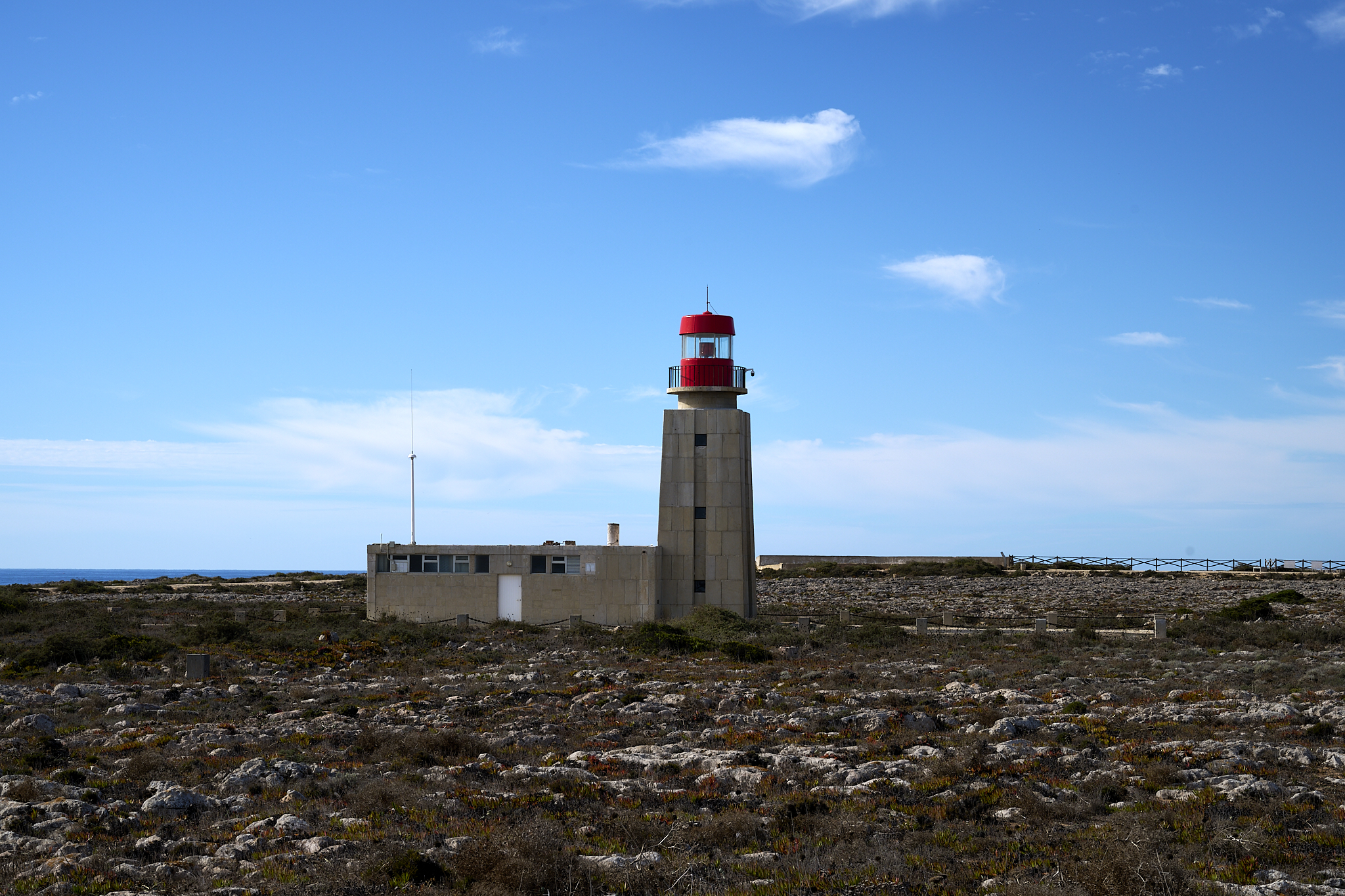
Cape Sagres Point Lighthouse (a.k.a The End of the World)
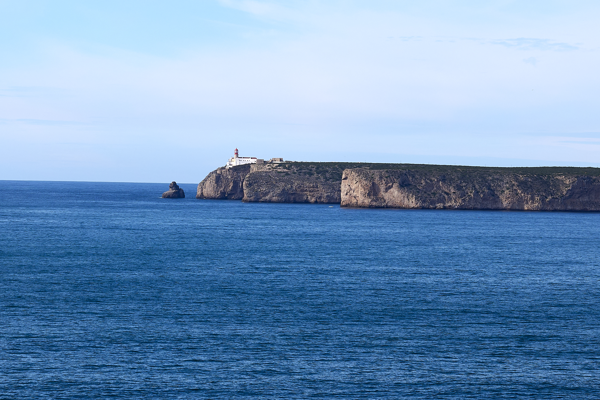
The Lighthouse at Cape St. Vincent, the actual southernmost point in Europe
The cliffs at Cape Sagres
The beach at Cape Sagres
*** Jeff’s Thoughts and Other Worthless Trivia ****
The People of Portugal
Portugal and its people are inviting and accommodating to visitors. Someone asked us why Americans are moving to Portugal. I’ve seen these kinds of headlines lately, but I don’t know if they’re true, or why. Evidence suggests more Americans are emigrating to Portugal. An interesting and related story is located [here].
All of the text and pictures presented on this Post are mine. All are work products © Copyright – Jeffrey H. Lubeck & MESH Art LLC – All Rights Reserved.
I receive no compensation for recommendations or links on this Post.