The Ke Ala Hele Makālae trail on Kaua’i’s Coconut Coast is a dandy. The trail was recently inducted into The Rails to Trails Conservancy’s Hall of Fame. Ke Ala Hele Makālae in Hawaiian means “The Path that Goes by the Coast.”
The official trail is 7.6 miles in length. It is paved and hugs the eastern coastline of the Island of Kauai from Lydgate to Ahihi Point.
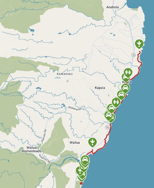
The Trail Map. South: Lydgate to North Ahihi Point.
The Ke Ala Hele Makālae trail is well maintained and built for the general population to utilize. It travels adjacent to a number of wonderful beaches. There are bridges over all the streams the trail encounters. The trail is intended for and used by bike riders, walkers and runners. Traffic levels on the trail drop considerably starting at Kealia Beach and moving north to Ahihi.
The Ke Ala Hele Makālae trail offers big wave beaches, sandy somewhat secluded coves, and rocky shoreline.
Our Trip
On this day Linda, The Border Collies (Sage and Willow) and I decide to hike the Ke Ala Hele Makālae trail from Kealia Beach to Ahihi Point. The out and back trip encompasses 5.2 miles of walking.
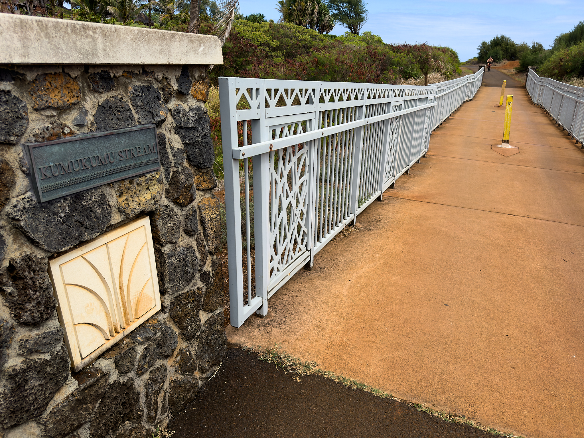
Kumukumu Stream crossing on the Ke Ala Hele Makālae trail
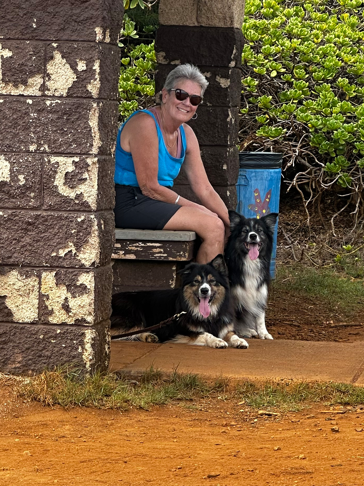
Linda with Sage and Willow on the Ke Ala Hele Makālae trail.
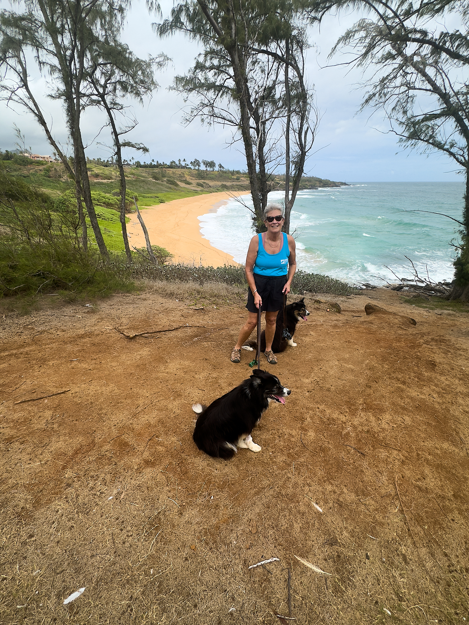
Linda with Sage and Willow on the Ke Ala Hele Makālae trail overlooking Kuna (aka Donkey) Bay.
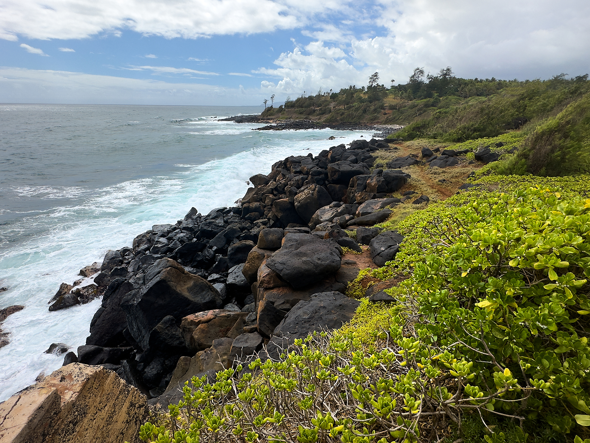
Along the Ke Ala Hele Makālae trail
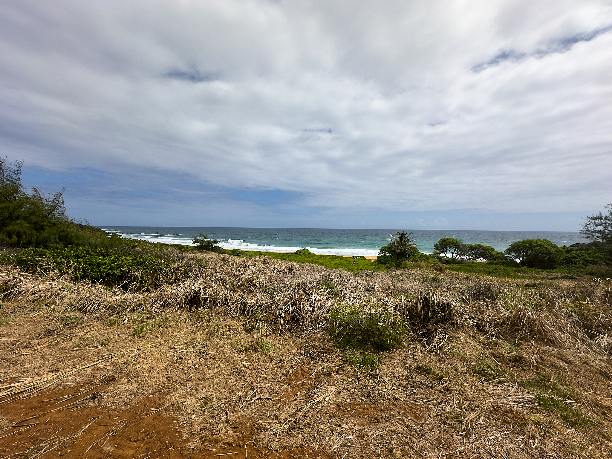
The Kuna (aka Donkey) Bay beach.
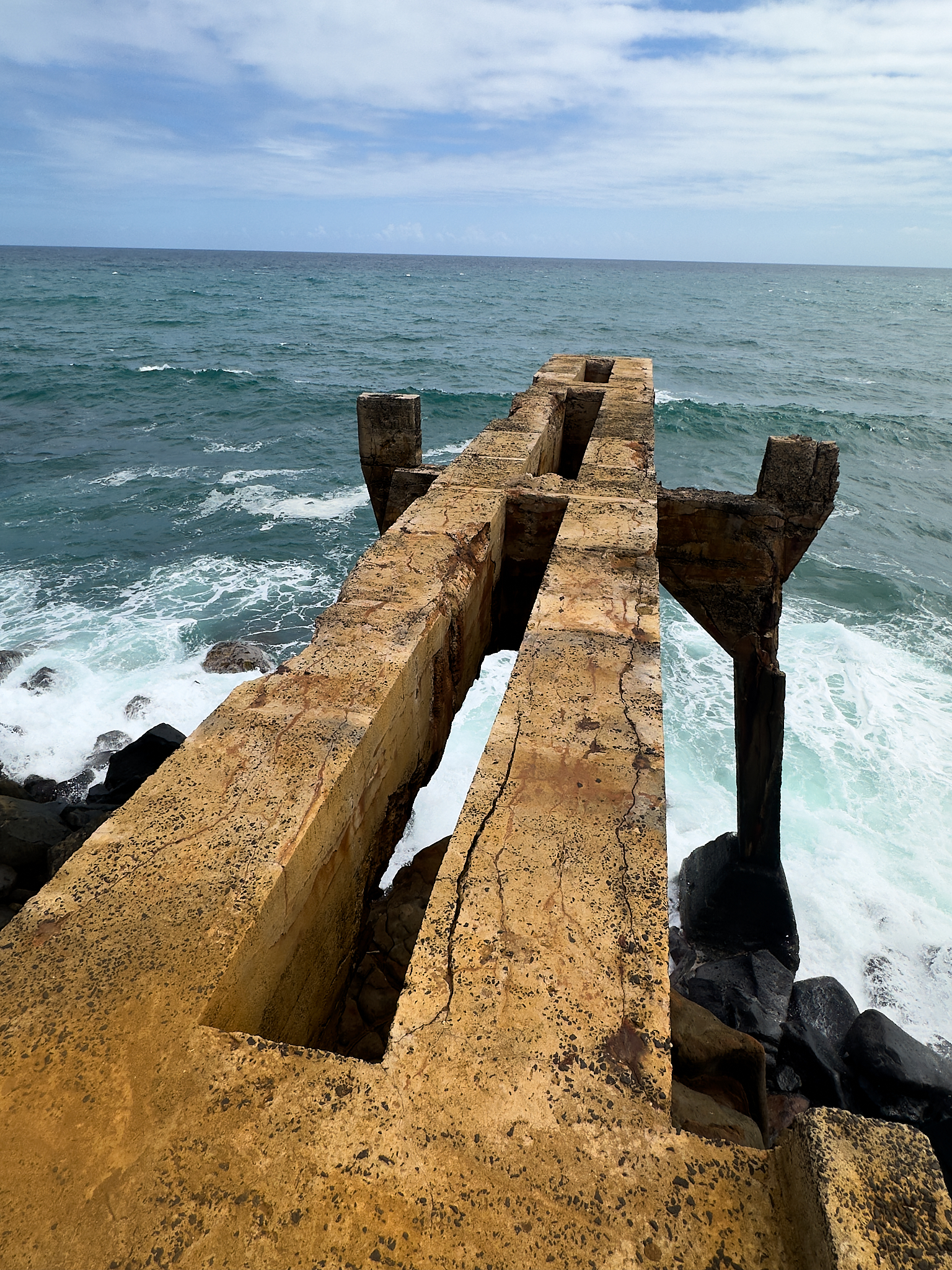
The Drop on the Ke Ala Hele Makālae trail.
Below is some information on the trail and Rails To Trails
*** Jeff’s Thoughts and Other Worthless Trivia ***
Kuna Bay (aka Donkey) beach is a lovely spot. Access to the beach from the Ke Ala Hele Makālae trail and Kuhio highway (56) is straight-forward. Donkey Beach used to be a “Clothing Optional.” beach. This is no longer the case. The setting of the beach surrounded by Ironwood trees is lovely. It is not a swimming beach as the surf is strong and the under-tow from the ocean current is notoriously dangerous.
This May Seem Stinky
The Drop or the concrete structure on the north end of the trail is a remnant of the sometimes inglorious human past.
The Sugar and Coconut Plantation companies of the 1920’s and 1930’s established it was inconvenient and costly to dispose the refuse from processing. It was determined the most cost effective approach was to drop the refuse from a railcar into the ocean.
The railroad tracks on the route from the plantations to Lihue via Kapaa were utilized. A junction, spur and large concrete dropping platform was created about 5 miles from Kapaa. There the waste refuse was dumped off the platform and over the rocky shore into the ocean.
Unfortunately, a large percentage of the waste did not disappear into the depths of the ocean. Instead the rotting waste would flow south and sit (some time for weeks on end) on the beaches at the town of Kapaa.