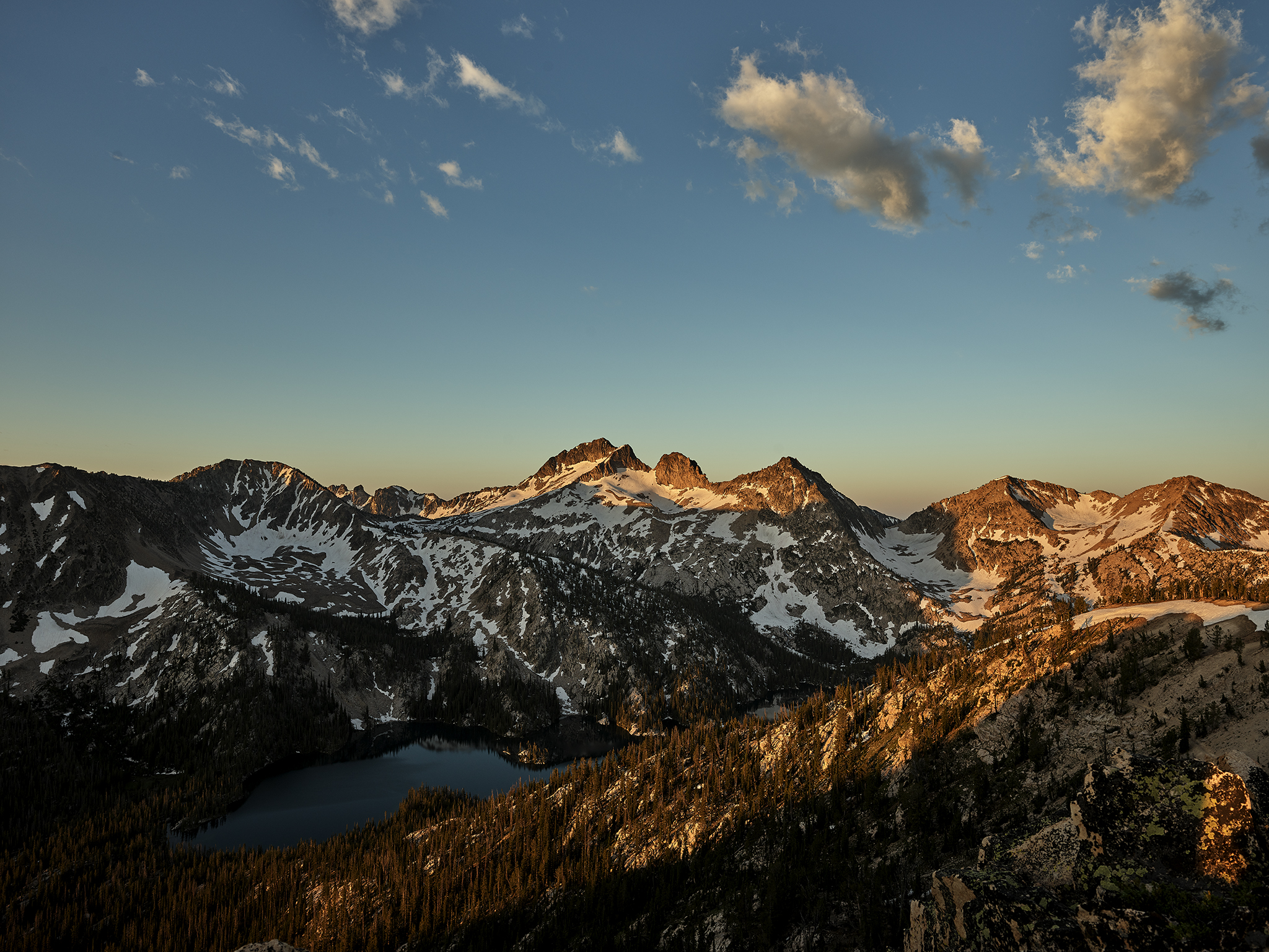
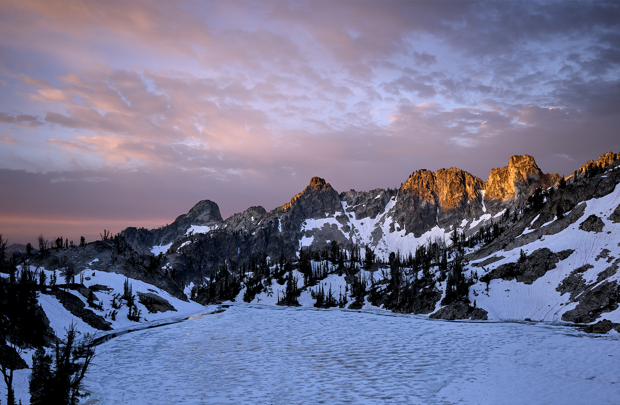
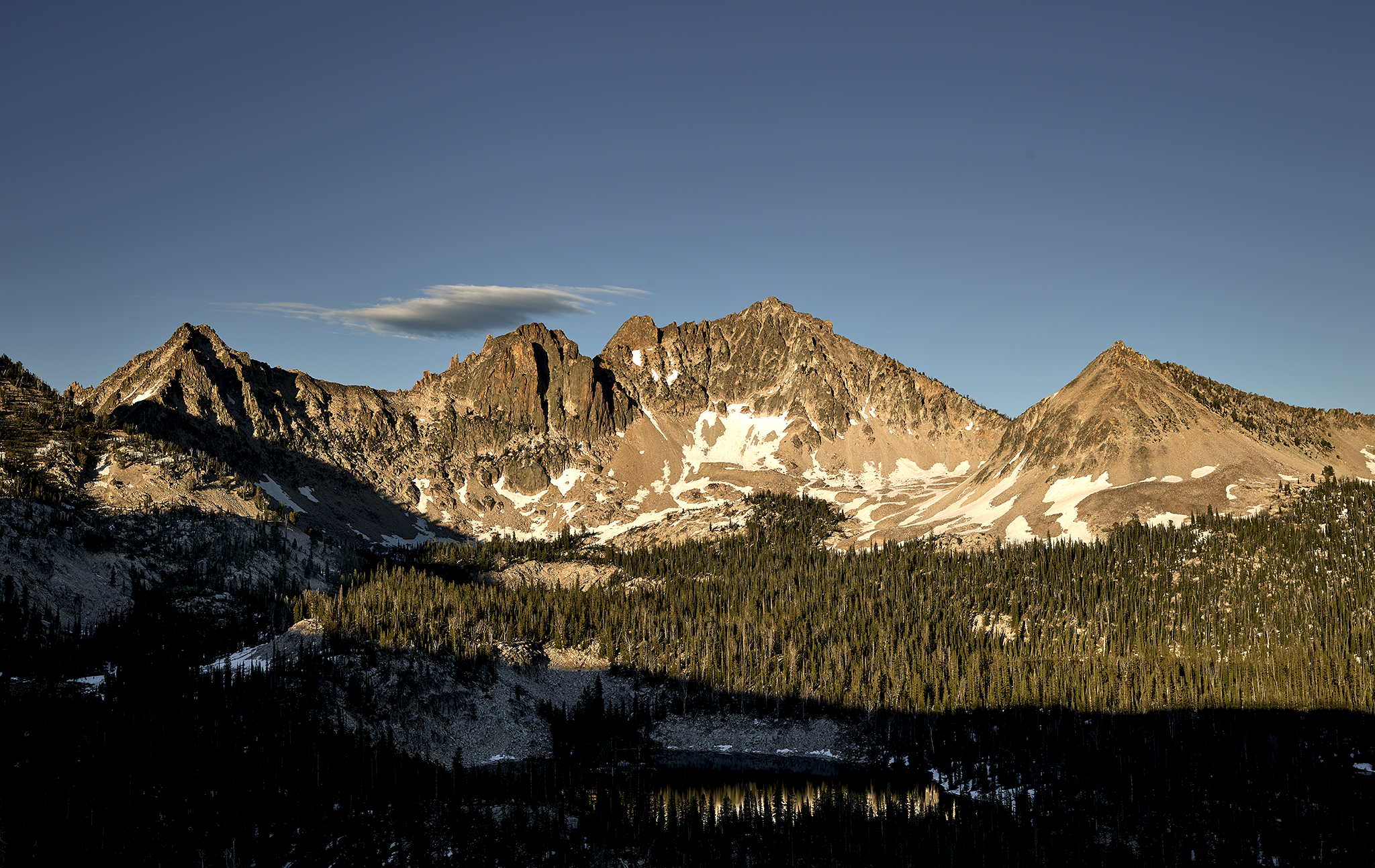
On this summer day in the Sawtooth Wilderness dawn is transforming to sunrise. Sunlight is hitting the rock crags that give Snowyside Peak (10,661 ft) its signature profile
 Snowyside Peak (10,661 ft) in the Sawtooth National Wilderness of Idaho is the reference point of what Outside Magazine considers The Best Loop Hike in the United States. Snowyside Peak looms over most of the 19.2 mile Alice – Toxaway loop route.
It is my intention to photograph the sunny-side of Snowyside at sunset, and the snowy-side of Snowyside at sunrise as part of a four (4) day back country photo-shoot. As is the case with most of these shoots the travel will primarily occur off trail. As is almost always the case, Chris & Sara Lundy – owners of Sawtooth Mountain Guides – join me as teammates. Skadi dog Lundy joins us for her 2nd photo-shoot. Skadi is a Karelian Bear Dog.
While approaching the later half of July, the unprecedented amount of snowfall this past winter suggest that some points in our route will likely require the use of crampon, ice-axe, and rope in order to progress as planned.
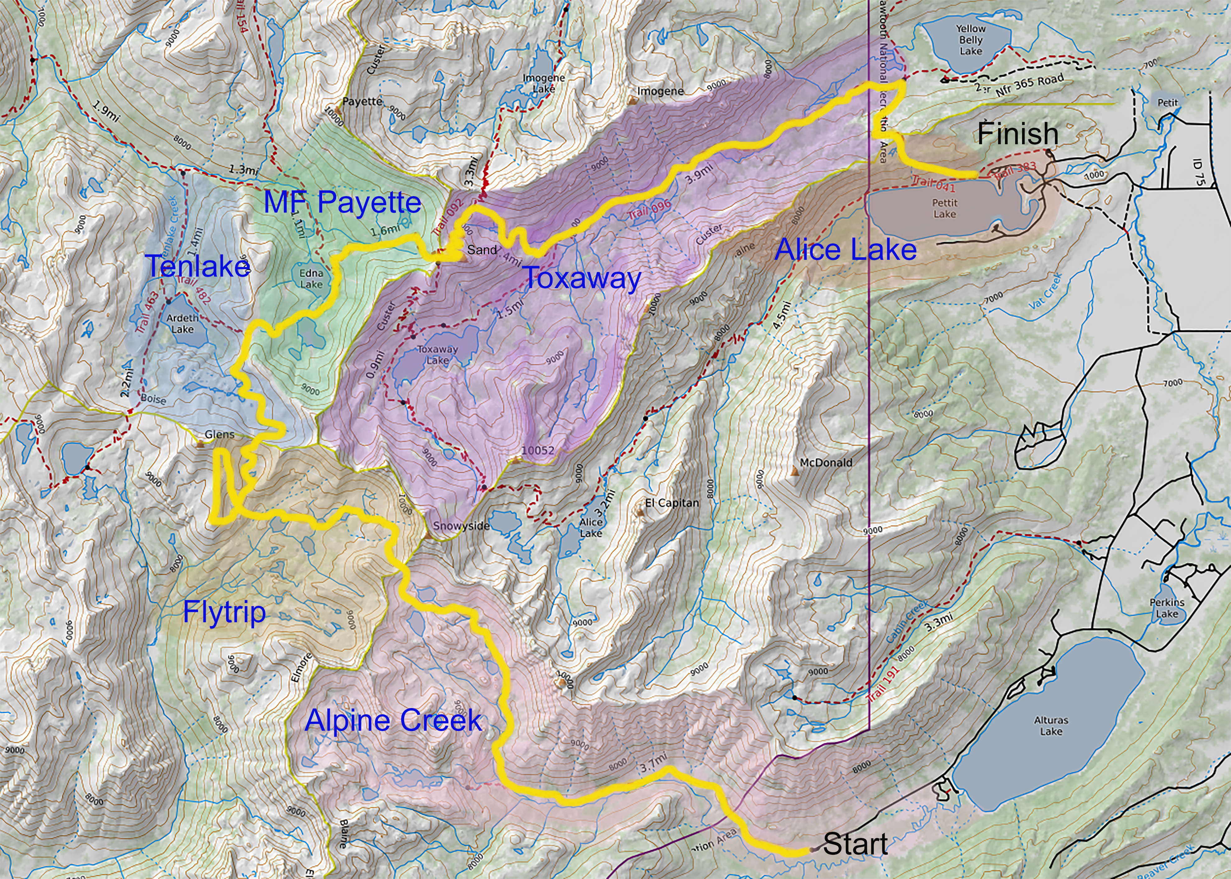
The plan is to shoot for 4 days covering six different drainages. If we can stay on schedule we will capture a sunset shot of Snowyside from the western edge of the Flytrip drainage and 33+ hours (and four drainage’s) later capture a sunrise shot of Snowyside from the summit of Sand Mountain in the Toxaway drainage.
It turns out we will put on crampons, wear rope connected to each other, and utilize the ice-axe more than once. To be honest in some cases the equipment was a necessity to continue following the itinerary. However, the equipment is mostly utilized as a safety precaution. While this is my trip, safety and mountaineering decisions are controlled by Chris and Sara.
This will also be the first-time I will put into use the Kyle Lubeck signature custom camera equipment bag on a multi-day back-country photo shoot. The bag doubles as a mini-studio. I used the bag with unprecedented success for my photo shoot in the South of France and day shoots in the region in the month of June. For this shoot the bag will contain two cameras, six lens, tripod, and the photographic accessories I would use in a studio setting. With two water bottles and some day-snacks the camera bag weighs in at 47.3 pounds.
Day 1
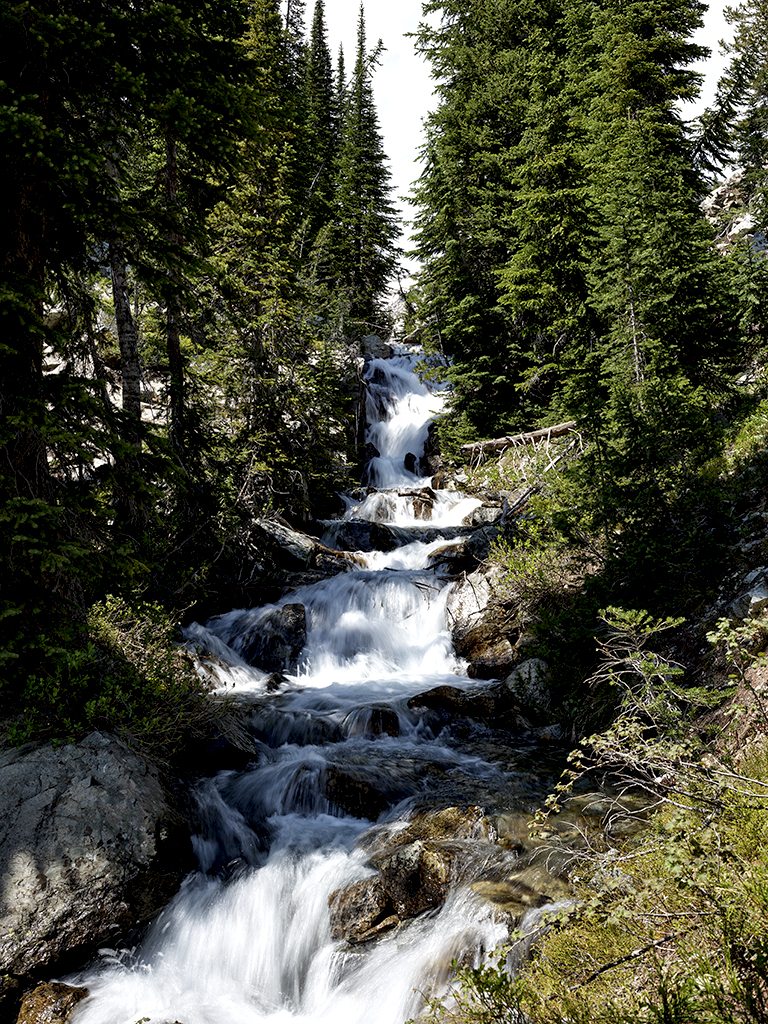
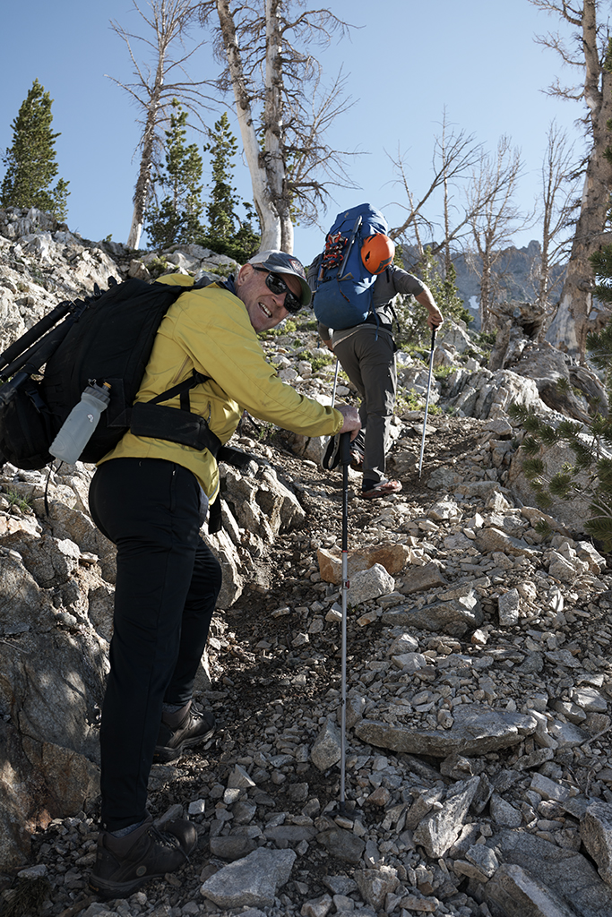
 The first day takes us up the Alpine Creek drainage. There are 22 lakes in this drainage. After a few miles it is time to leave the trail and follow Alpine Creek traveling up through water falls, wildflowers reaching for the sky, and lakes. We will not operate on a designated trail for the next 50 hours.
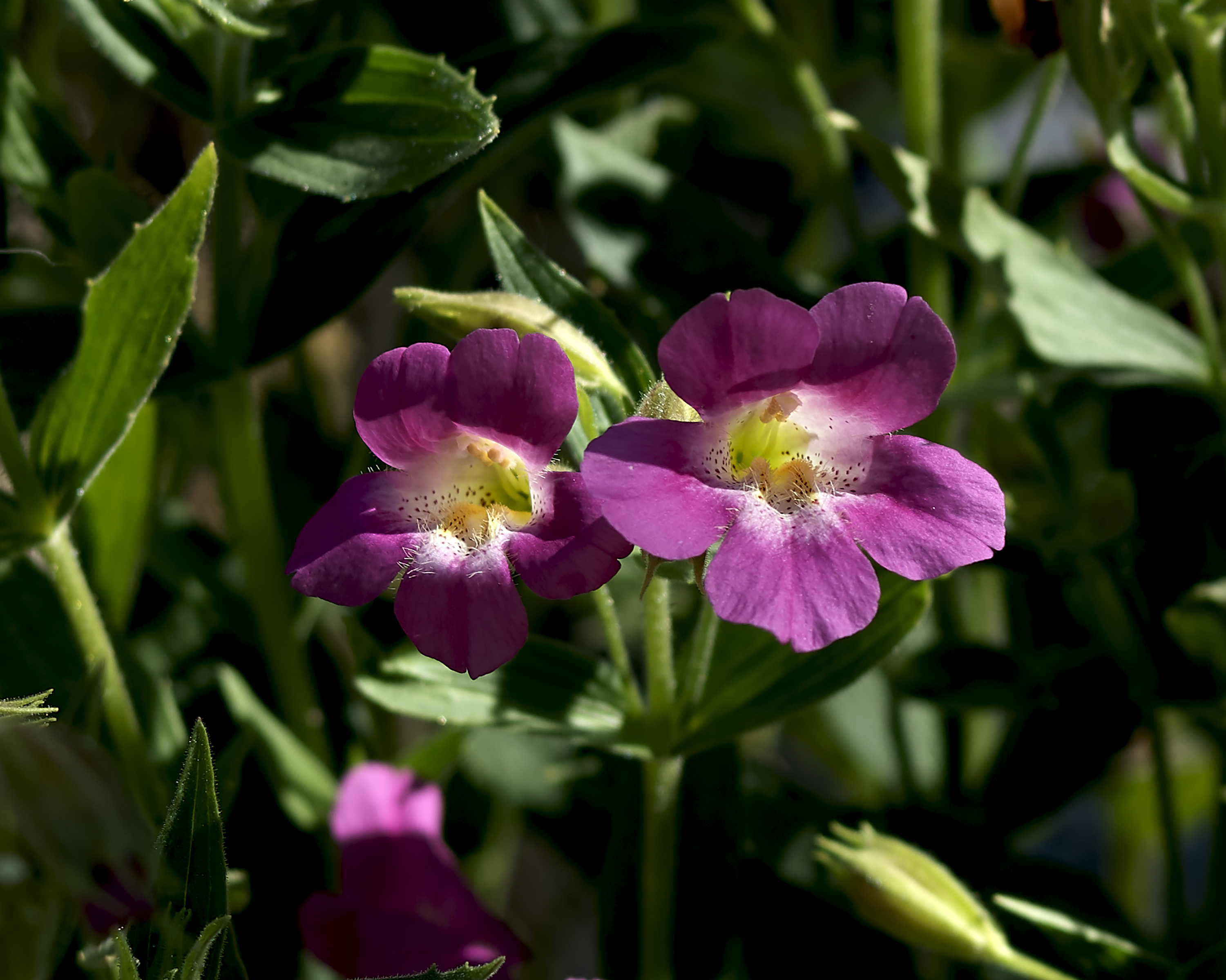
The wild flowers are in full form. Our desire is to identify and capture images of some of the less common wild flowers, such as the Monkey Flower. We prove to be lucky.
 Alpine Creek is experiencing a heavy flow for July. I have been in this drainage twice before – once in the late 1980’s for which I had forgotten until recently and two years ago at the suggestion of Chris. On the last trip I spent hours trying to get a decent waterfall shot – without success. All I was able to get was giardiasis.
The team breaks for lunch in a meadow on Alpine Creek. Our next break will be at the first lake – where Chris, Sara and I will conduct a brief swim to cut the heat of the day and strenuous climb with heavy pack. Only one word is needed for further description; Invigorating.
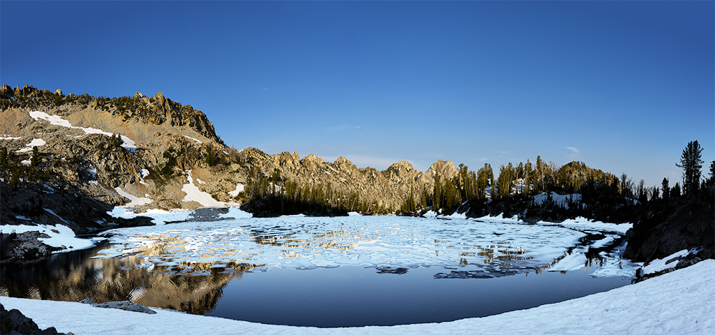
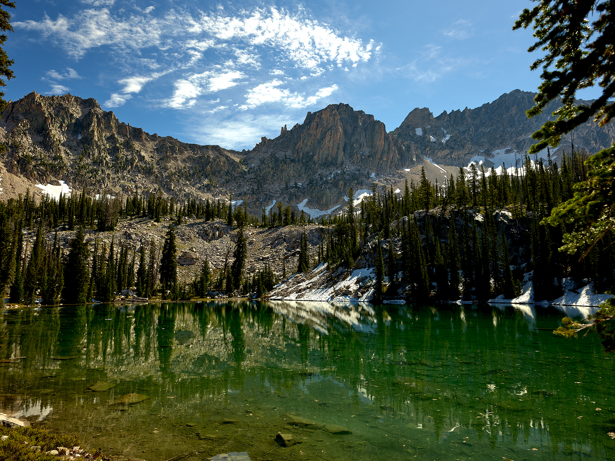
 Our destination on day one is a spot overlooking the last two lakes in this section of the Alpine Creek drainage. These lakes are holding the last vestiges of snow and ice from winter. Chris, Sara and I place bets as to whether (or not) the lakes will be covered in ice. Skadi dog chooses not to bet. Chris predicts partial coverage. The are partially covered and possess a blueish tint in the ice.
Day 2
Sunrise on day two produces a chalky pastel sky. Sara and I blurt out this description to each other almost simultaneously as the day moves from dawn to sunrise. After the sunrise shoot we plan to break camp, head up through the saddle just below Snowyside peak and descend into the Flytrip Creek basin. The Flytrip region is special for Chris and Sara as it was one of their first back country trips together after starting to date. This fall the Lundy’s celebrate their 10th wedding anniversary.
Our goal for the coming day is to traverse the Flytrip Lakes basin, and establish a camp at the summit of Glens Peak (10,053 ft) or a high spot on its ridge-line in order to shoot Snowyside Peak at sunset.
The ascent from our camp to the ridge (9,620) that divides the Alpine Creek and Flytrip basins is about 400 vertical feet. The ridge also acts the the dividing line between Blaine and Elmore Counties. Snowyside Peak just a few hundred feet above us acts as the dividing line between Blaine, Elmore and Custer Counties. Peak 9980 a mile in the the distance acts as the dividing line between Elmore, Custer and Boise Counties. Why does this matter? If we have an accident in the ground we are about to cover on this day, any one of four counties could have jurisdiction for rescue/recovery. The none of the county seats or emergency centers for rescue/recovery are within 75 miles of our location. As we descend to the highest of the Flytrip Lakes Sara explains her emergency call protocol to me. If she is injured Sarah will call Blaine County Rescue. If Chris is injured Sara will call Custer County Rescue. If I am injured Sarah will leave a voice mail with the Elmore Library/Youth Recreation/Emergency Rescue Center.
As the day progresses it becomes clear that while a shot from the summit of Glens Peak sounds impressive – the topography indicates a location farther west on its ridge-line is the better location. We agree to make camp in the middle of the area and then climb/traverse the entire ridge-line. This will prove to be the best move as we find the best shooting location and get to traverse the entire ridge-line of Glens Peak.
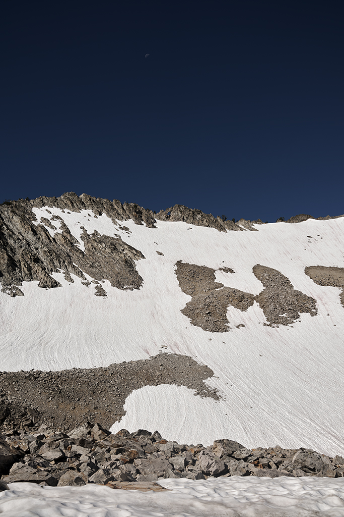
The plan for day three is to break camp at 4AM, climb to the saddle between the Flytrip and Tenlake drainage’s, and grab a sunrise shot. As we begin our ascent a frozen lake with steep slopes covered in hard frozen snow confronts us. Out comes the mountaineering equipment. Thank goodness! We anticipate this might happen so that is why you break camp at 4AM instead of 5AM.
The sunrise shots for day three prove to be of little value given clouds blocking the early sun.
Sorry I missed you guys, I heard you was on the trail we was working on… Farley Lake area