|
|
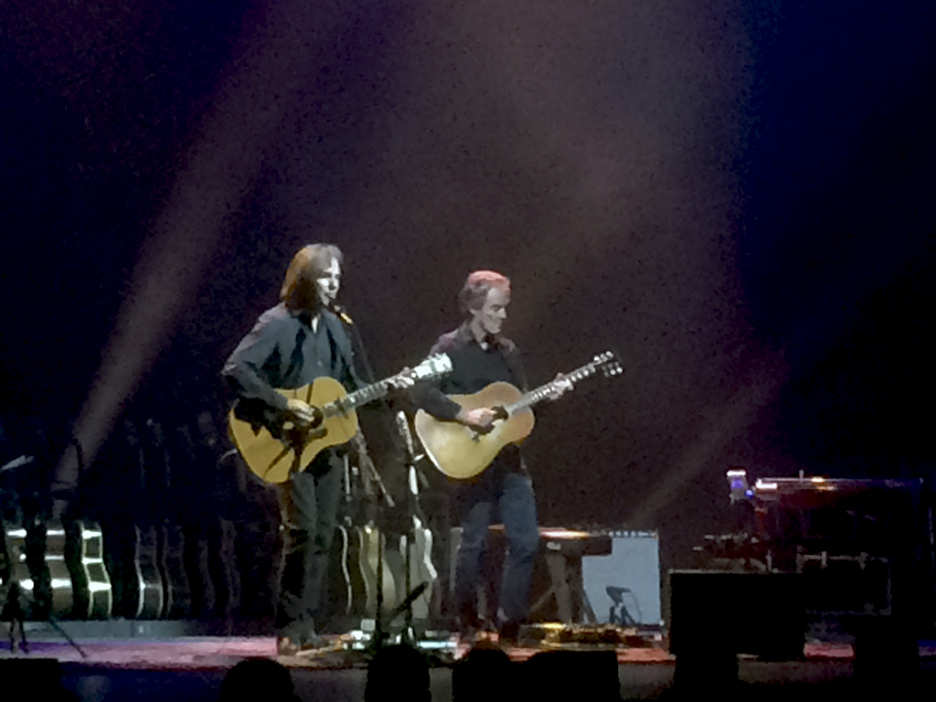 Jackson Browne and Greg Leisz (right) at the Morrison Center in Boise. Linda and I took in the Jackson Browne Acoustic Solo Performance in Boise on Thursday night October 13, 2016 at the Morrison Center in Boise, Idaho. Both of us love his music and the acoustic format enhances the listening experience (at least for me) exponentially. Thursday’s concert was our 2nd of his current tour – as we attended a performance in Reno, Nevada in June as well. Instead of playing solo, Browne is joined by long-time associate Greg Leisz – a wonderful and pleasant development.
It should be noted that with the exception of a run to the store (10 miles out and back), a trip to and or from our home in Idaho is by definition Destination Travel. As most of you know first-hand our regular 154 mile (one way) commute to Boise includes traversing the 100 mile Camas Prairie section of the actual Oregon Trail (US 20). After 30+ years, I remain enamored with this drive for which I never tire. Historians tell me the current driving conditions and modes of transportation are materially safer and improved upon from the Oregon Trail’s hey-dey of 1873.
Linda and I have attended Browne concerts since the 1970’s and together since the 1980’s. Truth be revealed we have used Jackson Browne and his music as a means to travel for over three decades. Need to see the family in Kansas City? Plan it around a Browne concert! Want to take in a professional ball-game? Is Jackson touring? Yes, well let’s take in both. Want to go to Winery? Oh… Browne will be performing there was well! Want to visit a city or region? What a coincidence… Jackson will be performing their in a few months. Music in a interesting setting? – Mississippi River Gambling, a former prison, music venues that are national historic sites, effectively a private party – hey why not with Jackson Browne!
One thing I am finding of interest is that the age of Browne’s audience at these concerts ranges from the 20’s to the 80’s – with Linda and I approaching the end of our 50’s. That is a big spread.
Browne is the consummate first-person performer. He connects to his audience with small reflective insights that feel personal and directed to you specifically. Sure it is showmanship, but effective no less. So when Browne makes fun of himself about the closeted nature life on the tour and how it was obliterated by the natural beauty of Idaho – to his absolute surprise – you take him at his word.
Browne is also a master of modifying the music to be performed based on the taste, inclination and request of the audience. To use a sports metaphor, Browne almost always seems to be in the zone – even when he is tour weary – as he was in Boise. So when Linda yells Fountain of Sorrow, Browne actually turns his head, tilts it sideways in acknowledgement, smiles, changes instruments, and plays the requested song. The beauty of this approach is that the concert goer gets the standard classics but also the album oriented songs of their choice. On this night that includes Browne playing – at the request of someone in the crowd – The Naked Ride Home. And therefore with Jackson Browne – for us at-least – no ride is too long.

The film Deepwater Horizon is best categorized as a Thriller that coincidentally is about a disaster – not a Disaster Film.
The Towering Inferno, The Poseidon Adventure, Airport – these films are the standard bearers of Hollywood Disaster Films. Thank goodness Deepwater Horizon is not a Disaster Film or we would be forced to see Helen Hayes sweetly encourage people to jump into the firery water.
Deepwater Horizon is a Thriller and a highly watchable one at-that. Directed by Peter Berg (Lone Survivor) and based on the New York Times reporting of the worst ecological event in our history, Deepwater Horizon stars Mark Wahlberg (The Fighter, Pain & Gain, Lone Survivor), Kurt Russell (Bone Tomahawk, Silkwood, Escape From New York), John Malkovich (Of Mice and Men, In The Line of Fire, Rounders), Kate Hudson (Almost Famous) and Gina Rodriquez in her first principle role in a film.
Deepwater Horizon can be broken down into two acts. The first act sets up the situation and the second deals with the immediate implication of the disaster itself. The initial scenes of the main characters getting ready for their tour of duty are the weakest point in the film. The dialog and settings are monochromatic and perfunctory. One in particular, I found – quite frankly – to be gratuitous and not worthy of the rest of the film.
The best parts of the film are presented in detail and with relative accuracy during the build up to the disaster event. The film does a superb job of taking the time to show in understandable terms, the huge and multi-varied challenges and pressure associated with a major exploration project. These projects are big money and big risk. It could be argued that Deepwater Horizon is a bit long with the background and technical details of the project. However, this technical background and the revealing of humans operating under monetary, political, and the contractual pressure makes the actual disaster and its causes better understood.
The disaster on the Oil Rig is pretty devastating. The challenges presented to the staff on the Oil Rig are formidable and presented with a manner that feels fairly believability. The film closes rather quickly and does not fall victim to forcing too much preachiness down the viewers throat. The real life heroes and villains and their updated story are presented in the credits.
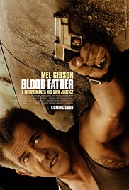
The film Blood Father is an interesting take on a dad protecting his daughter in her time of need. Blood Father is a taught, well acted, funny, ironic, somewhat bloody, and nicely paced thriller that takes 88 minutes start to finish.
Blood Father does not feel particularly original, but it also does not feel lamely derivative. Why? Blood Father is straight-shooter (literally) created by professionals who chose to make an independent feature. Blood Father is written by Peter Craig (The Hunger Games Mockingjay 1&2, The Town) and Andrea Berloff (World Trade Center, Straight Outta Compton) and directed by Jean-Fancois Richet (Assault on Precinct 13, Mesrine). They know how to make films of this genre and send you home feeling you easily got your money’s worth.
Blood Father stars Mel Gibson (Mad Max, The Bounty, Forever Young, Lethal Weapon), Erin Moriarty (The Kings of Summer, True Detective, Captain Fantastic) and William H. Macy (The Cooler, Shameless).
Given Gibson’s off screen issues (the list is long and offends many) and his relationship with the Hollywood establishment (the list is equally as long and offends as many) Gibson could be characterized as persona non grata when it comes to major production releases. So Blood Father is not a major Hollywood film. However, this does not mean Gibson is no longer a capable actor (or Producer for that matter). Quite to the contrary, Gibson is superb in Blood Father. Link is an ex-convict, recovering alcoholic, living on the very edge of the grid of society who is estranged from his daughter and is simply trying to lay low and get to the next day on earth without incident. This role is square in Gibson’s wheel-house. Gibson as Link is clearly a character, but does not play the role as a chariacture. Moriarty as Link’s daughter Lydia is highly convincing. The script and Moriarty’s performance afford you the opportunity to completely dislike, give a second chance and then cheer for Lydia – all with good reason. Gibson is often even better (in his role) when he has a partner as a sometime foil. Blood Father and Moriarty fit the bill.
Jeff’s Worthless Trivia
Because Blood Father is not a Major Hollywood release the Producers also made a deal with DirectTV/OnDemand to be purchased during its theatrical release.
Gibson narrates Blood Father in similar style as Payback (1999).
The Gibson produced Get The Gringo (2012) was one of my favorites of the year.
Forever Young is the highly watchable film co-starring Jamie – Lee Curtis, directed by Steve Miner, and written by JJ Abrams that showcases the other type of character Gibson plays to perfection – happy-go-lucky.
|
|