While hiking up to Horton Peak, as if out of nowhere, the lakes appear. They are surrounded by the jagged peaks of the Sawtooth mountains, blue skies, and green forest. The view can take your breath away.
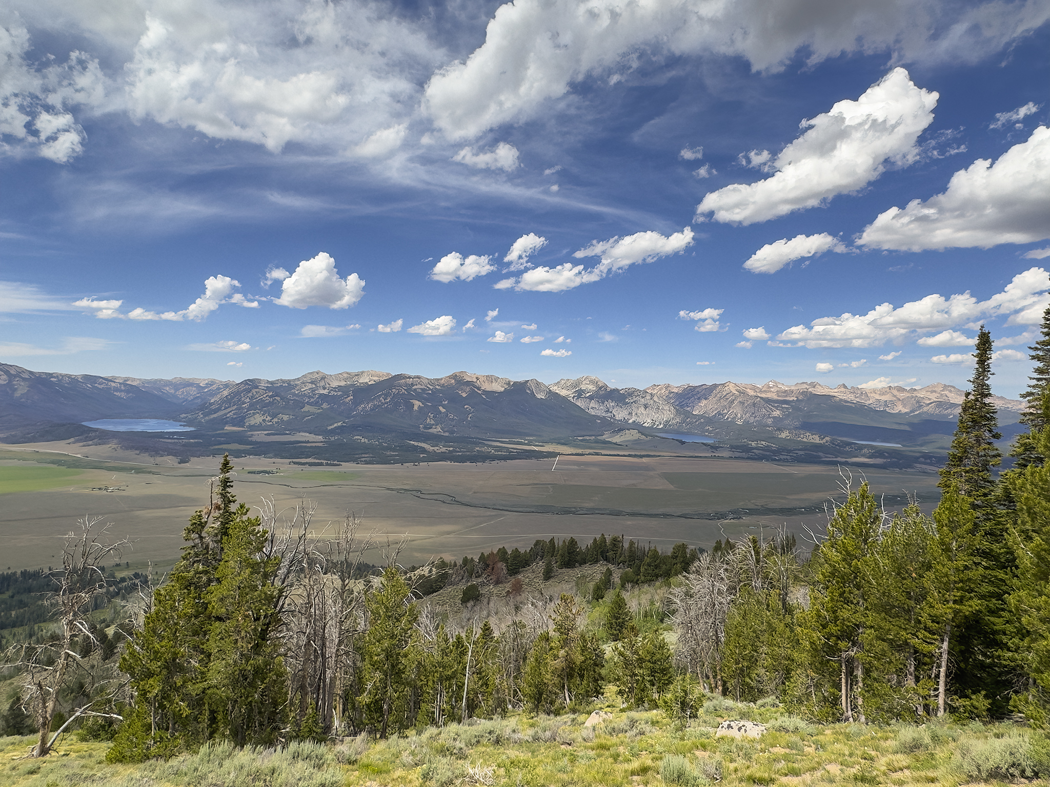
From left to right, Alturas Lake, Pettit Lake, and Yellow Belly Lake.
Venturing up to the Summit of Horton Peak in the White Cloud range in Idaho never seems to disappoint. On this day in late July, the result will be no different. Accompanying me is my wife Linda, the dogs – Sage, Willow, and Paxton, and friends Dennis and Linda.
Horton Peak is the southernmost named mountain in the White Cloud’s. The hike to the summit is 2.7 miles in length and gains 2,780 vertical feet. The summit sits just below 10,000 feet elevation (9,900). A former United States Forest Service Fire Lookout sits on top. The views from the summit of Horton Peak are excellent.
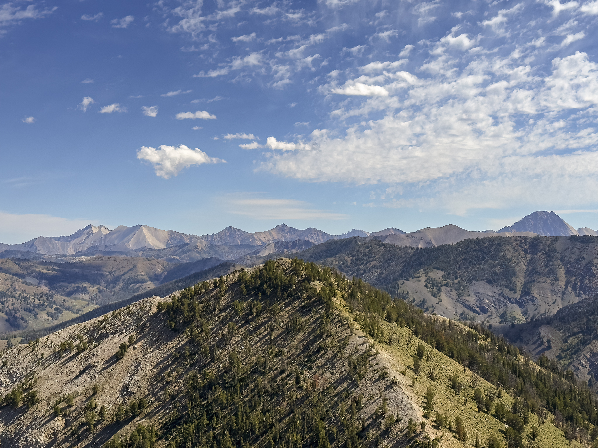
The White Cloud Mountains from Horton Peak.
Horton Peak is located in the Sawtooth National Recreation Area (SNRA), south of the town of Stanley and north of towns of Ketchum\Sun Valley. The trailhead is reached via Idaho State Highway 75, Valley Road and Forest Service Road 459.
I have travelled up Horton when the summit is arid\bone dry to covered in 15+ feet of snow and in a variety of weather conditions. However, my favorite time of year to hike Horton Peak is in the Fall.
My favorite Fall hike of Horton is described [here].
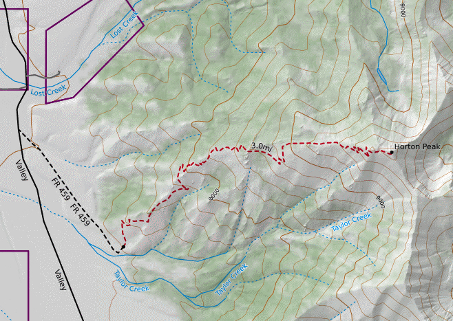
Map of hiking route to Horton Peak
My favorite photo (taken by me) of Horton is The Golden Path.
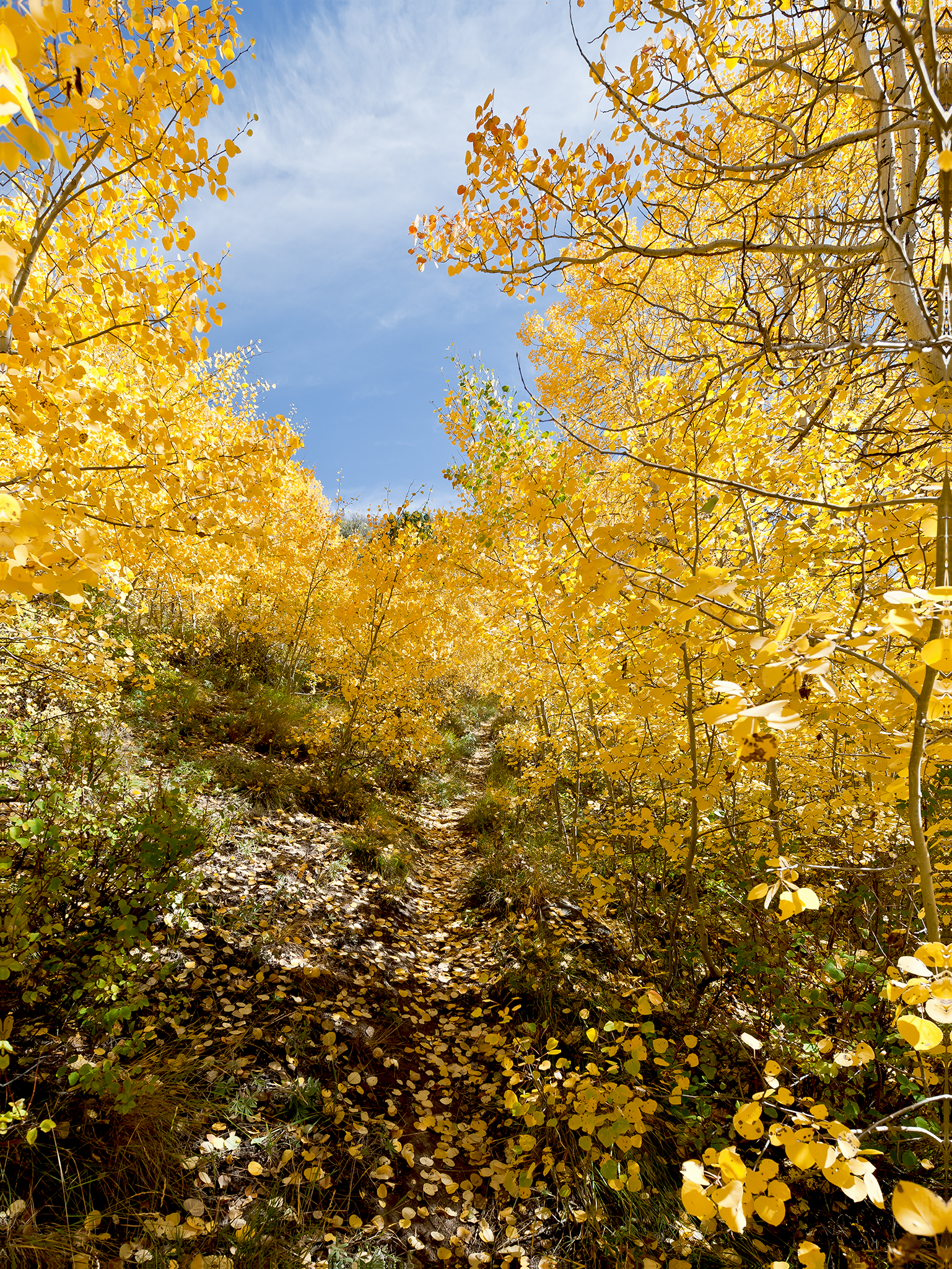
The Golden Path © Jeffrey H. Lubeck – MESH Art LLC – all rights reserved.
*** Jeff’s Thought’s and Other Worthless Trivia ***
The trail-bed is excellent. There is a wonderful combination of open space and shade on the hike. There is no real access to water while on the trail.
Once your done with the hike, head to the Smiley Creek Lodge (across the valley floor) on Idaho 75. Its an Old-School Idaho place that offers a friendly greeting and the Best Milkshakes in the World.
Nice!