The Solar Eclipse occurred as scheduled in Idaho (8/21/2017 11:30 local time). The eclipse from our viewing point was remarkable.
Our cabin in Stanley was almost dead-center : 100% eclipse and under the full shadow 99.83% (i.e., viewing time well over 2+ minutes).
More importantly, the Lubeck’s were able to host friends that live at distance but are close to our heart and soul. In short; friends who you can share the best of what life has to offer. However, remain at your side even when the worst of life presents itself. So to those (or who are associated) with the last name of Bescos, Brice, Connor and Wakeley thanks for coming and sharing in the view.
Also, a shout-out to the Pruder’s who were in contact from Michigan while the gig developed!
As luck would have it. We got some shots!
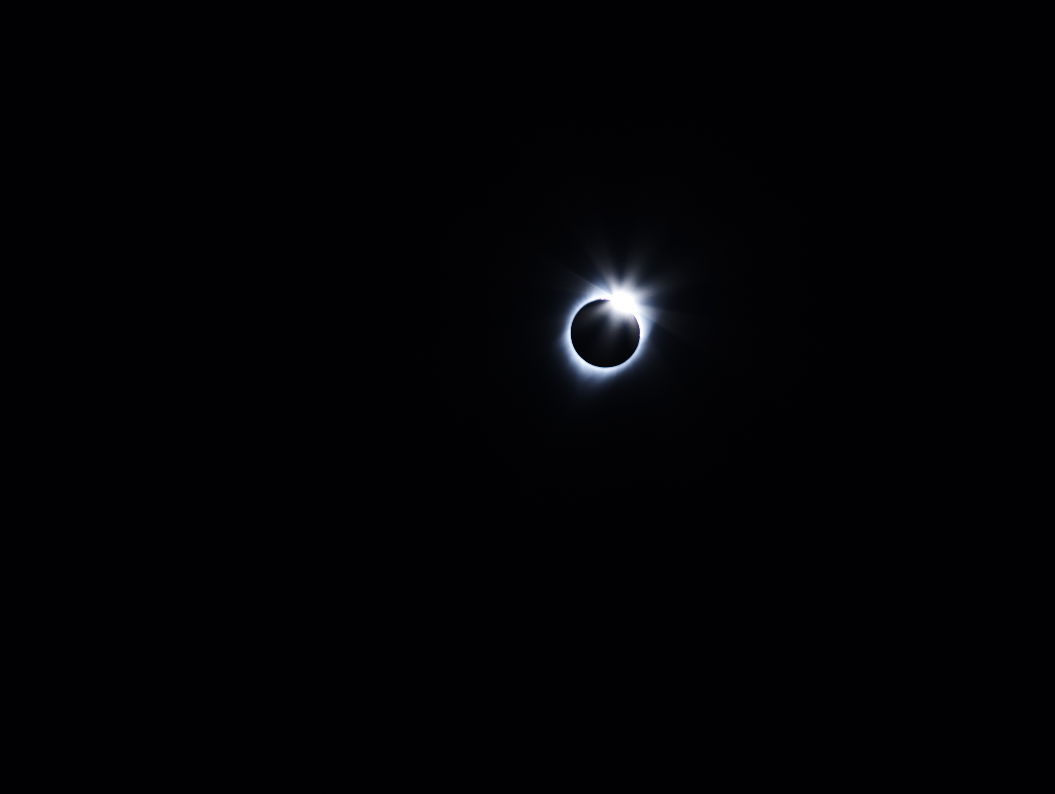
The Ring. Copyright Jeffrey H. Lubeck – MESH Gallery
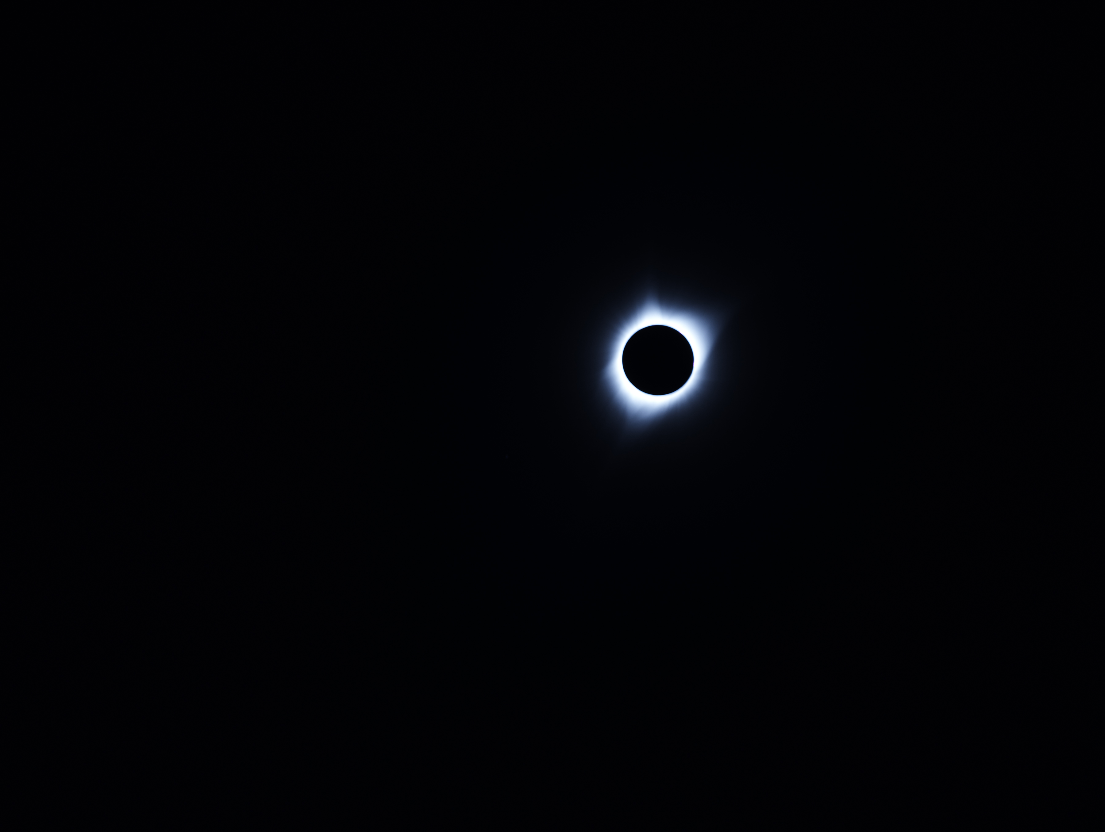
The Total Eclipse of the Sun – Full Corona. Copyright Jeffrey H. Lubeck – MESH Gallery