The route of Red Mountain Road in Idaho is considered one of the most demanding and dangerous accessible to production passenger vehicles. At points, the road requires the most from the best of the four-wheel drive trucks\cars on the market.
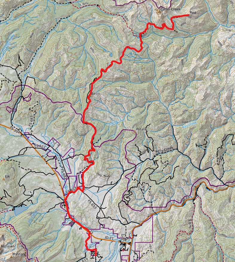
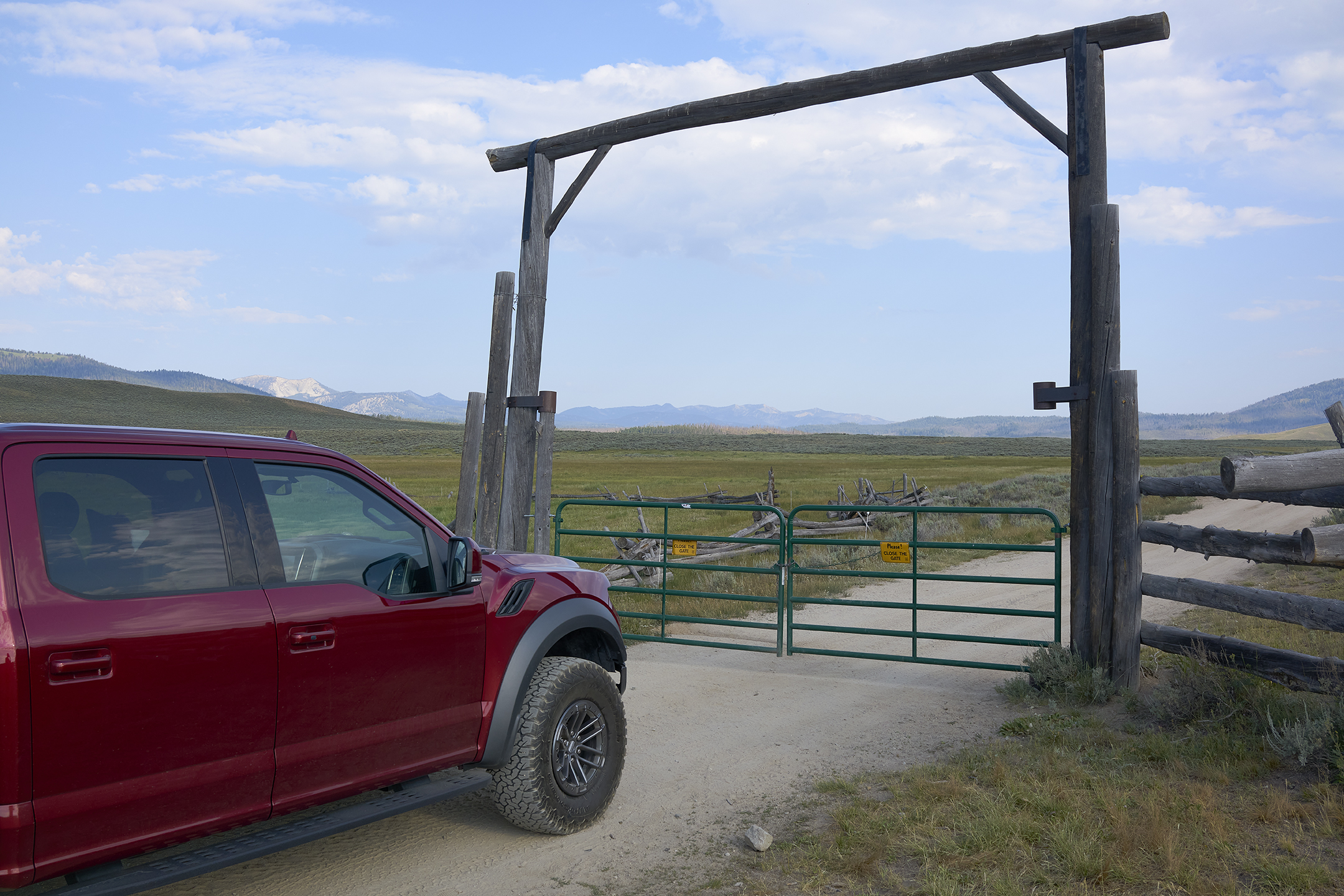
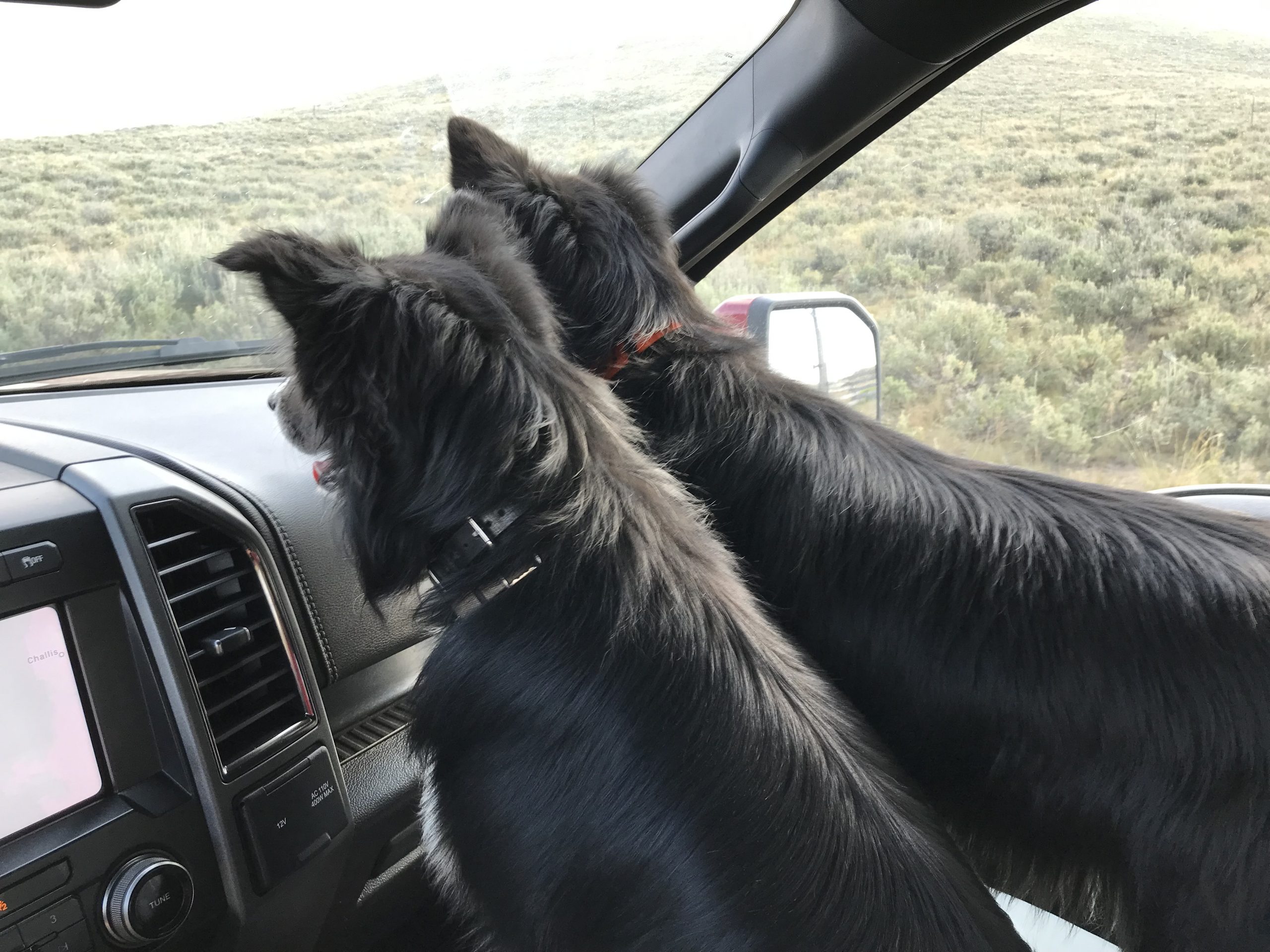
This adventure begins for me at my cabin in Stanley Idaho. My Border Collies – Sage and Willow – will join me as navigators. My cabin is located but a few miles from the start of the route at Idaho 21 and Stanley Creek Road (FS 653). After a few miles the route requires a left turn onto Anderson Creek Road (FS423). A closed gate will welcome you into the back-country. The request is simple – please close it after passing through. Eventually the road changes its name and designation to Basin Butte Road (FS 032).
The immediate goal is to take this road up to the turn-off to Basin Butte Lookout (FS 319). Up to this point the travel has been a fun and invigorating experience in a four-wheel drive vehicle. The travel up to the Lookout on FS 319 is materially more challenging but remains a fun drive if you are experienced in varied terrain.
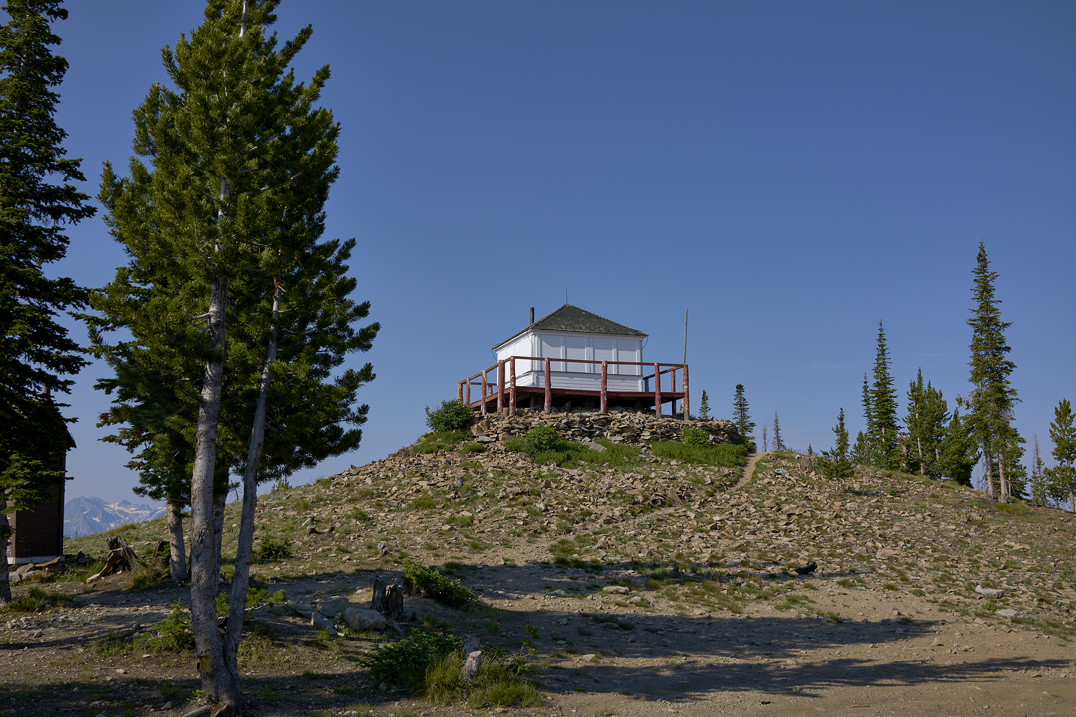
Basin Butte Lookout sits a 8,854 feet elevation. The Fire lookout was built in 1933 and 1934 following the United States Forest Service’s standard R4-80 plan. The Lookout was used to protect the Stanley Basin and Salmon River region through the late 1970’s. The USFS planned to replace, then decided to demolish the Fire Lookout. None of the plans were executed. The Basin Butte Fire Lookout was restored in 2009 by volunteers. For a period of time, the Lookout could be rented for an overnight stay. For some reason this is no longer the case.
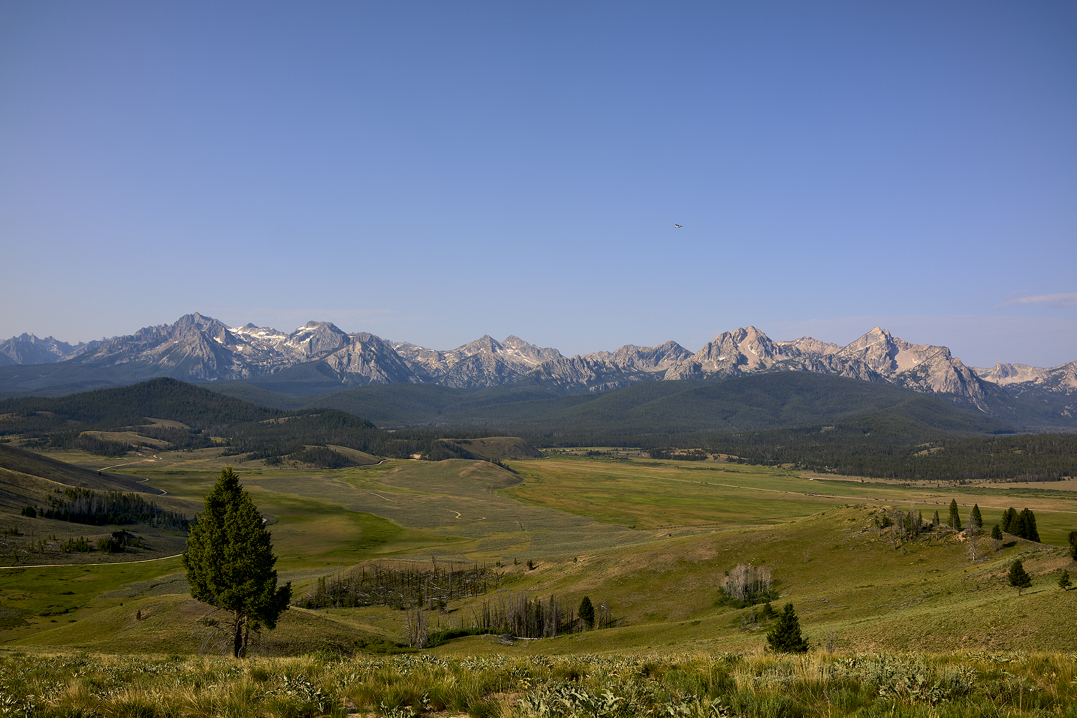
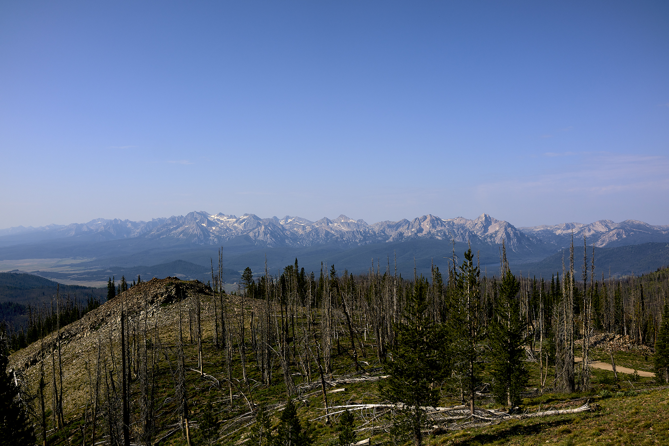
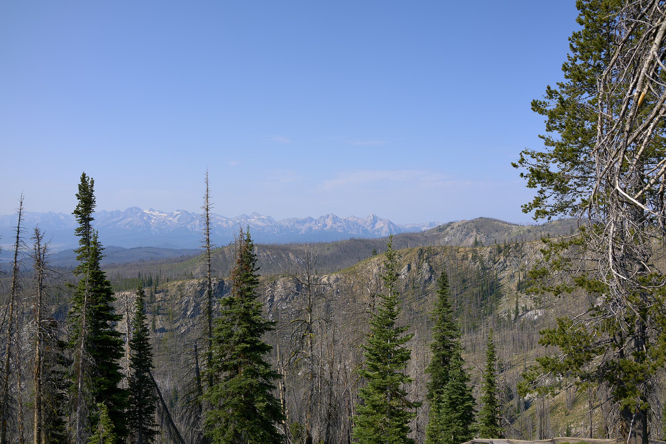
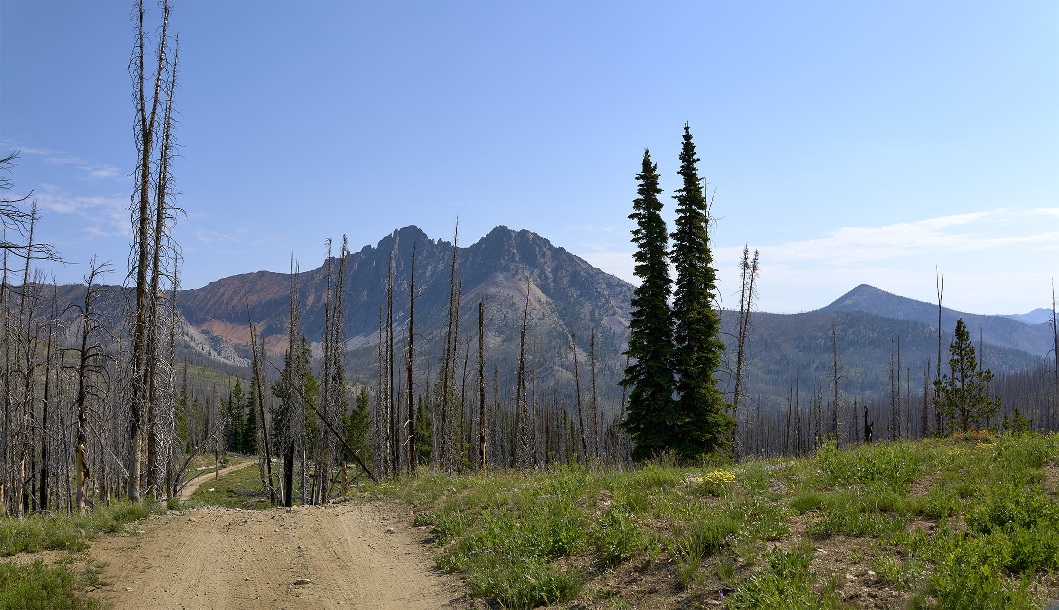
The views from the Lookout are 360 degrees and superb. Immediately to the south and west are the Sawtooths, to the north The Frank Church and to the east The White Clouds.
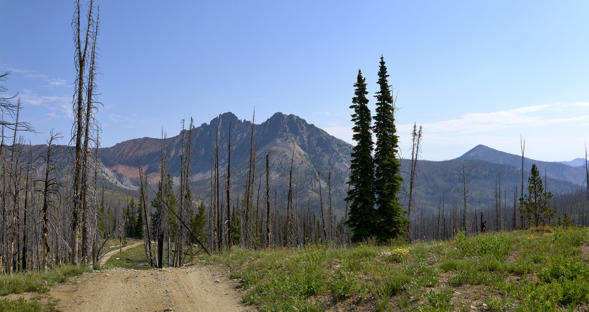
The Red Mountain Road officially begins as you head north from the Basin Butte Fire Lookout. The route on FS 319 north to re-join FS 032 (which has gone around Basin Butte) is rugged and exceptionally steep. The route is as steep and narrow has I have driven in 40 years of back-country experience. The next to last section of FS 319 drops 600 vertical feet in less than 1/2 mile. The roadbed is varied, and while not horrific, it is a challenge. This section includes a couple of demanding turns. Luckily my vehicle – Ford Raptor – is built to handle this terrain.
Another aspect to my advantage, is that I have had the foresight to put my vehicle in Terrain Crawl mode. In short, The Raptor will handle all aspects of accelerating, breaking, and adjusting shock absorption based on the conditions. All I have to do is establish the initial speed I desire, steer correctly, and pay attention. I can control the speed by 1/2 mile an hour increments with my finger tips – if I so choose. I have used the Raptor for this purpose since its inception in 2019. I cannot speak highly enough about the performance of Ford’s system.
While I enjoy challenges like this, I like to say that I always make sure I run out of guts, before I run out of gear. By looking at gauges and (subsequently) maps, it appears this 1/2 mile section of road was at 21-31 degrees of angle. Really??? This will be confirmed by a knowledgeable person some time later.
Upon rejoining FS 032, I am expecting the condition of the road will be similar in state as to that when approaching Basin Butte Lookout. This will not be the case. The road becomes materially more challenging. The scenery is stunning, but the drive demands all my attention and skill. There will be turns and angles where locking differential and front and back cameras come into play in a big way.
The mile of roadbed on Red Mountain Road before Cabin Creek and the pond\lake that feeds it proves to be as challenging as FS319. The roadbed – if you want to call it that – is ragged and rocky. At Basin Creek the road levels out a bit. The road wraps around a steep angled mountainside reaching a pleasant plateau. It is at this point Cabin Creek Mountain and Red Mountain come into full view. Magnificent! The Border Collies and yours truly park for a few minutes to stretch.
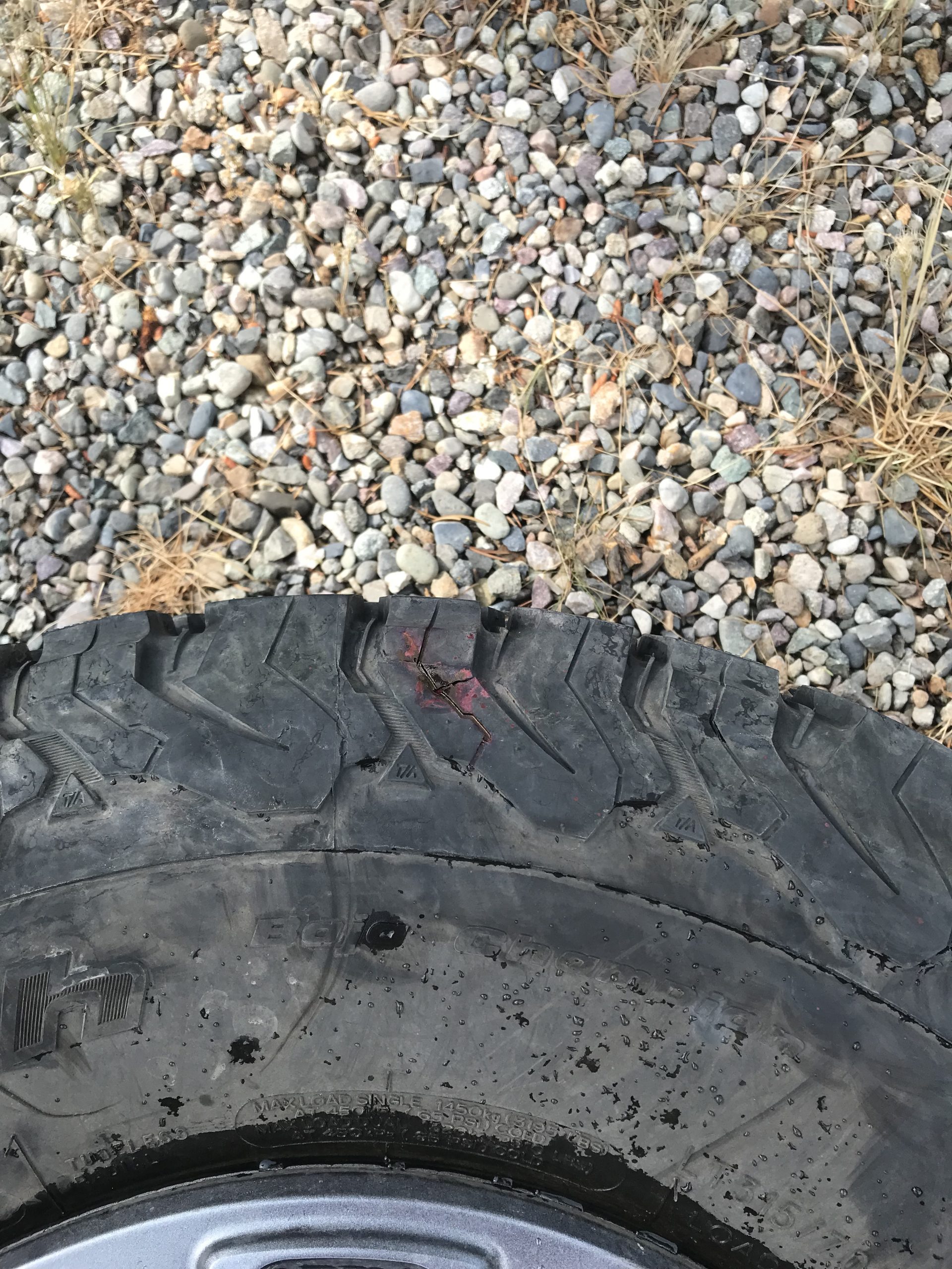
Upon re-entering and starting the truck, the Tire Gauge Section of the Display Panel warns me the right rear tire is losing pressure. The summit of Red Mountain is 3 miles away. It will not be visited by me and my two trusty friends on this day. My immediate job is to find a safe spot to access the tire situation and establish a stable condition so that I can cover the 17 miles back to highway 21. My options are two as I see it. 1.) Drive ahead 1/2 mile and drop into the level area of Hinman Lake and the Yankee Fork of the Salmon River and obtain assistance from hikers and ATVers. 2.) Drive back to the level and shaded Cabin Creek area. I choose option #2.
While attempting to get back to Cabin Creek, I monitor the tire pressure closely. The pressure drops slowly. The pressure of the right rear tire is 18 psi (versus 43 normal) when I reach Cabin Creek. Luckily there is shade and plenty of water.
Background Note: When taking these kinds of adventures, I attempt to always be prepared for less than optimal conditions. On this adventure, I have brought extra food and water along for me and the dogs. I have brought along a first-aid. I have brought along a powerful car battery starter and charger for other devices. I have brought along a powerful inflator for car tires and other devices that can work from multiple sources. I have brought along My GPS mapping software for the iPhone. I have brought along my SPOT Satellite communication device. This truck is only a few days in my possession, so I have forgotten to transfer my towing, muddy\winter weather kit with shovel.
The good news for me the truck has a full spare tire. I decide that the leak is causing too great a loss in pressure to attempt a re-pressurization. So I decide to change the tire. I have never changed a tire on a Ford F-150. As my wife Linda says, if all else fails read the instructions. As my son Kyle says, make sure to follow the proper order of operations.
I carefully read the instructions – which are not great. I carefully consider the order of operations. The sun and temperatures are not too bad, but they always have greater effect at high elevation. The Tire change is occurring at 8,900 feet elevation.
Given the location of the spare tire, its steps for removal, and the bulk of the 35 inch tires, I figure this endeavor will be 30-45 minutes when all is said and done. Luckily the tools to replace the tire are easy to find, assemble and put in place. About 15 minutes in, I hear noises. It is 3 ATVers coming from Basin Butte Lookout headed to Hinman Lake. The ATVers are from Boise and Oregon. One person is a mechanic. My stress level drops significantly. Instead of learning on my own, I am taught by people who know what they are doing. Tire Changed!
I head for Highway 21. There are about three spots on the road that gave me concern on the way out. I made note of them and deal with them carefully on the return. Luckily I will not go back via FS 319 and stay on FS032. As a side note, The ATVers mentioned to me they had gone up to Basin Butte Lookout, but retreated back southward to FS032 as they felt they could not handle the northward descent off using FS319.
Great read. Exciting drive. Video of the drive could channel Warren Miller
Nice! So cool!
Thank God you had help with that tire. You would still be there.